Community Corner
Update: Tornado Watch in Effect for Loudoun County, Strong Storms Predicted
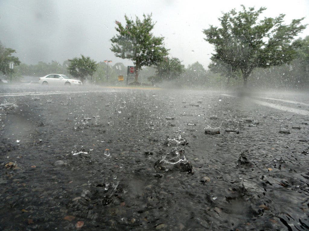
The commute may be impacted by rain, wind and hail.

Update: 4:10 p.m.: The initial line of storms has passed over the Leesburg area, but a stronger line is headed toward Northern Virginia. The tornado warning from earlier this afternoon has expired, but a watch remains in effect until 9 p.m. The entire area is also under a flash flood watch until midnight.
The temperature at 4:10 p.m. was 73 degrees, but humidity is above 90 percent. The strongest area of storms coming toward Leesburg is currently over Clarksburg, W. Va.
----------
Find out what's happening in Leesburgfor free with the latest updates from Patch.
Update: 2:45 p.m.: A tornado warning has been issued for Loudoun County until 2:45 p.m. The National Weather Service indictated a severe thunderstorm capable of producing a tornado near Brambleton, moving NE at 30 mph. Strong rotation has been observed with this storm. Locations impacted could include Leesburg, Lansdowne, Ashburn, Countryside and Poolesville.
Storms will continue through Friday evening as a cold front with stronger and more widespread thunderstorms follows.
Find out what's happening in Leesburgfor free with the latest updates from Patch.
Thunderstorms are expected to increase right before rush hour this evening with the strongest storms predicted from 7-9 p.m.
With heavy rain in the forecast, Loudoun County public safety officials remind everyone to be aware of the force and power of water.
Many deaths occur in automobiles as people and their vehicles are swept downstream. Many of these drownings are preventable, but too many people continue to drive around barriers warning that roads are flooded.
Whether you are driving or walking, if you come to a flooded road, stop and do not cross. With water across the roadway, you cannot always determine the depth of the water or the condition of the road under the water. Six inches of moving water can knock a person down and a mere two feet of water can move a large vehicle such as a bus.
More information on how to prepare for heavy rain and other weather-related hazards can be found online.
----------
Original Post - Thursday, May 31
By Beth Lawton
Weather forecasters in Northern Virginia are casting a wary eye toward the west, where severe thunderstorms are developing ahead of a cold front. Those storms could hit Northern Virginia around 5 p.m. Friday and have a significant impact on the evening commute.
“There may be a couple waves of storms affecting the region through midnight or so with heavy rain, gusty winds and dangerous lightning. Some storms may contain damaging winds and large hail with the outside chance of isolated tornadoes,” Capital Weather Gang’s Jason Samenow predicted Thursday.
Friday will start out cool and partly cloudy, with temperatures in the upper 60s around sunrise. Temperatures will rise into the low 80s with an increasing threat of scattered thunderstorms throughout the day before the evening storms roll into the area.
While driving tomorrow evening, remember these tips for driving during severe weather from The Weather Channel:
- Turn on your lights (low beams) and leave plenty of distance for braking.
- If you do not feel safe driving or visibility gets too low, pull over and off the road to a safe location and wait for the rain to subside.
- In a lightning storm, your car generally is a safer place to be than outside.
- If the power is out at an intersection, treat it as a four-way stop.
- Do not drive through large puddles – your car may stall or flood.
Friday is the first day of meteorological summer and the first day of the , which may be “near normal” according to some forecasters.
Temperatures will rise only into the 70s on Saturday as skies clear.
The Capital Weather Gang is predicting a slightly warmer-than-average June in the D.C. metro area despite a cool start.
Get more local news delivered straight to your inbox. Sign up for free Patch newsletters and alerts.