Weather
Here's What Forecasters Are Predicting For Fall Weather In Puget Sound
Fall arrives Wednesday in Puget Sound, and federal climate forecasters have a fresh round of projections for the cooler months ahead.

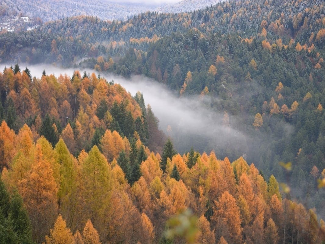
SEATTLE — Wednesday afternoon marks the official beginning of autumn, and a timely shift in conditions should lend to a few rain showers and clouds to welcome the changing of the seasons. While the rest of the week looks to be sunny and pleasant, extended climate forecasts predict the next three months will turn out to be wetter than average in Washington — an alluring prospect as Puget Sound exits one of its driest summers on record.
Starting in the near term, forecasters are tracking the return of unsettled, wet weather as soon as next week.
This past weekend wasn't just a blip on the radar. It does appear that by early next week we'll settle into a fairly unsettled weather pattern. So, pluviophiles, fear not. Autumn is still on schedule. #wawx pic.twitter.com/yaLS6wdWTo
— NWS Seattle (@NWSSeattle) September 21, 2021
If long-range expectations hold firm, next week's rainier turn should set the tone for the coming months. Last week, the National Oceanic and Atmospheric Administration's Climate Prediction Center updated its seasonal outlooks for both fall and winter, finding favorable odds that both will bring more precipitation than usual to Washington and other parts of the Pacific Northwest.
Find out what's happening in Seattlefor free with the latest updates from Patch.
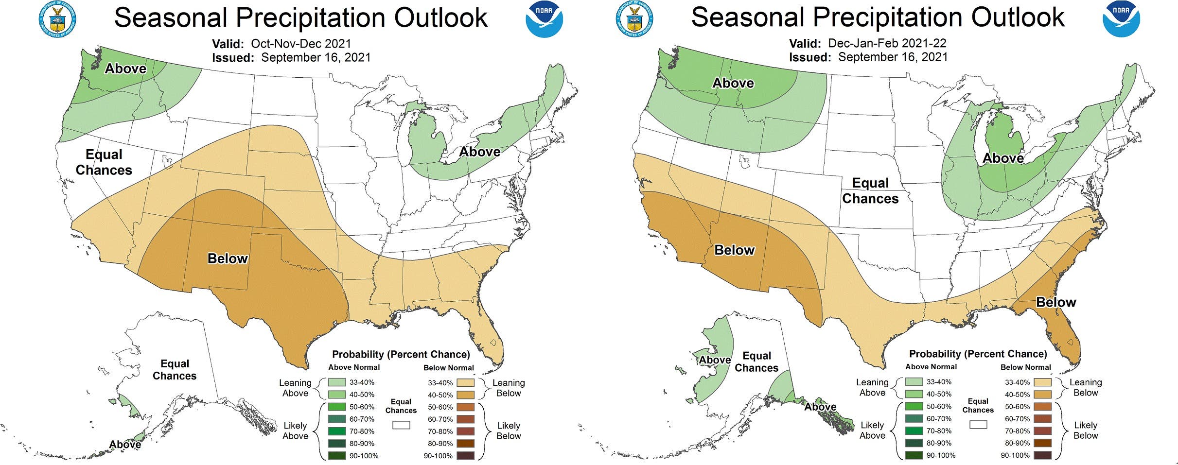
"Model guidance remains consistent from previous months depicting elevated probabilities of below normal precipitation for much of the southern and central [contiguous United States], and increased chances of above normal precipitation for the Pacific Northwest during [October, November and December]," the Climate Prediction Center wrote. "Models are consistent in depicting an expansion of a dry signal eastward across the Southeast, with influences from potential tropical disturbances decreasing and La Niña influences increasing as we progress deeper into the fall and early winter."
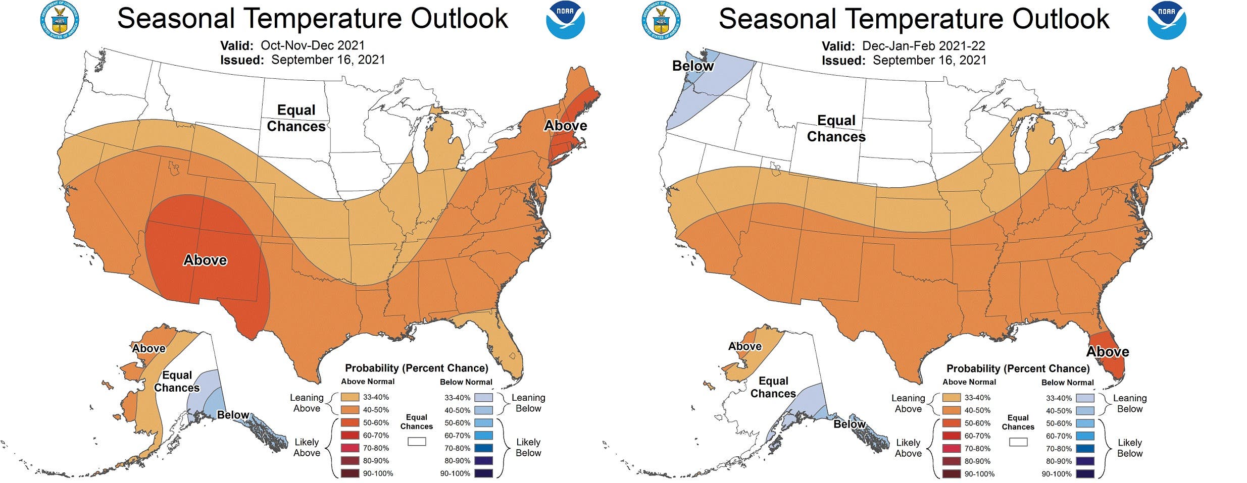
For temperatures, climatologists place equal chances for landing on either side of average in the fall, before things take a colder turn in the winter.
Find out what's happening in Seattlefor free with the latest updates from Patch.
One part of the calculus for NOAA's winter expectations is the increasing odds for La Niña, whose winter appearance often means cooler, wetter conditions in Washington. The current odds for La Niña arriving over the next couple of months are as high as 80 percent. Stronger La Niña winters in Washington typically mean more snowfall, but current projections see a better chance for a weaker pattern emerging.
NOAA updates its seasonal outlooks and tracks La Niña developments on a monthly basis. A detailed winter outlook is usually released by mid-October.
Get more local news delivered straight to your inbox. Sign up for free Patch newsletters and alerts.