Weather
'Vigorous' Front Brings Rain And Wind To Puget Sound: Forecast
The first significant rainstorm in months arrives Friday, setting up for a weekend soaking to send off the summer. Here's what to expect.


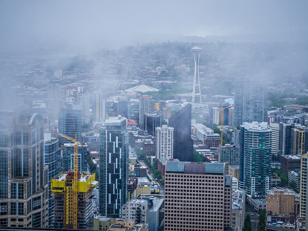
SEATTLE — Dousing rains, blustery winds, and even a few thunderstorms are inbound for Puget Sound, as the last weekend of summer serves up an excellent preview of the autumn ahead.
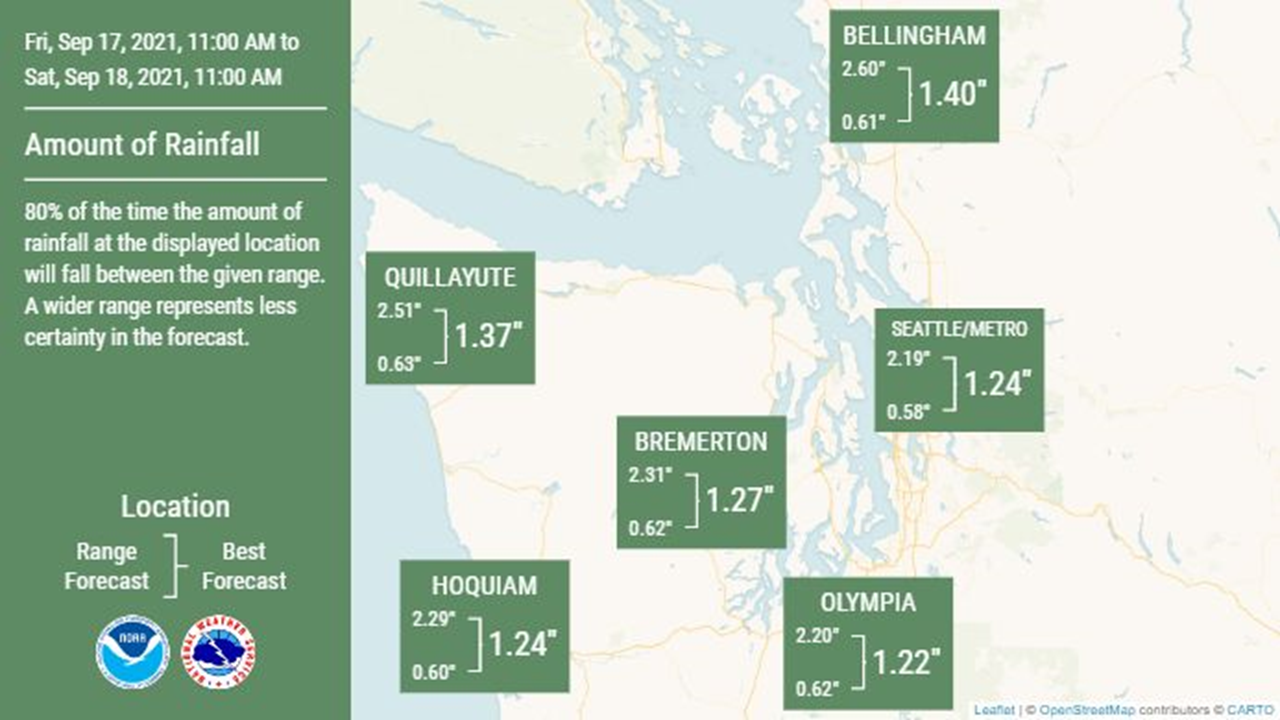
Earlier forecasts for the fall-like frontal system remain on track, with rainfall amounts across Western Washington ranging from 1 to 2 inches between Friday and Saturday morning — and closer to 2 to 4 inches possible in the mountains and along portions of the coast.
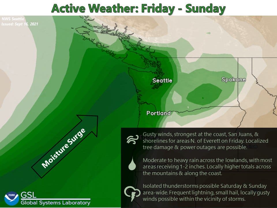
"A vigorous frontal system will move through the area Friday and Friday night, bringing rain, heavy at times, and windy conditions to some locations," NWS Seattle wrote. "Models remain consistent with fairly impressive rain totals for the area as the front moves through slowly throughout the day."
Find out what's happening in Seattlefor free with the latest updates from Patch.
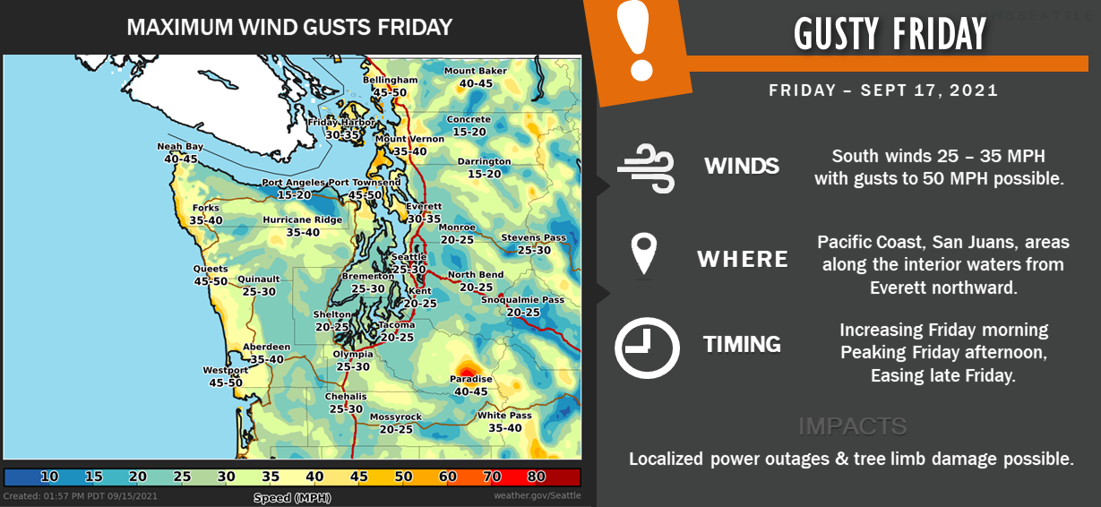
Forecasters expect rain will begin in the morning and pick up throughout Friday afternoon and evening, with showers continuing through the weekend. Friday is likely to be especially gusty, with afternoon winds peaking between 25 and 35 mph for most, then easing into the night.
The National Weather Service said area rivers will rise rapidly through the weekend, but flooding is not expected. The front will move further inland Saturday, bringing a chance for thunderstorms as showers continue in the lowlands. The mountains are likely to see snowfall above pass level.
Find out what's happening in Seattlefor free with the latest updates from Patch.
"The trough itself looks to have enough dynamics with it to bring some instability and thus looking at a slight chance for some thunderstorms, mainly during the afternoon and evening hours," forecasters wrote. "Snow levels will fall to 6,500 - 7,000 feet on Saturday, and the higher terrain should get the first accumulating snows of the season."
For Sunday, the National Weather Service said temperatures will be "impressively below normal," at 10 or more degrees below average, and barely cracking 60 degrees. Rain showers are likely to persist, and there could be a few more shots at thunderstorms through the end of the day. Long-range models suggest things will begin to dry out early next week, but a few more showers are possible into next Wednesday.
Here is the 5-day weather outlook for the Seattle area:
- Friday: 64°/56° (Rain)
- Saturday: 64°/53° (Showers)
- Sunday: 61°/53° (Showers)
- Monday: 63°/51° (Chance of showers)
- Tuesday: 65°/53° (Chance of showers)
Get more local news delivered straight to your inbox. Sign up for free Patch newsletters and alerts.