Weather
Storms Could Turn Severe Overnight In Wisconsin Monday
Multiple rounds of storms this week could bring severe weather, heavy rain and flooding risk

MILWAUKEE, WI — Severe thunderstorms are possible across parts of Wisconsin late Monday into Monday night, with the potential for damaging winds, hail, and tornadoes as storms move in from the west.
The National Weather Service says isolated storms could begin developing between 3 p.m. and 6 p.m., with the greatest potential for more widespread activity from the evening into the overnight hours.
Forecasters say storms along and south of a warm front will carry the greatest severe weather risk, including tornadoes and damaging winds.
Find out what's happening in Milwaukeefor free with the latest updates from Patch.
The exact placement of that boundary remains uncertain and will determine which areas see the strongest storms.
Large hail is also a concern, especially north of the warm front, where stones up to 2 to 3 inches in diameter are possible.
Find out what's happening in Milwaukeefor free with the latest updates from Patch.
While some areas farther south may see isolated severe storm development, confidence in that scenario remains lower.
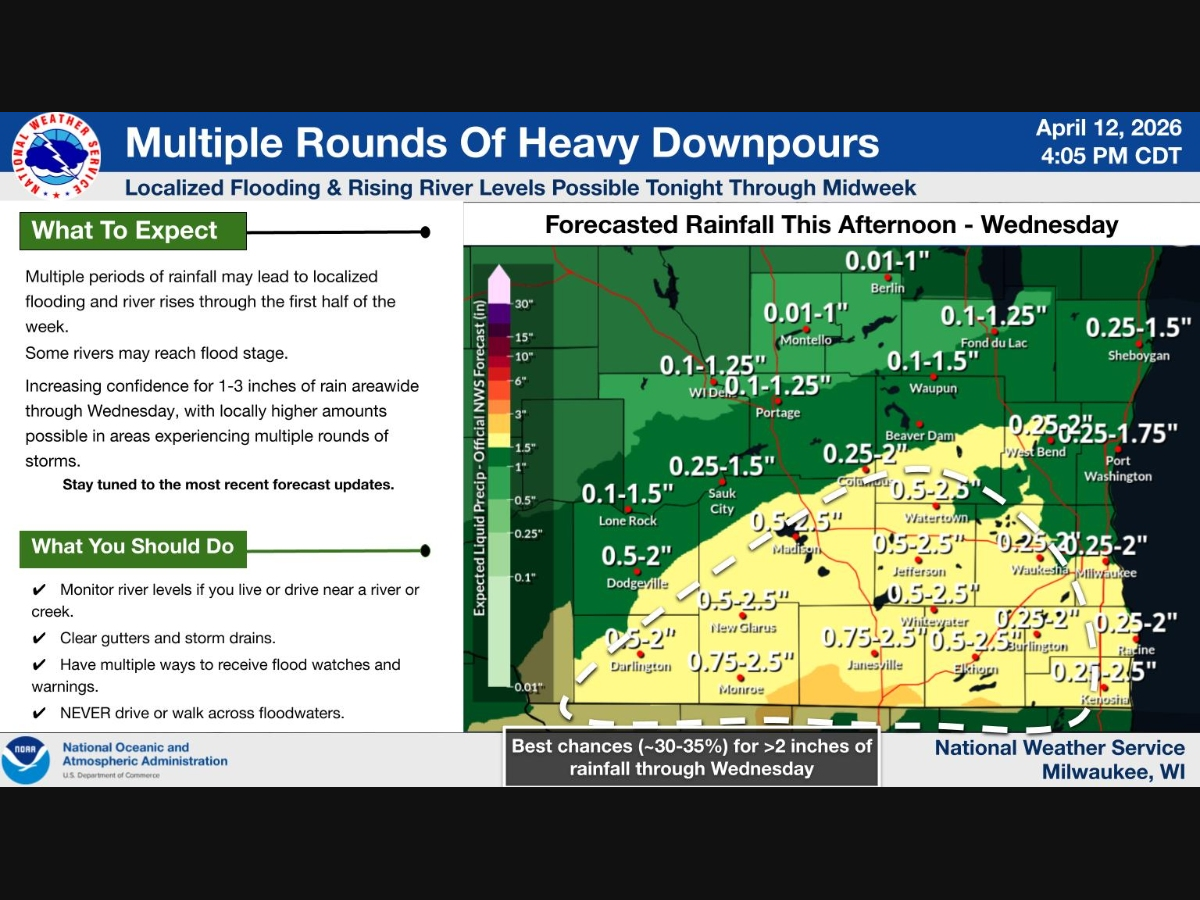
In addition to the severe weather threat, multiple rounds of thunderstorms are expected through midweek, bringing the potential for heavy rainfall, localized flooding, and rising river levels.
Rainfall totals of 1 to 3 inches are possible through Wednesday, with locally higher amounts in areas that see repeated storms.
Forecasters say the most widespread severe weather risk in Wisconsin may shift into Tuesday, when confidence in storm development and placement is higher.
Residents are urged to stay weather-aware through the week, monitor forecasts, and be prepared to take action if warnings are issued.
Get more local news delivered straight to your inbox. Sign up for free Patch newsletters and alerts.