Weather
Flash Floods: Ivey Issues State Of Emergency
The National Weather Service has issued a Flash Flood Watch effective through Wednesday.

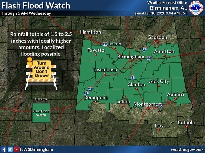
BIRMINGHAM, AL — Birmingham area residents were greeted Tuesday morning with more rain, a sight all-too-common over the last couple of weeks. Rainfall totals of 1.5 to 2.5 inches with locally higher totals will be possible over portions of Central Alabama, according to the National Weather Service in Birmingham, and a Flash Flood Watch has been issued through Wednesday.
Gov. Kat=y Ivey issued a State of Emergency for the entire stste of Alabama Tueday afternoon.
"The significant amount of rain that has fallen across Alabama over the last few weeks has caused flooding in several portions of the state," Ivey said in a statement. "We assured our citizens that we would be prepared to help however needed, which is why I have decided to issue a State of Emergency. This will allow a continued smooth recovery for our state, and I am confident it will aid the efforts already happening on the local level."
Find out what's happening in Birminghamfor free with the latest updates from Patch.
Widespread showers and storms Tuesday night and into Wednesday morning, and with the ground already soaked from last week's storms, flooding is a high possibility, the NWS said.
Birmingham’s rain total for February is 9.2 inches, and should exceed 10 inches by Wednesday. Rain will end from west to east Thursday evening as dry air pushes into the state. Rain amounts between now and Thursday night will be in the 2- to 3-inch range for much of north and central Alabama.
Find out what's happening in Birminghamfor free with the latest updates from Patch.
No severe storms are expected Tuesday or Wednesday, the NWS said, but flood conditions are expected to be dangerous and residents are urged to take caution, especially when driving.
Get more local news delivered straight to your inbox. Sign up for free Patch newsletters and alerts.