Weather
Hurricane Ida: Flash Flood Watch For Tuscaloosa, Impacts Expected
Emergency officials are cautioning of impacts across west Alabama as Hurricane Ida made landfall as a Category 4.

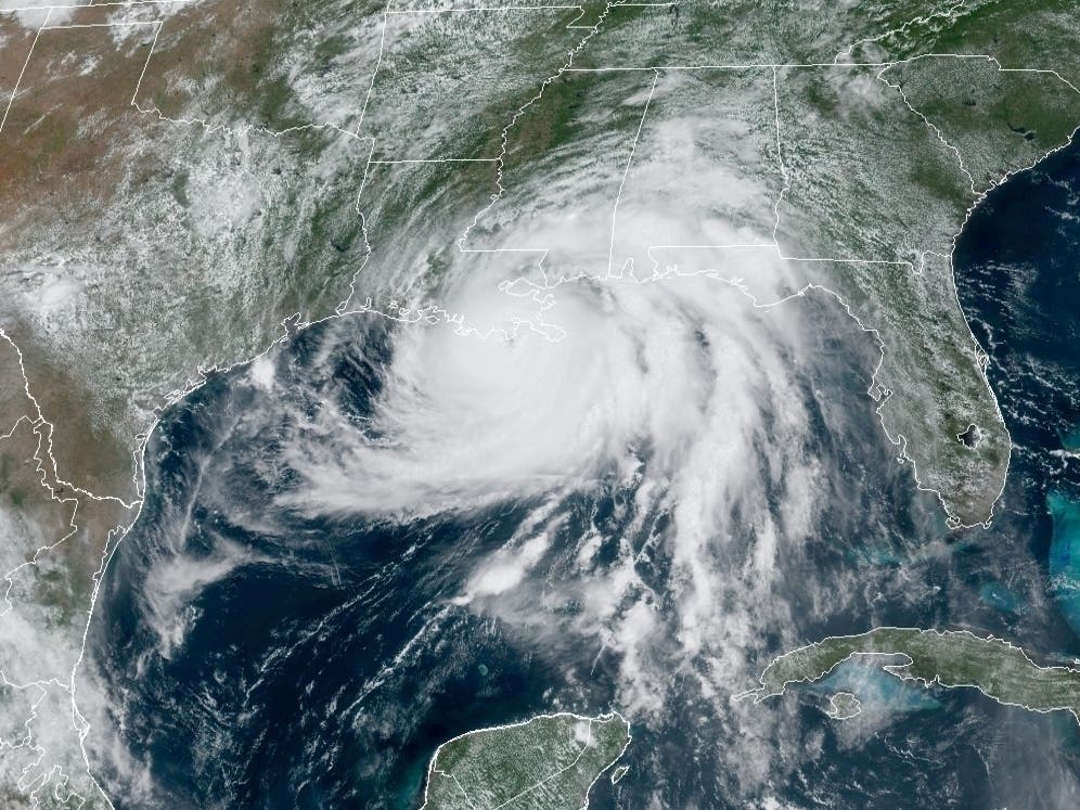
TUSCALOOSA, AL — Hurricane Ida is expected to bring widespread devastation to the Gulf Coast as the powerful storm made landfall Sunday in Louisiana as a Category 4 hurricane. Ida's approach also comes on the anniversary of Hurricane Katrina making landfall in 2005.
Click here to subscribe to our free Tuscaloosa Daily newsletter and breaking news alerts
While Hurricane Ida is expected to bring its most severe weather to Louisiana and Mississippi, Alabama — particularly the western part of the state — could also see heavy rain, damaging winds and the possibility of tornadoes.
Find out what's happening in Tuscaloosafor free with the latest updates from Patch.
As Patch previously reported, Ida is expected to pack winds in excess of 130 mph, life-threatening storm surge and flooding rain for those in its path. When the storm made landfall in Louisiana Sunday morning, winds were reported to be as high as 150 mph — marking only the third time in the state's history that a Category 4 hurricane has made landfall.
Tuscaloosa County EMA pointed out on Sunday that the heaviest rain over the western half of the state will occur Monday, in addition to a statewide tornado threat.
Find out what's happening in Tuscaloosafor free with the latest updates from Patch.
Officials expect 3-6 inches of rain for west Alabama through Tuesday night, which raises concerns of flash flooding. In anticipation of the storm, a Flash Flood Watch has been issued for Tuscaloosa County through Tuesday evening. What's more, Hurricane Ida will bring the potential for sustained winds up to 25 mph with gusts over 40 mph for west Alabama.
CBS 42 anchor and reporter Jack Royer is currently on the Louisiana Gulf Coast covering Ida's landfall and described the weather on the ground to Patch.
Royer said they are mostly experiencing high winds and a heavy, pelting rain that's painful to the skin.
"Officials just sent a wind warning and urged people to stay in," he said.
Click here to follow Royer's live coverage from New Orleans.
Tuscaloosa County EMA offers a free emergency notifications service - TuscALERT — that sends updates on severe weather directly to your phone, email or mobile device. Click here to sign up for TuscALERT.
Click here for a map of storm shelters across the Tuscaloosa metro. The Tuscaloosa County EMA website also provides regular updates on when shelters open during severe weather events.
Have a news tip or suggestion on how I can improve Tuscaloosa Patch? Maybe you're interested in having your business become one of the latest sponsors for Tuscaloosa Patch? Email all inquiries to me at ryan.phillips@patch.com
Get more local news delivered straight to your inbox. Sign up for free Patch newsletters and alerts.