Weather
Hurricane Isaias Strengthens Into Major Category 3 Storm With 120 MPH Winds
Hurricane Isaias strengthened into a major Category 3 hurricane Friday morning as it continued moving toward the northern Gulf Coast.


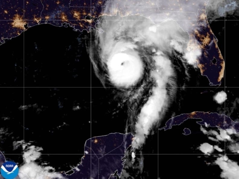
TUSCALOOSA, AL — Hurricane Isaias strengthened into a major Category 3 hurricane Friday morning as it continued moving toward the northern Gulf Coast.
Click here to subscribe to our free daily newsletter and breaking news alerts.
In a special update issued at 7:20 a.m. CDT Friday, the National Hurricane Center announced that data collected by an Air Force Reserve hurricane hunter aircraft indicated Isaias had intensified, with maximum sustained winds reaching 120 mph and higher gusts.
Find out what's happening in Tuscaloosafor free with the latest updates from Patch.
The latest development marks a significant increase in the storm's intensity as communities along the Gulf Coast prepare for potentially dangerous conditions.
According to the National Hurricane Center, Isaias was located near latitude 27.0 degrees north and longitude 87.6 degrees west, approximately 240 miles south of Pensacola, Florida, and 170 miles south-southeast of the mouth of the Mississippi River.
Find out what's happening in Tuscaloosafor free with the latest updates from Patch.
The hurricane was moving north-northeast at 15 mph, with a minimum central pressure of 959 millibars.
Officials say the storm's strengthening to Category 3 status makes Isaias a major hurricane on the Saffir-Simpson Hurricane Wind Scale, which classifies hurricanes with sustained winds of at least 111 mph as major hurricanes.
The latest intensification also raises concerns for inland communities across Alabama, including Tuscaloosa County, where heavy rainfall, gusty winds and the possibility of isolated tornadoes have been identified as potential threats as the storm moves inland.
This comes as Tuscaloosa prepares to host the highly anticipated football matchup between Alabama and Georgia, which is expected to be attended by President Donald Trump.
ALSO READ: College GameDay Moving To Coleman Coliseum, Guest Picker Revealed
Previous forecasts from the National Weather Service in Birmingham indicated that portions of west Alabama could receive 2 to 4 inches of rainfall, with isolated totals reaching 5 inches, between Friday and Saturday.
Heavy rainfall could lead to flash flooding, particularly in low-lying areas and locations with poor drainage.
Alabama Gov. Kay Ivey previously declared a state of emergency for 40 counties in anticipation of the storm, allowing state and local agencies to coordinate emergency preparations and response efforts.
The National Hurricane Center has not provided a new potential landfall location or timing in its latest special update, which focused primarily on the hurricane's rapid intensification.
Residents are urged to have multiple ways to receive weather alerts, identify a sturdy shelter location and stay updated on changing conditions.
As Patch previously reported, the Tuscaloosa County EMA recently rolled out a new emergency notification system to send updates on severe weather directly to your phone, email or mobile device.
Click here for a map of other storm shelters across the Tuscaloosa metro.
The Tuscaloosa County EMA website also provides regular updates on when shelters open during severe weather events.
Get more local news delivered straight to your inbox. Sign up for free Patch newsletters and alerts.