Weather
Isaias Strengthens Into Hurricane, Takes Aim At Gulf Coast
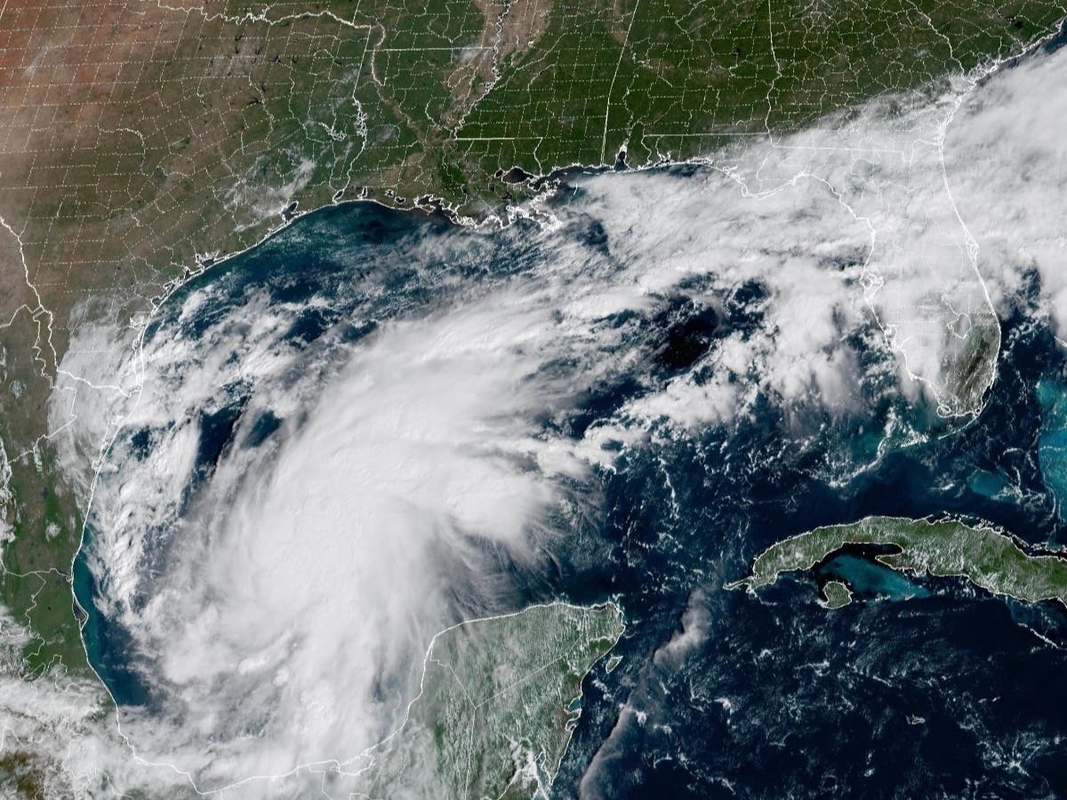
Hurricane Isaias is expected to bring heavy rainfall, gusty winds and the possibility of isolated tornadoes to a large part of Alabama


TUSCALOOSA, AL — Hurricane Isaias is expected to bring heavy rainfall, gusty winds and the possibility of isolated tornadoes to a large part of Alabama beginning Friday night.
Click here to subscribe to our free daily newsletter and breaking news alerts.
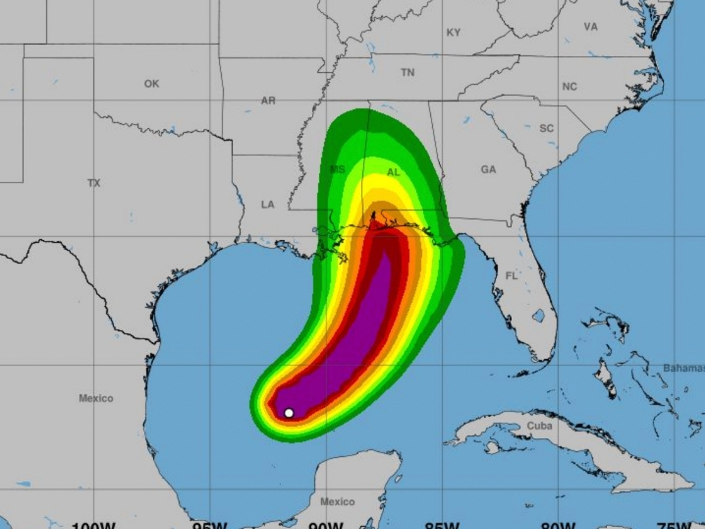
In its 10 p.m. Wednesday update, the National Weather Service forecast office in Birmingham said Isaias had strengthened into a Category 1 hurricane over the southwestern part of the Gulf and was continuing toward the northern Gulf Coast, with potentially significant impacts expected across Alabama this weekend.
Find out what's happening in Tuscaloosafor free with the latest updates from Patch.
Current maximum sustained winds for the storm were reportedly 81 mph as of the publication of this story, with current maximum wind gusts of 98 mph.
The storm's approach also coincides with the highly anticipated football matchup in Tuscaloosa between Alabama and Georgia Saturday evening — a game that is expected to be attended by President Donald Trump.
Find out what's happening in Tuscaloosafor free with the latest updates from Patch.
Alabama Athletics said Wednesday evening that it is continuing to closely monitor the weather forecast ahead of game, focusing on the safety and well-being of the student-athletes, coaches, staff and fans.
"We remain in close communication with the National Weather Service, the Southeastern Conference office and the University of Georgia as we observe conditions," UA said in a statement. "At this time, kickoff remains scheduled for 6:30 p.m. CT Saturday. We continue to encourage fans to rely on official Alabama Athletics and SEC channels for the latest information regarding Saturday’s game."
Forecasters say central Alabama could receive 2 to 4 inches of rainfall, with localized totals reaching 5 inches, between Friday and Saturday.
Heavy rainfall remains the greatest concern for inland communities, including Tuscaloosa County, where flash flooding could create hazardous travel conditions and threaten low-lying areas.
The NWS said rivers and streams could rise rapidly, while smaller waterways, drainage ditches and canals could overflow. Flooding could also inundate underpasses and other low-lying areas, potentially making some roads impassable.
The latest forecast also calls for increasingly windy conditions as Isaias approaches, with tropical storm-force winds potentially reaching portions of central Alabama as early as midday Friday.
However, forecasters said Friday evening and overnight remain the most likely periods for the arrival of tropical storm-force winds.
The NWS reported a 20% probability of tropical storm-force winds in Birmingham, compared to 32% in Montgomery and 42% in Mobile. Meteorologist said those probabilities were increasing as of Wednesday night.
In addition to flooding and wind, the NWS warned of a potential tornado threat, particularly in areas east of the hurricane's projected center.
The NOAA Storm Prediction Center has introduced a Level 1 out of 5 severe weather risk for portions of the Gulf Coast on Friday, followed by a Level 2 out of 5 risk Saturday that includes the southern third of Alabama.
Forecasters emphasized that confidence in the tornado threat remains lower than confidence in the potential for heavy rainfall and gusty winds.
The NWS concluded its overnight update by cautioning that uncertainties remain regarding Isaias' eventual track, intensity and timing.
This is a developing story. Tuscaloosa Patch will have more information as it becomes available.
Get more local news delivered straight to your inbox. Sign up for free Patch newsletters and alerts.