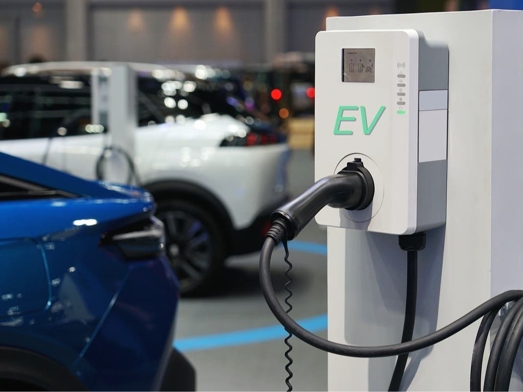
Weather
El Niño 'Imminent,' Could Reshape Weather Patterns. Here’s What It Means For CA
A fast-developing El Niño could significantly reshape weather patterns in California.

CALIFORNIA – Meteorologists have a better idea of how a fast-developing El Niño could significantly reshape weather patterns in California and across the West Coast this year.
The heightened risks vary widely by region, from heavy rain and flooding in parts of the Southwest and Southeast to drought and wildfire concerns in the Northwest, Northern Plains and Upper Midwest, according to a news release from AccuWeather, a private weather company.
AccuWeather expert meteorologists said the developing El Niño is unusual because it is expected to begin early and strengthen quickly.
Find out what's happening in Across Californiafor free with the latest updates from Patch.
“El Niño is not a storm. It doesn’t affect you directly overnight. But the stronger the signal, the more it can dominate other weather patterns and amplify extremes,” Meteorologist Paul Pastelok said. “This El Niño is developing unusually fast. Most El Niños begin in the fall. This one should start in June and strengthen quickly.”
El Niño is a natural climate pattern that occurs when sea surface temperatures in parts of the equatorial Pacific Ocean warm significantly above historical averages. That warming can trigger changes in global atmospheric patterns, shifting storm tracks and influencing rainfall, drought, wildfire risk and hurricane activity.
Find out what's happening in Across Californiafor free with the latest updates from Patch.
What does this mean for California?
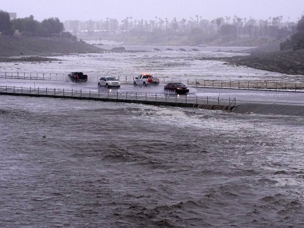
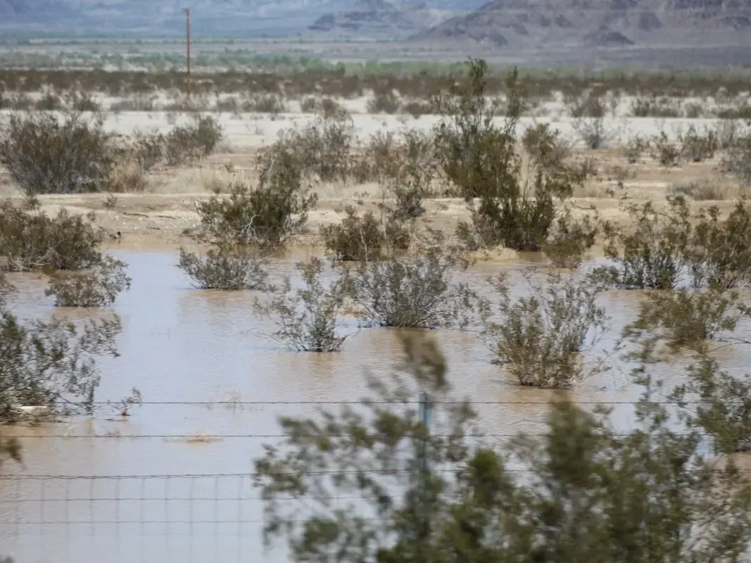
California and parts of the Southwest could see increased moisture from eastern Pacific tropical storms and hurricanes, raising the risk of heavy rainfall, runoff, debris flows and flash flooding.
El Niño often has its greatest impact from late fall into early spring. During that period, heavier rain and mountain snow events can occur in California.
Residents in wildfire burn-scar areas may face a higher risk of debris flows if heavy rain develops over vulnerable terrain.
In 2023, a natural El Nino, human-caused climate change, a stubborn heat dome over the nation’s midsection and other factors cooked up Tropical Storm Hilary’s record-breaking slosh into California and Nevada, according to reports from the Associated Press at that time.
If the models are correct, an El Niño event into California's 2026-2027 winter would surpass the previous super El Niño's recorded in 1997-98 and 2015-2016 with surface temperatures of 2.4, and 2.6 degrees Celsius above average, respectively.
The NOAA's Niño index also tracks ocean temperature changes linked to El Niño.
The development of a potential El Niño comes as the Pacific Ocean has already been warming, with temperatures near the equator about 7 degrees Celsius above normal.
Is ‘Super El Niño’ Still Possible?
AccuWeather indicates a potential “Super El Niño” if equatorial Pacific temperatures reach 3.6 degrees Fahrenheit (2.0 degrees Celsius) above average.
Pastelok estimates a 40 percent chance for this rare event, noting that current conditions must persist through late 2026 to reach that threshold.
Only seven such events have occurred since 1957, according to the Climate Prediction Center’s Relative Oceanic Niño Index. The last one was in 2015-16.
Hurricane Season Adjustments
El Niño typically increases wind shear in the Atlantic basin. Wind shear, which is the change in wind speed and direction with height, can disrupt tropical storms and hurricanes before they organize or intensify.
In 2023, the Pacific Ocean saw the formation of Hurricane Hilary, which weakened to a tropical storm before making landfall in northern Baja California in Mexico. There, its center became less defined as it encountered mountainous terrain and other atmospheric conditions, a National Hurricane Center report said. As a tropical storm, it crawled up the coast into southern California, where it wreaked havoc on coastal and desert communities, flooding streets, closing roads, and stranding residents amid over 11 inches of rain in some areas.
AccuWeather’s 2026 Atlantic hurricane season forecast projects 11 to 16 named storms. DaSilva said the early arrival of El Niño is causing forecasters to lean closer to 11 named storms than 16.
“With El Niño’s arrival early in the hurricane season, we are now leaning closer to 11 named storms rather than 16 in the Atlantic this year,” DaSilva said.
Even so, AccuWeather warned that a quieter Atlantic season does not eliminate the danger, especially from storms that form close to the U.S. coastline. Those “homegrown” systems can leave residents with less time to prepare.
People along the coast and well inland should continue to monitor forecasts for tropical rainstorms, tropical storms and hurricanes.
Outlook For The Rest Of U.S.
Here’s what could be in store for the rest of the country.
Southwest: The Southwest could see more moisture drawn northward from a busier eastern Pacific hurricane season. That could increase the risk of heavy rainfall and flash flooding in parts of the region, especially if tropical moisture interacts with storm systems.
AccuWeather said this year’s eastern Pacific hurricane season is already running ahead of schedule. The basin’s third tropical storm, Cristina, formed almost a month earlier than the July 6 historical average for the season’s third named storm.
“Warm water is one of the key ingredients in creating tropical storms,” AccuWeather hurricane expert Alex DaSilva said. “The rapid pace of early tropical storm development in the Eastern Pacific can be attributed to the near-record water temperatures observed in the Eastern Pacific. This is a very typical pattern in an El Niño setup.”
DaSilva said a marine heat wave is underway from Baja South along the Central American coastline, where sea surface temperatures are 3 to 5 degrees Fahrenheit above historical averages in some areas.
AccuWeather is forecasting 17 to 22 named storms in the eastern Pacific this year.
Northwest: The Northwest could face a drier and warmer summer, AccuWeather said. That pattern could worsen drought in some areas and increase wildfire risk.
The region may also miss out on consistent or intense precipitation during the wet season, which could contribute to longer-term drought concerns even after El Niño peaks.
Northern Plains and Upper Midwest: The Northern Plains and Upper Midwest could also see a warmer, drier summer, which may prolong drought conditions in some areas.
AccuWeather said drought concerns could linger for years in parts of the Plains after El Niño conditions peak, especially from Texas northward into the Dakotas.
“Following the end of El Niño, the next two to three years could end up being significantly drier, leading to drought conditions, especially in parts of the plains from west Texas to the Dakotas,” Pastelok said. “El Niño patterns tend to be persistent, meaning places that end up drier than average can stay that way for an extended period of time, possibly for months or even years.”
Central Plains: The Plains could see lingering drought impacts even after the strongest El Niño conditions subside.
AccuWeather warned that pockets of severe to extreme drought could extend well into 2027 and potentially beyond in parts of the Plains from Texas to North Dakota.
That could affect agriculture, water supplies, wildfire risk and regional heat patterns.
Texas and the Southern Plains: The southern U.S. can initially see wetter conditions during El Niño, but AccuWeather said those conditions can reverse after the peak of a strong event.
Parts of Texas and the southern Plains could face long-term drought implications in the years after El Niño, particularly if the pattern turns significantly drier.
Gulf Coast: The Gulf Coast could see a wetter pattern from late fall into early spring, which may help ease the ongoing drought in some areas.
However, heavier rainfall can also increase the risk of flooding, especially in poorly-drained areas or places that receive repeated rounds of rain.
Southeast: The Southeast could also see wetter conditions, particularly from late fall into early spring.
AccuWeather said the pattern may help ease drought in the region, but it could also bring an elevated risk of excessive rainfall and severe weather.
Florida may face a heightened severe weather risk during the mid-to-late winter season, which is typically the state’s drier time of year.
A stronger southern storm track could increase the likelihood of severe weather in Florida and nearby areas.
Northeast and Mid-Atlantic: While AccuWeather’s main concerns are focused on the South, West, Northwest, Plains and hurricane-prone coastal areas, El Niño can still influence storm tracks across the eastern U.S.
For the Mid-Atlantic and Northeast, impacts may depend on how the southern storm track evolves later in the season and whether storms bring rain, snow or mixed precipitation into the region.
Local effects will likely vary by elevation, proximity to the coast and the timing of individual storm systems.
More California News:
- 'You Think Yo Can Get Rid Of Me?' Pratt Threatens To Release Dirt On Foes In Apparent Concession Speech
- 5-Year-Old Girl Swept Into Sea ID'd; 'She Was My Little Princess,' Dad Says
- World Cup 2026: 10 Ways CA Helped Shape Soccer History
- Million-Square-Foot Tracy Warehouse Fire Could Burn For Days: What We Know
- Teens On E-Bikes Ride Through Aisles Of South OC Grocery Store: Report
- Suspected Serial Killer Charged In SoCal Murder Spree Spanning More Than 30 Years: DA
- FBI Reveals Reason Behind Overnight Military Exercises That Alarmed SoCal Residents: Report
- Porn Images Found In City Recreation Guides, 'Rogue Actor' Suspected: Report
Get more local news delivered straight to your inbox. Sign up for free Patch newsletters and alerts.