Crime & Safety
Riverside County Fire: Map Of Springs Fire Perimeter, Evacuation Areas
See a location map of the fire and areas affected by evacuation orders and warnings.

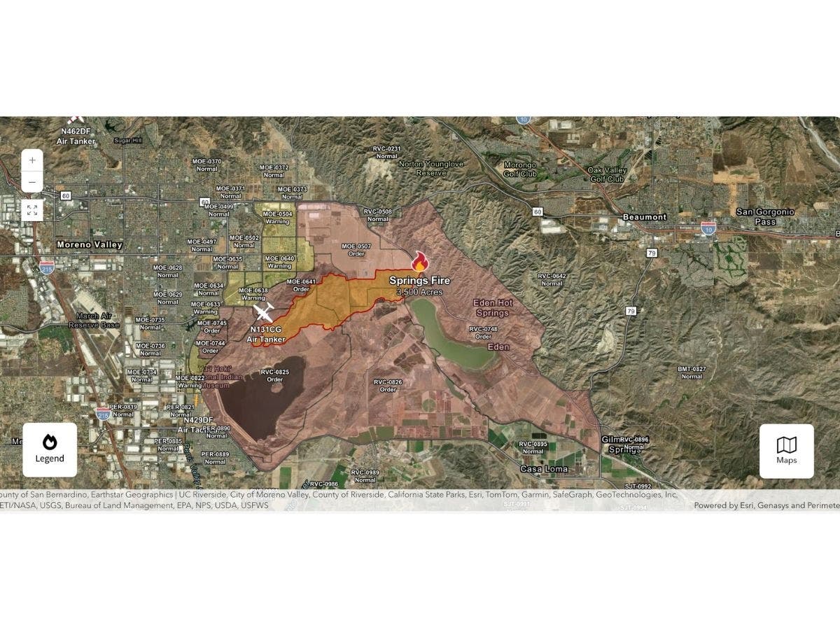
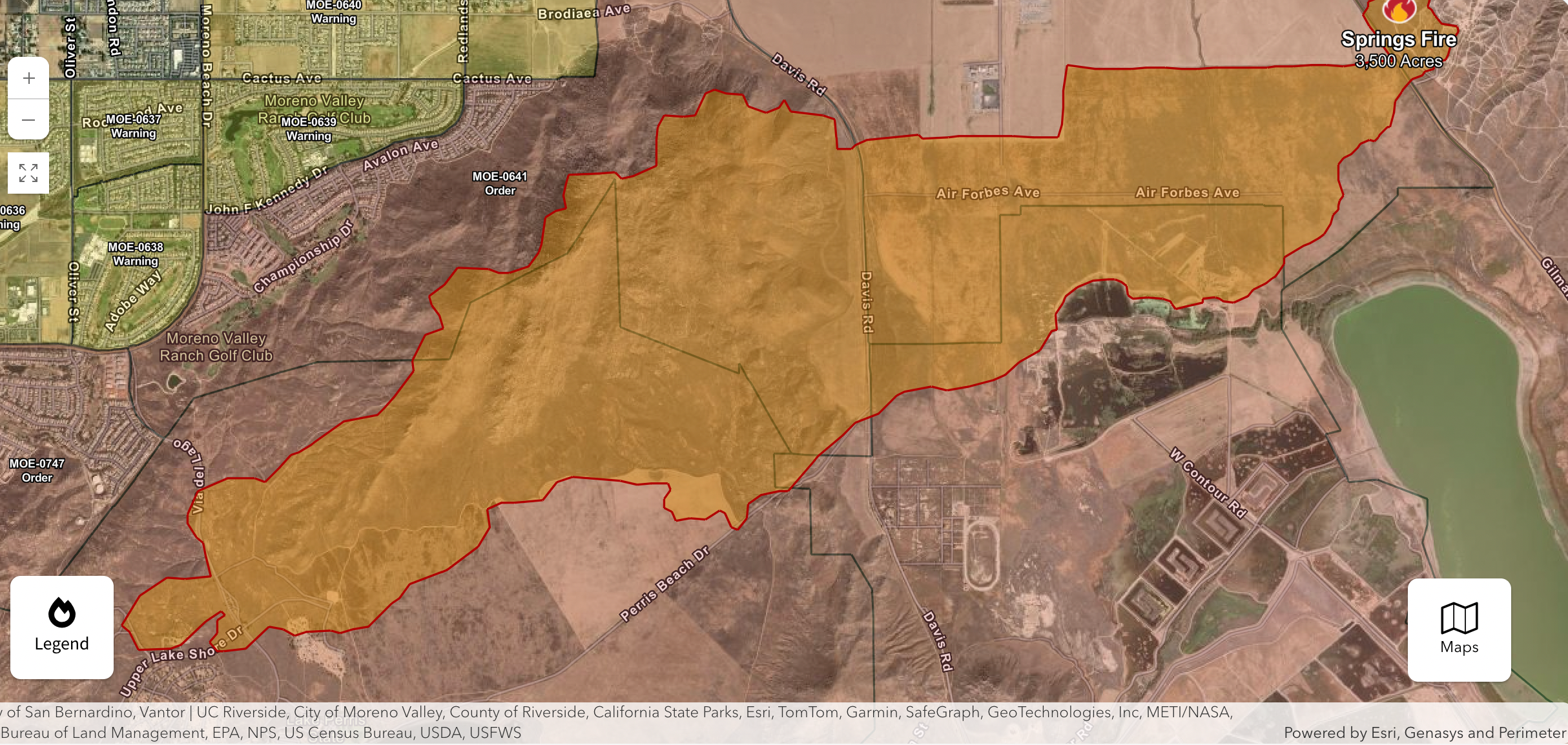
RIVERSIDE COUNTY, CA — A brush fire that broke out Friday in Riverside County near Moreno Valley ballooned to approximately 4,176 acres by the evening hours, prompting evacuation orders and warnings nearby.
The fire was reported at 11:01 a.m. in the 15900 block of Gilman Springs Road, just east of Moreno Valley, according to the Riverside County Fire Department.
The blaze, named the Springs Fire, was 5 percent contained as of 6:48 p.m.
CalFire officials tell Patch that 2,200 homes were under evacuation orders as of 6:30 p.m., and another 4,300 homes were impacted by the evacuation warnings.
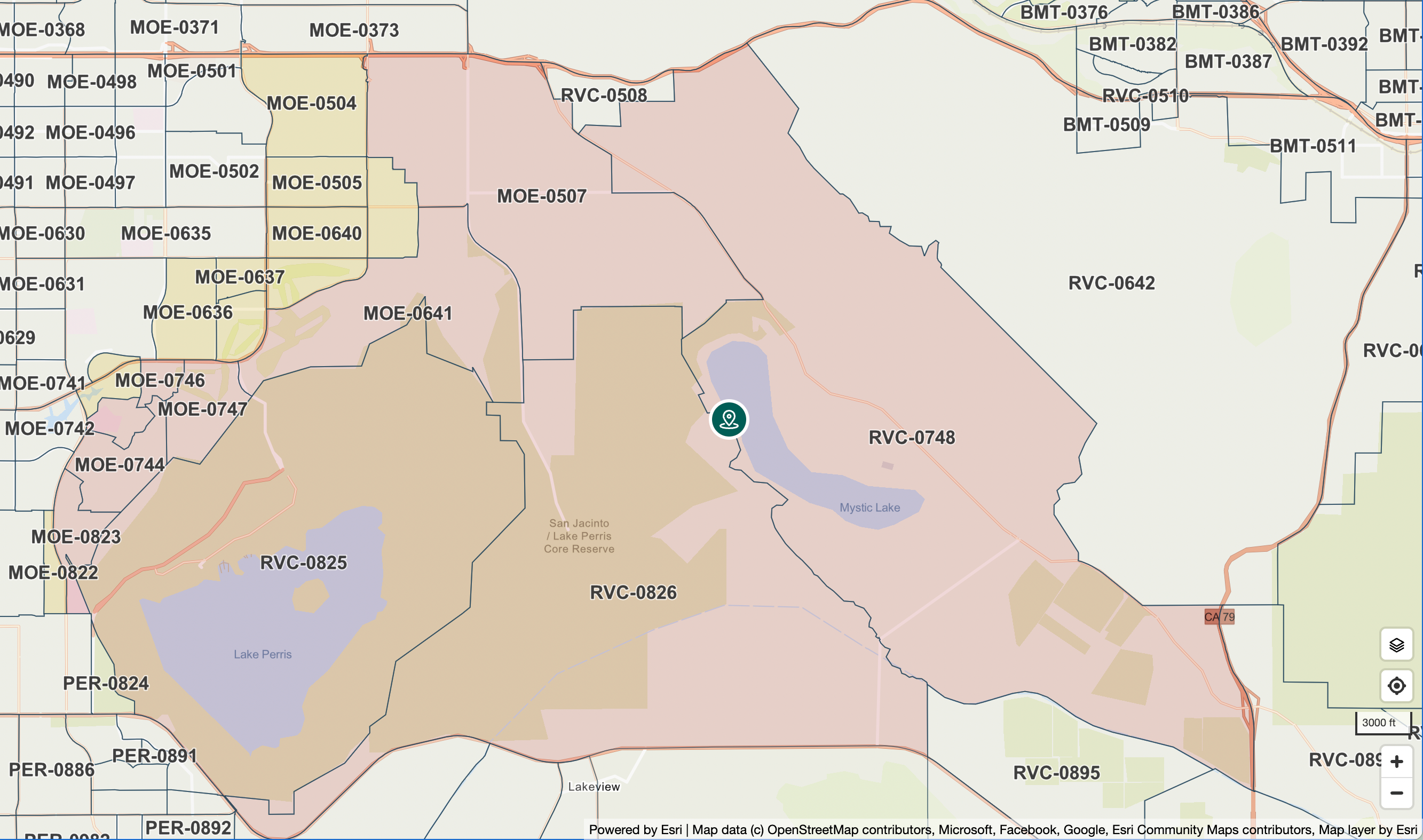
As for the evacuation orders, there were nine zones included:
- MOE-0507
- MOE-0641
- MOE-0744
- MOE-0745
- MOE-0746
- MOE-0747
- RVC-0748
- RVC-0825
- RVC-0826
You can click on the image below to access an interactive version of the evacuation map:
Evacuation warnings were announced for another 11 zones, including:
- MOE-0504
- MOE-0505
- MOE-0506
- MOE-0633
- MOE-0637
- MOE-0638
- MOE-0639
- MOE-0640
- MOE-0743
- MOE-0822
- MOE-0823
As for the fire's perimeter, you can click on the image below for an interactive map:
Follow along for the latest on the Springs Fire here.
Get more local news delivered straight to your inbox. Sign up for free Patch newsletters and alerts.