Weather
Trio Of Storms To Slam SoCal Starting President's Day, Snow Likely
All of Southern California should expect wet weather and mountain snow much of next week, including possible thunderstorms, the NWS says.

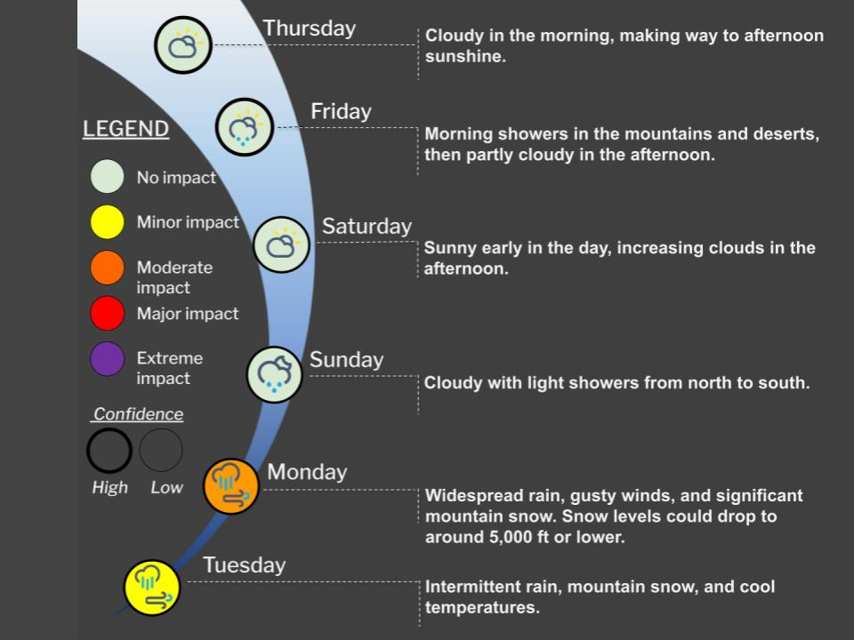
More rain is on the way across Southern California next week, the National Weather Service predicts. At least three distinct storm systems are expected to move across the region, the first arriving Sunday evening into Monday morning for Los Angeles and Ventura Counties.
The arriving powerful storm brings with it the likelihood of heavy rain, with the best estimates calling for 1 to 1.2 inches of rain regionally on Monday, with an added 1.5 to 3 inches of rain likely on Tuesday and Wednesday, and a possibility of 3 to 6 inches of total rain in the mountains, according to the NWS meteorologists.
At least two more storm systems will follow through on Wednesday, with temperatures falling. There's an increased chance of thunderstorms and snow levels that could fall as low as 3,000 feet or "slightly lower," the NWS predicts.
Find out what's happening in Banning-Beaumontfor free with the latest updates from Patch.
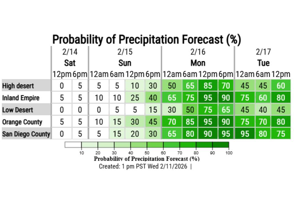
Expect snow above 6,000 feet and significant snow accumulations over the higher mountains. Coastal valleys can expect between 1 and 2 inches of rain on Monday, and twice that in the mountain areas.
Drivers and residents in flood-prone areas should be mindful of "the typical hydrologic hazards, like ponding of water on roads, minor mudslides in canyons, and burn scar areas," the NWS advised.
Find out what's happening in Banning-Beaumontfor free with the latest updates from Patch.
What To Expect From This Storm System
"The first storm system appears to be the strongest, in terms of overall rainfall and amounts of rain rates," meteorologists say. "Similar to the last storm, it's moving at a fast clip, but it's a larger storm, so it will take longer to move through than the recent rainstorms."
The coast should expect higher surf Friday through Saturday, with large waves and coastal flooding possible, coinciding with the new moon cycle and the storm system early next week. Though no coastal flood advisory was immediately in place, one may be needed.
There is a High Surf Advisory currently in place from 9 a.m. Friday to 2 a.m. Saturday, which may be extended as the storms arrive.
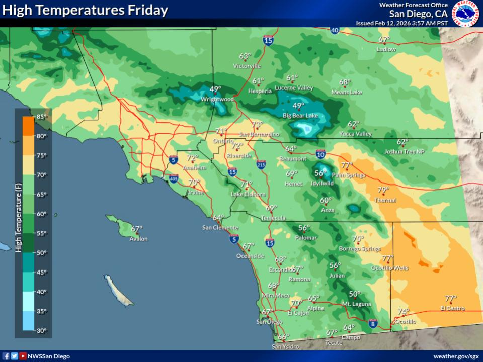
Here's a look at forecasted high temperatures across Southern California:
| City | Friday | Saturday | Sunday | Monday |
| Banning | 66 | 67 | 63 | 54 |
| Carlsbad | 65 | 66 | 65 | 62 |
| Downtown LA | 71 | 70 | 67 | 61 |
| Foothill Ranch | 69 | 69 | 67 | 60 |
| Fullerton | 72 | 71 | 69 | 62 |
| Laguna Hills | 69 | 70 | 68 | 63 |
| Lake Elsinore | 70 | 71 | 67 | 59 |
| Long Beach | 68 | 67 | 65 | 62 |
| Monrovia | 72 | 70 | 66 | 57 |
| Northridge | 74 | 71 | 67 | 62 |
| Palm Desert | 77 | 79 | 74 | 66 |
| San Diego | 67 | 68 | 67 | 64 |
| Santa Monica | 68 | 66 | 64 | 60 |
| Temecula | 69 | 71 | 67 | 59 |
Read also:
Flowers Pop Early In SoCal, But Superbloom Chances May Wilt Under January Heatwave
Get more local news delivered straight to your inbox. Sign up for free Patch newsletters and alerts.