Crime & Safety
First Major Storm of the Season Wreaks Havoc on Morning Commute
Heavy downpours are contributing to a series of accidents on local freeways triggering multiple SigAlerts.

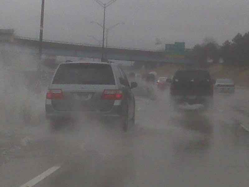
A low-pressure system suffused with moisture from former tropical cyclone Linda unleashed heavy rain on the Southland today, wreaking havoc with the morning commute.
At one point this morning, the rate was falling at a rate of between a fourth and a third of an inch per hour, a National Weather Service statement said.
“The rain will cause ponding of water on area roadways through the morning commute, with local flooding of low-lying areas and intersections. Heavy downpours may cause minor mud and debris flows in and around the recent burn areas,” it said.
Find out what's happening in Encino-Tarzanafor free with the latest updates from Patch.
The wet conditions triggered traffic mishaps throughout the Greater L.A. area and prompted the issuance of SigAlerts on the Ronald Reagan (118) Freeway in Granada Hills, the Golden State (5) Freeway in Echo Park and the Foothill (210) Freeway in Pasadena, but by 7 a.m. only the one on the 210 remained.
“We have certainly seen an real increase in crashes on area freeways,” said CHP Officer Francisco Villalobos. “There’s been a lot of spinouts, overturned vehicles, jackknifed trucks and fender benders.”
Find out what's happening in Encino-Tarzanafor free with the latest updates from Patch.
The weather system’s main band of rain will hover over the region until around noon, said NWS meteorologist Andrew Rorke in a telephone interview from his monitoring station in Oxnard. Some showers are expected Wednesday morning, followed by a sunny afternoon, he said.
Los Angeles County is generally expected to see between two-tenths and a half-inch of rain from this weather system, which is attributed to a low- pressure system combined with moisture from former tropical cyclone Linda, an NWS statement said, slightly reducing Monday’s volume projections.
The chance of rain was set at 70 percent this morning, falling to 50 percent tonight. Forecasters said there is also a chance of showers this afternoon.
The system is also expected to produce high winds, including gusts of 50 miles per hour in the Antelope Valley, it said.
“Since many areas have seen little or no rainfall in the past couple of months, a buildup of oil on the roadways could lead to extra slippery driving conditions,” the statement warned. “Rainfall could cause minor urban roadway flooding across Los Angeles county, which could be worsened by clogged storm drains and culverts.”
The NWS forecast highs today of 69 on Mount Wilson; 71 in Avalon; 74 at LAX; 75 in Pasadena and Saugus; 76 in San Gabriel, Burbank and San Clemente; 77 in Long Beach, downtown L-A and Woodland Hills; 78 in Newport Beach; 79 in Laguna Beach, Palmdale and Lancaster; 80 in Irvine and Mission Viejo; 81 in Anaheim and Fullerton; and 82 in Yorba Linda.
Marginally lower temperatures were expected under partly cloudy skies tomorrow, followed by a slight temperature uptick under sunny skies on Thursday and a return to highs in the 90s in some Southland communities on Saturday.
City News Service; Photo: www.flickr.com
Get more local news delivered straight to your inbox. Sign up for free Patch newsletters and alerts.