Community Corner
After The Rains: NASA Earth Observatory Captures The Greened-Up Golden State
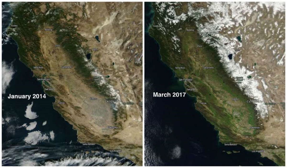
NASA Earth Observatory compared photos from 2014 to 2017, showing just how California has changed after recent rains.


The NASA Earth Observatory has aimed its cameras toward the Golden State to show the differences a few years can make.
Original photos taken in January of 2014 were compared to the same angle photo taken in March of 2017. The differences were striking enough to get the internet talking.
The state of California receives half of its precipitation between December and February, and the 2013-2014 water year was one of the driest on record, leading the state into emergency drought response.
Find out what's happening in Lake Forestfor free with the latest updates from Patch.
"From brown landscapes to bare mountains, California is clearly dry in the view from NASA's Terra satellite," NASA stated online.
The culprit behind all of the rain? Atmospheric rivers, according to NASA, that are sweeping channels of moisture across the Southland.
Find out what's happening in Lake Forestfor free with the latest updates from Patch.
"California has been experiencing drought since 2012, though 2017 has brought some relief in the form of torrential rains," NASA said on Facebook. "These rains traveled to California in a series of atmospheric rivers, long narrow channels of water vapor in the atmosphere."
These channels bring rain to the state when they are disrupted by atmospheric conditions over California's eastern mountains.
"This visualization of atmospheric water vapor and precipitation during the first three months of February clearly show the successive atmospheric rivers and the resulting rainfall."
Terra Satellite photos also captured the dramatic flooding of the spillway from the Oroville Dam, another effect of the recent rains that have inundated California.
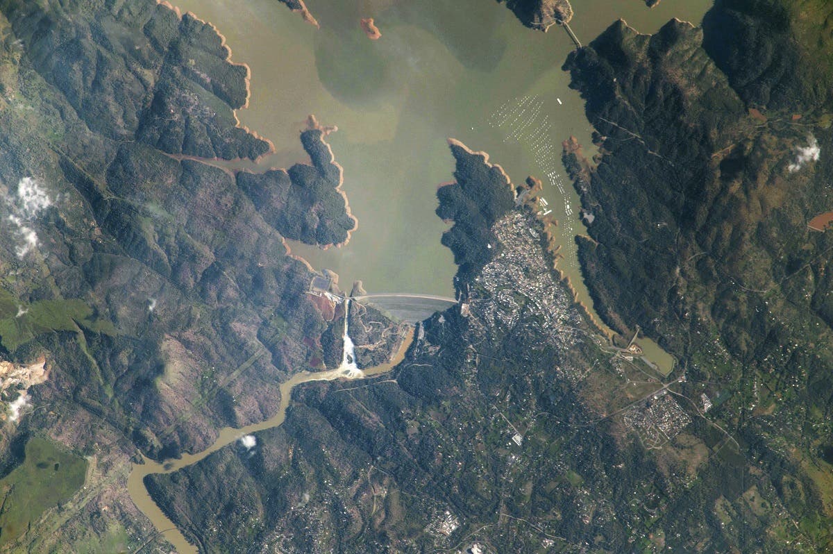
"In February 22, 2017 an astronaut on-board the International Space Station took this photograph of California’s Oroville Dam," NASA reported from the Earth Observatory website. "Oroville has been in the news since water reached critically high levels and a large hole appeared in an emergency spillway on February 7, 2017."
NASA's photographs of the greening of California have gone viral, showing rain- swollen rivers and reservoirs as well as sediment stirred up by flooding.
According to NASA, weather stations in the northern Sierra Nevada have recorded remarkably high levels of precipitation for the 2016-2017 water year, and reservoir levels are well above historical average across California.
"As of February 11, Lake Oroville stood at 151-percent of the historical average, Folsom Lake was at 144-percent, Lake Shasta was at 138-percent, and Lake McClure was at 182-percent," NASA said.
According to the California Department of Water Resources, the 2016-2017 water year is heading toward being the wettest recorded year in history.
Recently, Patch reported that the majority of California has moved from extreme drought to "abnormally dry," per the National Weather Service, with Orange County remaining in the "moderate drought" category at last check.
Read: Orange County Remains In Moderate Drought, NWS Says
"It has been a very wet rainy season in Southern California so far, with many stations receiving more than 150% of their normal precipitation through the end of February for the current 'water year,'" The National Weather service reported.
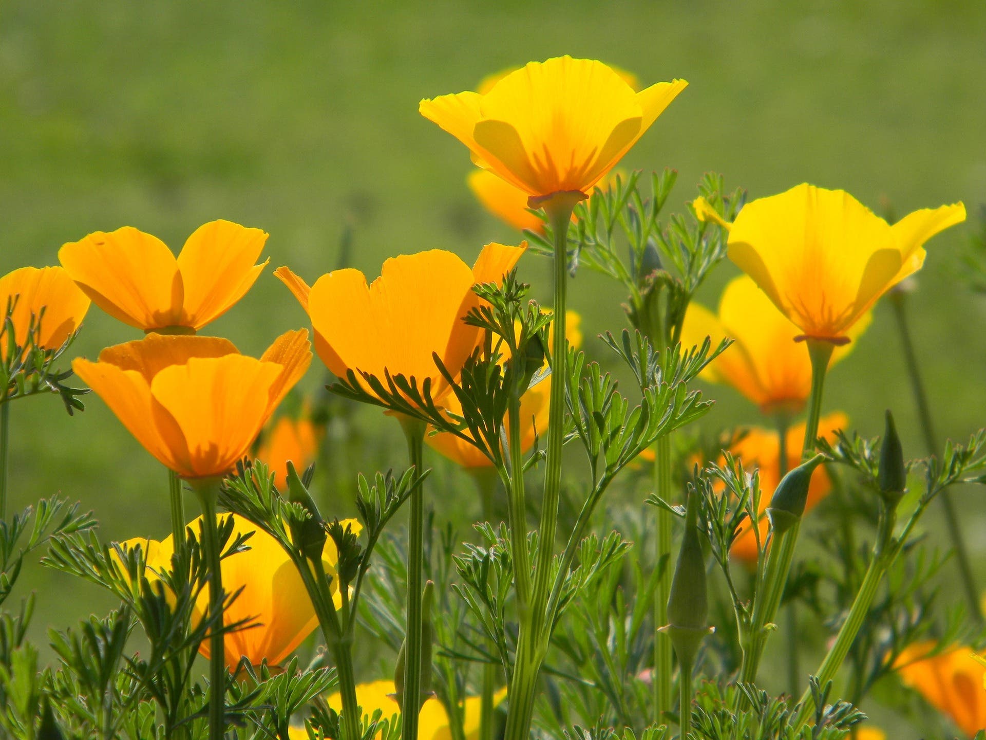
It's all of the ingredients needed for for a gorgeous spring. Rain, a more than healthy snowpack and now added sunshine all contributing to a plethora of poppies. The California state flowers can be seen bobbing their orange heads all across the green hills of southern California.
Photos, courtesy NASA Earth Observatory
Get more local news delivered straight to your inbox. Sign up for free Patch newsletters and alerts.