Weather
SoCal Storm Timeline: When To Expect More Rain, Snow And A Reprieve
A look at the timeline of rain and snowfall expected across the Southland Tuesday and Wednesday.

SOUTHERN CALIFORNIA — The final storm in a series that dumped record rain and snow across the Southland will go out with a bang.
A record-breaking weekend of rain and snow dropped nine inches of rain across Los Angeles and 90 inches of snow in Wrightwood, according to the National Weather Service. The County of San Bernardino on Monday declared a state of emergency as mountain communities in Big Bear and Lake Arrowhead try to dig out from under several feet of snow.
However, the snow will keep falling through Wednesday, according to AccuWeather. A winter weather advisory will remain in effect across Southland mountains until 4 p.m. Wednesday.
Find out what's happening in Los Angelesfor free with the latest updates from Patch.
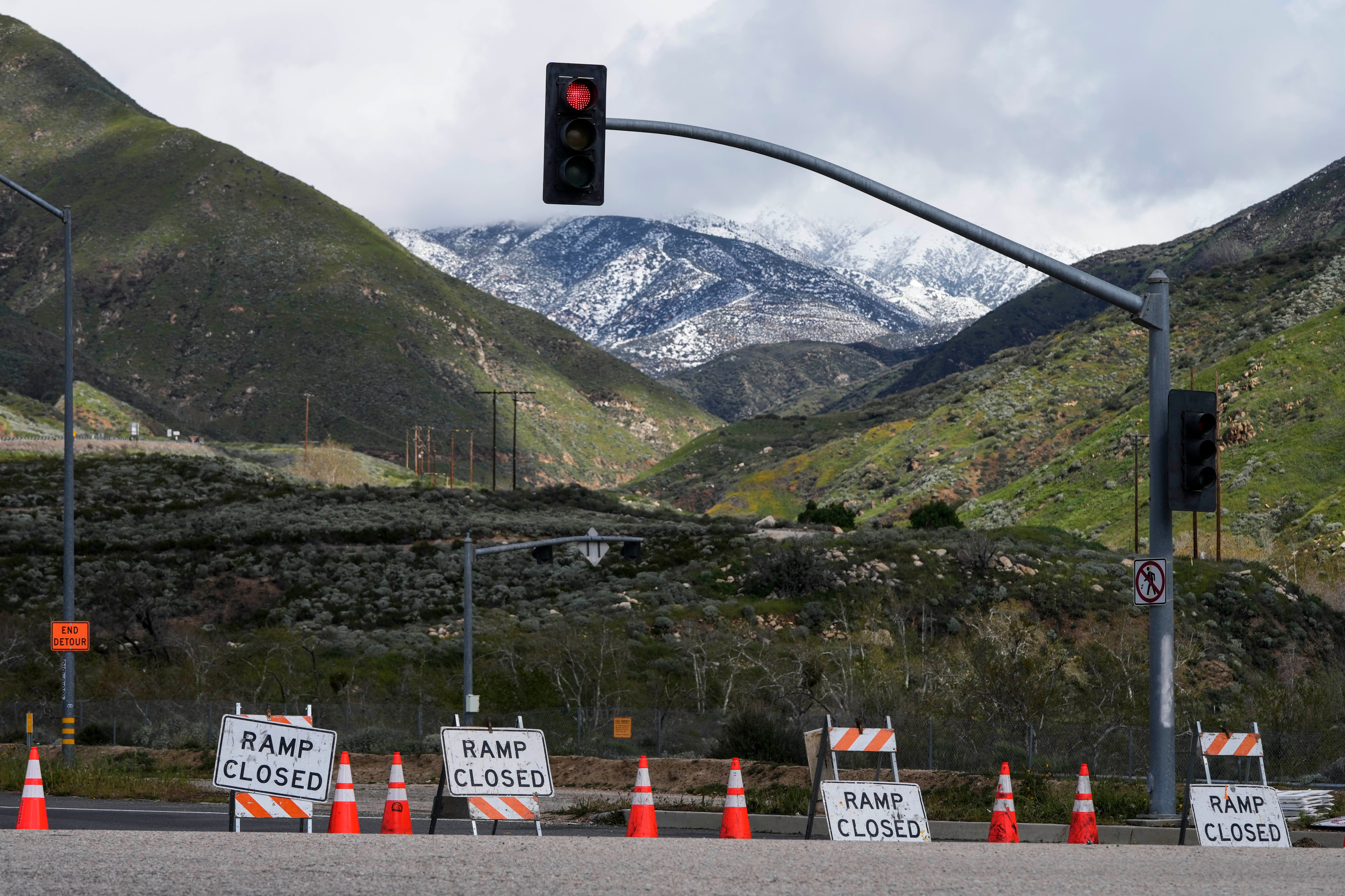
Big Bear, which sits at an elevation of about 6,700 feet, will see another two feet of snow between Tuesday night and Wednesday, according to the National Weather Service. Meanwhile, Wrightwood— at 5,900 feet— can expect another 7 to 13 inches of snow, and Mt. Baldy could get between 17 and 27 inches of snow.
Moderate snowfall was expected Tuesday evening with heavier snow falling overnight above 5,000 feet. As happened Friday, a light dusting of snow could fall as low as 1,500 to 2,000 feet, bringing rare March snowfall to places such as Glendale and Rancho Cucamonga.
Find out what's happening in Los Angelesfor free with the latest updates from Patch.
Wind gusts could reach 60 mph, the National Weather Service warned.
Dangerous driving conditions could result from the snowy and winter conditions, forecasters warned.
Southern California was just beginning to dry out from two days of virtually nonstop rain Sunday, although thousands of people remained without electricity in Los Angeles County.
Tuesday saw sunny skies throughout the Southland, but by 5 p.m. storm clouds were expected to open up in the San Fernando Valley and were expected to move south to Mission Viejo in Orange County by about 6 p.m. By 7 p.m., the storm was forecast to hit the San Diego region, according to AccuWeather.
In Riverside County, a winter storm warning remained in effect for the Banning, which was expected to get snow by about 6 p.m. The storm was expected to reach Temecula by 9 p.m. Tuesday, according to AccuWeather.
Forecasters said by the time the storm series ends, most valley and coastal areas would see between 0.75 to 1.25 inches of rain, with some mountain areas receiving up to 3 inches.
Another (weaker) storm will impact the area tonight-Weds. Snow levels will be lowest Tues-Weds. While we won't see snow levels quite as low as this last storm, the Grapevine will still be affected. Make sure to check road conditions before any travel! #CAwx #LArain #LAwx #socal pic.twitter.com/zRX5XDMn0Z
— NWS Los Angeles (@NWSLosAngeles) February 26, 2023
After the storm passes on Wednesday, a slight warmup is expected as sunny skies return for the rest of the week.
For many, the reprieve from powerful winter storms will be welcome.
The torrential rains in La Cañada Flintridge prompted a mudslide Sunday that severely damaged at least one home on Paulette Place and raised concerns about additional slides that could occur with more rain.
"Gusty southwest to west winds are possible for periods of times, especially across the interior portions of the area and mountain areas over the next several days," according to the NWS.
State Route 2 in the Angeles National Forest was closed from two miles north of I-210 to Islip Saddle due to snow. State Route 39 in the Angeles National Forest was closed at East Fork Road due to mud and debris blocking the roadway.
Temperatures continue to be well below normal.
Daytime highs on Sunday were 54 degrees in downtown Los Angeles, 52 in North Hollywood, 51 in Pasadena and 49 in Valencia. Those numbers were expected to be roughly the same over the next few days.
Lows were mostly in the 30s, dropping to the 20s in some mountain areas and in the 40s in Orange County.
This weekend was the first time downtown Los Angeles received at least 2 inches of rain on consecutive calendar days since Feb. 28 and March 1 of 1978, according to the NWS.
The weather service added that Friday was the wettest February day at Burbank Airport since records began there in 1939, beating the previous record of 4.50 inches set on Feb. 8, 1993.
The powerful series of storms are expected to help replenish California's reservoirs after the driest year on record. The state's snowpack is already at one of the highest totals on record.
“Given the outlook of a continuation of very active and cold, snowy conditions for at least the next couple of weeks, it’s very possible we’ll end up vying for one of the top two snow years on record in parts of the state,” Daniel Swain, a UCLA climate scientist, said in a virtual discussion Monday, the Los Angeles Times reported.. “Regardless, we’re going to end this year with a very large Sierra Nevada snowpack.”
City News Service contributed to this report.
Get more local news delivered straight to your inbox. Sign up for free Patch newsletters and alerts.