Community Corner
Mt. Gower Open Space Preserve
A panoramic view and interesting rock formations make this a "must" for hikers.
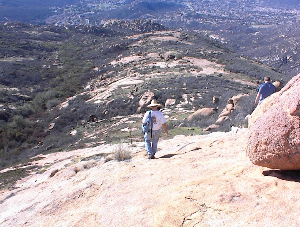


There are several trails to hike at Mount Gower, which is a county-operated preserve. We choose the main trail to the peak. It's a robust trail in a few places. Mount Gower is a granite pluton, which is clearly evident in satellite images—valuable resources for hikers.
The trail from the parking lot goes west into Swartz Canyon between Swartz Ridge (where the water tower is) and the small peak to the north. It crosses the creek and winds up to the water tower and heads east along the ridge. The ridge has a couple of undulations of about 100 to 400 feet in elevation. After this, the trail crosses the brush area and up another rise to a meadow. Then hikers cross the meadow and climb up another rise to the mantle below the peak.
The mantle is a solid rock outcrop. The Mount Woodside granadorite of this formation is weathering in sheets and then breaking into blocks of various shapes. There are very dramatic shapes around the mantle, shaped by wind, water and ice. Sometimes I see evidence of a lightning strike in the rocks which has shattered or split boulders.
Find out what's happening in Powayfor free with the latest updates from Patch.
When the Cedar Fire burned the mountain top, a different type of shattering occurred and boulders explosively released shards from around the sides. One of the natural wonders on the mantle can be found by hitting the rock with your hiking stick. The rock resonates like a hollow tree trunk. The fires also tend to stress the granite and make it ring better.
Wind weathering on the rocks also has made some interesting shapes and patterns. Heading through a bit of brush to the peak, following the thread markers or stacked rock piles, you get to the side wall of the peak. This is only for the hardy. It requires some strenuous climbing. No ropes are necessary, just hands and foot work.
Find out what's happening in Powayfor free with the latest updates from Patch.
The view from the summit is a sweeping panorama of San Diego County, from the coast and coastal range mountains to the high mountains in the east. If you have time, you can enjoy walking around the plateau on the mantle, looking at the granite formation. Maybe you can find the amphitheater with the Stonehenge headstones.
If you go, please say hi to the chief on the way up. You will know these features when you see them. There is a historical Indian site up there somewhere. It's a great place to lose part of a day exploring.
By the way, Swartz Canyon has a mine cut into the east valley wall. It only goes in about 25 feet. There has also been flour gold panned out of Swartz Creek. The San Diego Mineral Report shows an Apatite outcrop on the north flank of the mantle where the trail crosses.
Trailhead: East end of Gunn Stage Road, 5.5 miles east of downtown Ramona.
Directions: Take San Vicente Road to Gunn Stage to the Swartz Canyon County Park.
Length of trail: 7 miles round-trip to peak
Elevation: 3,104 feet
Elevation increase: 1,500 feet
Difficulty level: Moderate to steep in places.
Suggestions: Trail can be hot in summer, so plan morning hikes then. It is recommended to carry at least two quarts of water for this hike on hot days. Be watchful for rattlesnakes, especially in creek beds.
Parking: Free parking in a large lot.
Restrooms: Portable units.
GPS: Latitude 33.016435 Longitude: -116.762523
Suggested Link: