Weather
Flood Watch In Orange County's Burn Scar Areas, Storm Prep Underway
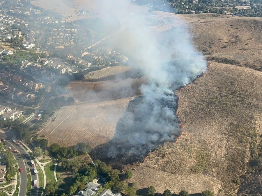
Silverado Canyon and Williams Canyon residents in the Bond Fire burn scar area are keeping a watchful eye on the forecast as storms move in.


RANCHO SANTA MARGARITA, CA — Rows of sandbags line unincorporated Orange County roads as OC Public Works crews prepare for the next rain onslaught. According to the National Weather Service, the area is under a Flood Watch from Wednesday night through Thursday afternoon.
Silverado Canyon and Modjeska Canyon residents are expecting showers and thunderstorms all day Thursday, with about 1 to 2 inches of rain blowing through the area, along with winds gusting up to 35 miles per hour.
"The cold front of a strong Pacific storm is moving inland through California and is expected to bring more widespread and locally heavy rainfall," NWS spokesperson Alexander Tardy said. Residents should prepare to take action should flooding develop and monitor the official channels in case of evacuation orders.
Find out what's happening in Rancho Santa Margaritafor free with the latest updates from Patch.
Over New Year's weekend, Silverado Canyon and Williams Canyon residents in the Bond Fire burn area were under voluntary evacuation warnings due to potential mudflows. As the next storm approaches, they may be asked once again to leave their homes again to ensure their safety.
"Our crews are in the canyon areas today preparing for rain and possible mud flows," Orange County Public Works spokesperson Shannon Widor announced over Facebook. "We’ll have teams in the community monitoring conditions over the next couple of days as rain is expected."
Find out what's happening in Rancho Santa Margaritafor free with the latest updates from Patch.
(Video: Our team at Santiago Canyon Road in Silverado)
The entire area was evacuated during the Bond Fire which decimated the hillside above their homes two years ago. The threat of mud and debris flows remains at the forefront of Silverado Canyon residents' minds, such as Dale Aviss. He has watched weather events in this area for over 30 years, he told CBS's Michelle Gille in a recent interview.
"We've been fortunate," he told Gille. "Below us, on the south side, there has been a lot of damage."
Residents are sandbagging and barricading driveways and clearing the roads knowing the potential damage that could occur during a strong storm.
The flood watch will remain in effect Wednesday evening through Thursday afternoon over the bulk of the Southland, according to the NWS.
A wind advisory will remain in effect in Orange County from 2 a.m. to 4 p.m. Thursday, with winds of 15 to 25 mph possible, including gusts of up to 40 mph, according to the NWS.
Get more local news delivered straight to your inbox. Sign up for free Patch newsletters and alerts.