Weather
100-Degree Heat Expected During Intense NorCal Heatwave
A midweek warm-up will bring potentially dangerous heat across the Bay Area, with some inland areas approaching 100 degrees.


A sharp midweek warm-up will bring potentially dangerous heat to much of the Bay Area, with temperatures expected to peak Wednesday after more than a week of unusually cool weather.
The National Weather Service issued a heat advisory for its entire Bay Area forecast area, covering 11 counties from Sonoma County south to Monterey County. The advisory is in effect from 10 a.m. Wednesday through 10 p.m. Thursday.
Forecasters expect widespread moderate to major heat risk during that period, meaning conditions could affect people who are particularly sensitive to heat, especially those without adequate cooling or hydration.
Find out what's happening in San Franciscofor free with the latest updates from Patch.
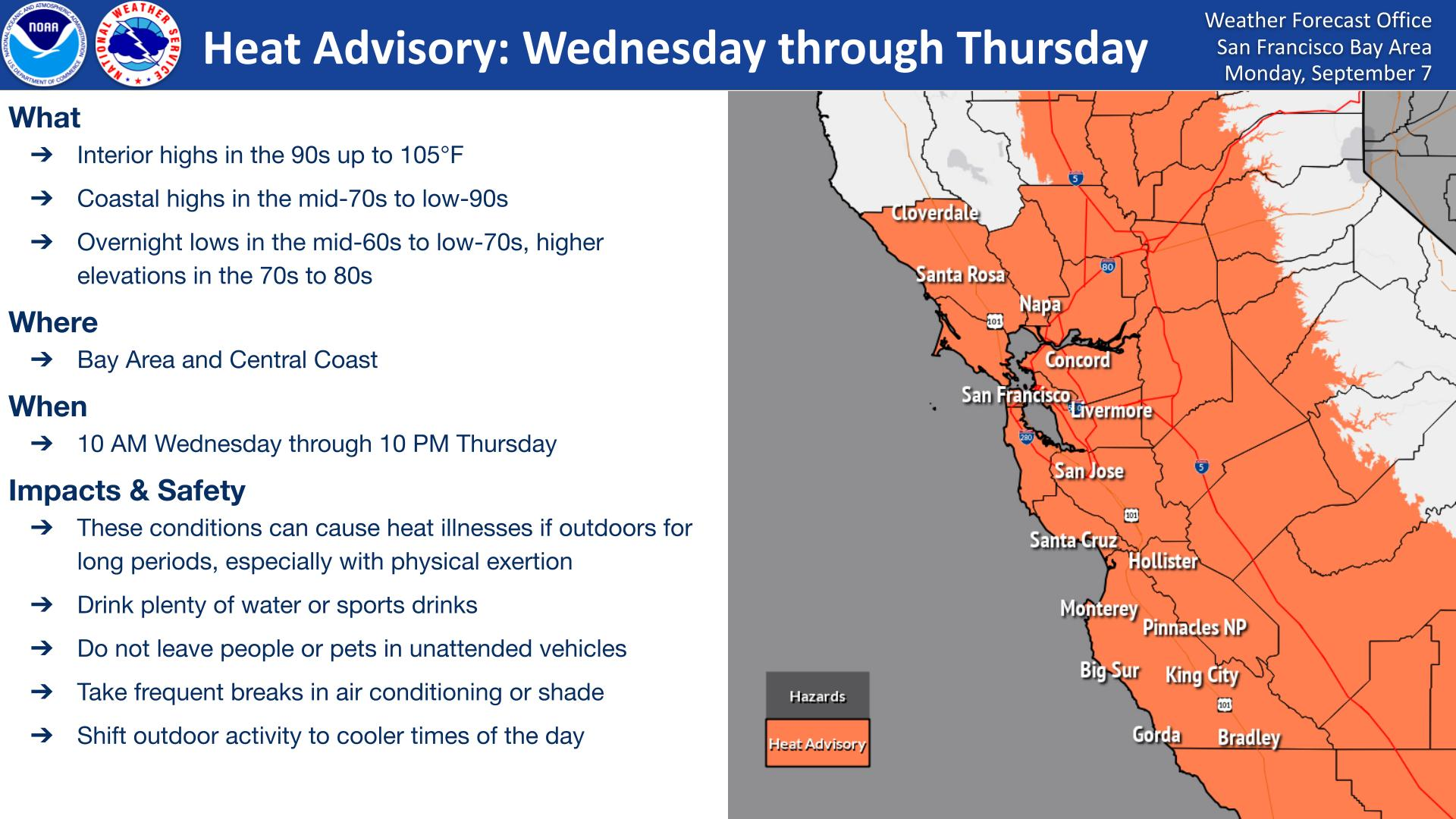
The warming trend began Tuesday and will intensify Wednesday before temperatures moderate somewhat Thursday. Temperatures are expected to move closer to normal by Friday and into the weekend, according to the NWS.
Even Tuesday will feel noticeably warmer across much of the region, including some coastal communities, where weak offshore winds are helping temperatures climb.
Find out what's happening in San Franciscofor free with the latest updates from Patch.
"Not only will we see higher temperatures, we'll see less relief overnight with the higher dewpoints and higher relative humidity levels during peak heating Wednesday and Thursday, further complicating heat impacts," forecasters said.
The heat comes after around 10 days of below-normal temperatures, particularly inland, making the rapid change more noticeable.
Coastal temperatures could climb into the low 90s, while some interior and higher-elevation locations could reach triple digits. Overnight temperatures in warmer areas are expected to remain in the mid-60s to mid-70s.
High Temperatures For Northern California
| City | Tues. | Weds. | Thurs. |
|---|---|---|---|
| Alameda | 86 | 90 | 80 |
| Danville | 98 | 102 | 97 |
| Livermore | 94 | 99 | 95 |
| Mill Valley | 88 | 92 | 87 |
| Napa | 87 | 93 | 88 |
| Novato | 94 | 98 | 92 |
| Palo Alto | 89 | 93 | 87 |
| Sacramento | 94 | 99 | 100 |
| San Francisco | 82 | 86 | 76 |
| SFO | 87 | 92 | 84 |
| Santa Cruz | 83 | 91 | 85 |
The National Weather Service urged residents to stay out of direct sunlight when possible, remain hydrated and move strenuous outdoor activities to cooler parts of the day. People working outdoors should take frequent breaks and seek shade or air conditioning.
Pets and children should never be left inside parked vehicles, even with the windows down.
Along with the heat, minor coastal flooding is possible around high tide Tuesday evening and potentially again Wednesday along low-lying shoreline areas of Marin County.
At the San Francisco tidal gauge, Tuesday night's high tide was expected to reach about 1 foot above normal around 10 p.m. Forecasters said any flooding would likely be limited to about an hour around high tide and primarily affect the lowest-lying bayshore locations.
Get more local news delivered straight to your inbox. Sign up for free Patch newsletters and alerts.