Weather
Flood Advisory, Wind Warning As Storm Rolls Over Bay Area: Forecast
A fast-moving atmospheric river will soak Northern California Tuesday, and wind gusts could hit 70 mph in some places. Here's what to know.


SAN FRANCISCO, CA — Several weather warnings and advisories will stay in place through Tuesday as another atmospheric river pours over Northern California, packing damaging winds and flood risks.
The latest soaker picked up intensity Tuesday morning, and the National Weather Service was reporting localized urban flooding, downed trees and other hazards leading up to 10 a.m.
A big-rig crash on I-680 forced a two-hour shutdown of the northbound lanes of I-680 near Pleasanton earlier in the morning, with backups rippling for miles. Authorities also closed a major trail near Shadow Cliffs due to erosion.
Find out what's happening in San Franciscofor free with the latest updates from Patch.
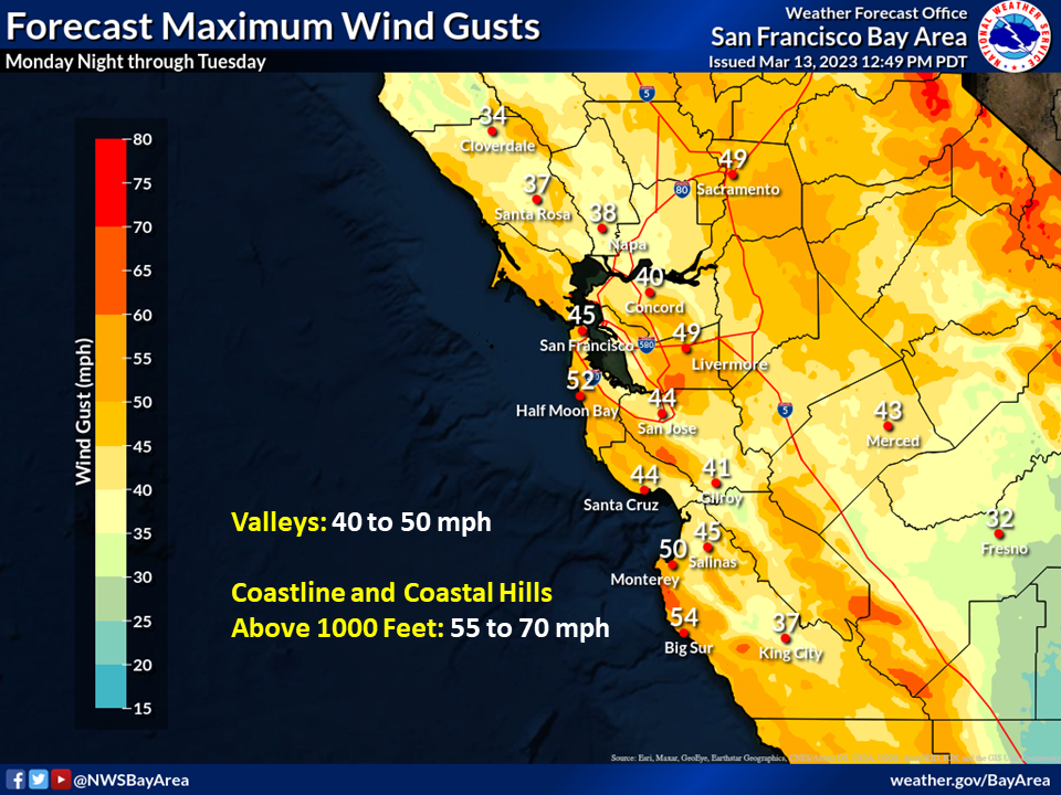
An estimated 275,000 PG&E customers were without power across the Bay Area by the afternoon, and a high wind warning will remain in effect until 11 p.m. Tuesday.
"Winds are strongest along the coast and in the hills, with gusts up to 50 mph (coast) and 60+ mph (above 2500 ft)," NWS forecasters wrote Tuesday, "Around the SF Bay Shoreline, sites are reporting 30-40 mph gusts."
Find out what's happening in San Franciscofor free with the latest updates from Patch.
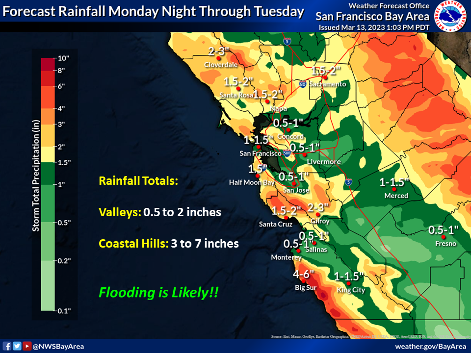
A flood watch will remain in effect for the entire Bay Area and Central Coast into early Wednesday, with forecasters predicting 1 to 3 inches of rainfall in the valleys and inland hills, and 3 to 6 inches possible along coastal ranges. A broader flood advisory for central and northern California is set to expire at 5 p.m.
Fortunately, the National Weather Service said the storm should move rather quickly.
"The one saving grace is that this appears to be a fast moving system, with the back edge of the precipitation shield now in view just off the coast," forecasters said. 'Thus, much of the area aside from the Central Coast, Santa Cruz Mountains and Santa Clara Hills will be transitioning to lighter shower activity this afternoon."
Forecasters warned that flood impacts around rivers and streams will be the biggest concern with this system, due to excessive runoff, and asked residents to avoid unnecessary travel and heed all advisories, warnings, and orders from local authorities.
We are seeing reports of roadway flooding on Hwy 1 near the Salinas River this morning. Please continue to heed road closures and never drive through flooded roadways. #CAwx https://t.co/Obc5NcfUfs
— NWS Bay Area 🌉 (@NWSBayArea) March 14, 2023
Get more local news delivered straight to your inbox. Sign up for free Patch newsletters and alerts.