Weather
NorCal Braces For Stormy Holiday Week That Could Impact Travel
Incoming storms were expected to douse the state through the holiday weekend, potentially creating travel troubles for Californians.

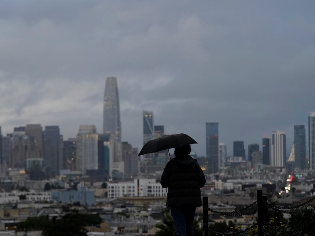
SAN FRANCISCO, CA — Rain was forecast to drench Northern California through the weekend. The incoming storm could trigger landslides and snarl traffic as travelers hit the road to reach their holiday destinations.
Spells of light to moderate rain were expected to hit Northern California beginning Tuesday. The drizzle was expected to linger through the Holiday weekend, according to the National Weather Service.
Winds were forecast to be breezy at times with intermittent moderate gusts between 20-30 mph in higher terrain, weather officials said.
Find out what's happening in San Franciscofor free with the latest updates from Patch.
"With upcoming holiday travel, be sure to drive with caution as roads could be slick and wet. Minor flooding on roadways possible as well," weather service officials tweeted.
Successive waves of precipitation were expected to persist in Northern California through Sunday afternoon. The storm could coat parts of the Sierra Nevada with 1 to 5 feet of snow and possibly up to 8 feet at higher elevations, weather officials said.
Find out what's happening in San Franciscofor free with the latest updates from Patch.
"Rainy, wet week ahead through the weekend," Bay Area weather officials tweeted. "Good news is that rain totals are spread out over many days which should mitigate major impacts."
Coastal areas and interior areas of the Bay Area were forecast to receive 2 to 3 inches of rain. Big Sur was predicted to get 4 to 6 inches of rain, creating hazards for drivers planning to journey through the scenic Highway 1 during the holiday week.
Authorities were also bracing for moderate to heavy rain which could trigger flooding and minor debris flows in area of the Bay Area that were scarred by wildfires.
Rainy, wet week ahead through the weekend. Good news is that rain totals are spread out over many days which should mitigate major impacts. But be prepared for minor flooding, slick roads, and potential for debris flows/mudslides. Burn scars outlined in red. #cawx #BayArea pic.twitter.com/47MC9rZh0A
— NWS Bay Area (@NWSBayArea) December 19, 2021
News of the holiday wet weather comes after storms earlier this month shattered rain records across California. In Los Angeles, 2.16 inches fell, breaking a 133-year-old rainfall record. In Sacramento, 2.51 inches of rain fell, breaking a 1.19 inch record set in 2002.
Powerful storms charged through the Golden State on Dec. 14, drenching drought-stricken regions that desperately needed rain.
The National Weather Service reported remarkable rainfall in several parts of the state.
North of the Golden Gate Bridge, Mount Tamalpais accumulated more than 11 inches over 72 hours. By early Tuesday, nearly 7 inches of rain had fallen in one area of Santa Barbara County, northwest of Los Angeles. More than 4.6 inches fell within 24 hours in Orange County's Silverado Canyon, south of LA, where sheriff's deputies rescued residents from homes inundated by mudslides.
The storm also triggered rescue efforts and mandatory evacuations due to the threat of mudslides in some areas scarred by wildfires.
In Orange County, about 800 canyon homes were under evacuation orders on Dec. 13 after a flash flood warning was issued in the area scorched by a 2020 wildfire.
Meanwhile, residents near the Alisal Fire burn scar in California's Santa Barbara County were ordered that same day to evacuate over concerns that heavy rains might cause flooding and debris flows.
While such storms may not be enough to stamp out the drought entirely, they are helping to quench a dry state.
Jeffrey Mount, a senior fellow at the Public Policy Institute of California’s Water Policy Center, this month told the Associated Press that water watchers are excited about all of the snow these storms are dumping in the Sierra Nevada.
Melted snow that runs into California’s watershed when the weather warms makes up about a third of the state’s water supply. It’s important for a strong base of snow to develop in December so that storms later in the winter have something to build on, he said. Most western U.S. reservoirs that deliver water to states, cities, tribes, farmers and utilities rely on melted snow in the springtime.
"You’re literally putting water in the bank up there," he said.
Any moisture is much-needed in the broader region that’s been gripped by drought that scientists have said is caused by climate change. The latest U.S. drought monitor shows parts of Montana, Oregon, California, Nevada and Utah are classified as being in exceptional drought, which is the worst category.
The Associated Press contributed to this report.
Get more local news delivered straight to your inbox. Sign up for free Patch newsletters and alerts.