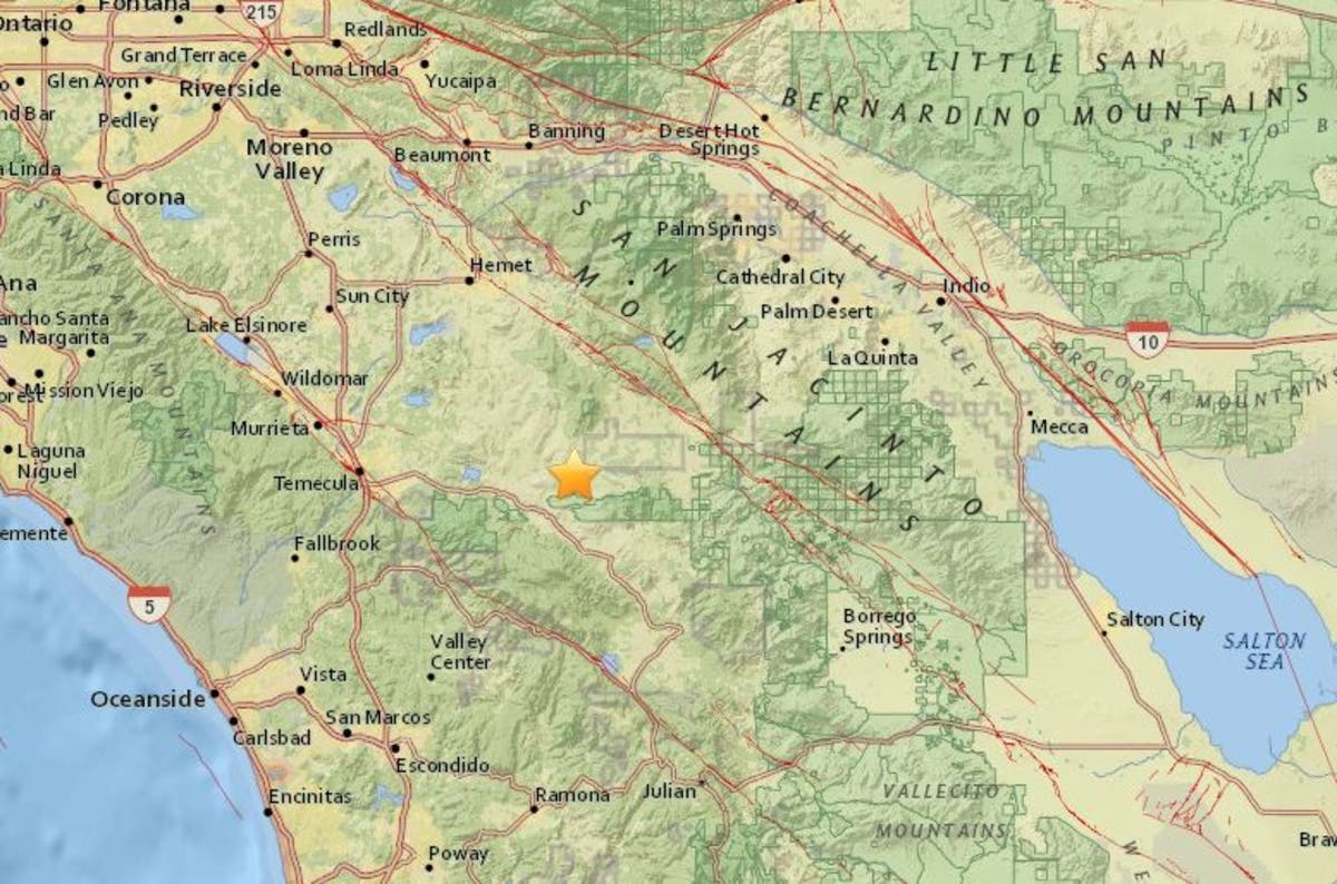
RIVERSIDE COUNTY, CA — A magnitude 3.3 earthquake shook just east of Temecula on Monday morning, the U.S. Geological Survey reports. The temblor hit at 8:44 a.m.
According to the U.S.G.S., the quake was located about a mile below the earth's surface and was centered:
- 5.0 mi) NE of Aguanga
- 8.7 mi) WSW of Anza
- 9.9 mi) NNE of Palomar Observatory
- (17.4 mi) N of Lake Henshaw
- 28.0 mi) SW of Palm Springs
Four smaller aftershocks were recorded in the next 10 minutes, ranging from 0.7 magnitude to 1.6 magnitude, data shows.
Find out what's happening in Temeculafor free with the latest updates from Patch.
By subscribing, you agree to Patch's Privacy Policy and Terms of Use.
Just last week, the same area near Aguanga was rocked by a 4.4-magnitude quake, which was widely felt in the Temecula Valley.
Did YOU feel Monday's quake? Let us know in the comments below!
Find out what's happening in Temeculafor free with the latest updates from Patch.
By subscribing, you agree to Patch's Privacy Policy and Terms of Use.
--
Image via U.S.G.S.
Get more local news delivered straight to your inbox. Sign up for free Patch newsletters and alerts.