Neighbor News
Tweed-New Haven Airport: How’s your Approach?
If you ask a Hawk, not very good! In this article I will describe the kinds of instrumentation that pilots use to stay safe.

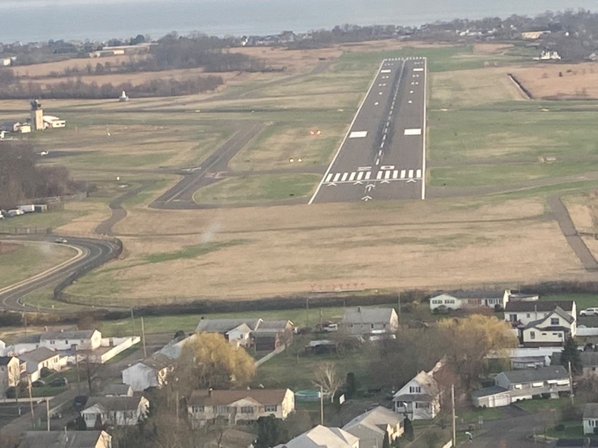
As the opposition to Tweed New Haven Airport musters it’s strength, I thought it appropriate to share their proclamations of “danger from above” and to counter such fanfare with the reality of FACTS. In their munitions’ against Tweed, they arm themselves with claims of dangerously low flying aircraft. They substantiate their claims with internet flight trackers and non-stop videos of daily near disaster. Adding to their claims, they verbally lament that airplanes are flying at tree-top level, grazing their roofs or buzzing their cars! I am afraid they are mistaken.
Glide slope! Glide slope! Pull Up! Pull Up!
Believe it or not, the AVELO 737 aircraft and the private jets that frequent Tweed, all use and are required to have Ground Proximity Warning Systems as onboard instrumentation (GPWS) or Terrain Awareness Warning System (TAWS) These systems alert 🚨 the flight crew to the danger of being too low ( the very thing the 10,000 Hawks seem to be experts at judging) when landing with verbal and visual warnings. Without getting overly technical, these and other warnings are always “armed”, ready to alert the Flight Crew if they deviate from the proper flight path. Again, GPWS/TAWS systems alert pilots to a number of improper flight path conditions. Did the “10,000 Hawks” know about this safety feature? I think they do now. You know what’s more important though than them? You. I want you to know about this safety mechanism on all the jets that fly into Tweed.
Here, I pasted an excerpt of what GPWS and TAWS does...
Find out what's happening in East Havenfor free with the latest updates from Patch.
Commercial aircraft -GPWS
The FAA specifications[19] have detailed requirements for when certain warnings should sound in the cockpit.
The system monitors an aircraft's height above ground as determined by a radar altimeter. A computer then keeps track of these readings, calculates trends, and will warn the flight crew with visual and audio messages if the aircraft is in certain defined flying configurations ("modes").
The modes are:
Find out what's happening in East Havenfor free with the latest updates from Patch.
- Excessive descent rate ("SINK RATE" "PULL UP")[Note 1]
- Excessive terrain closure rate ("TERRAIN" "PULL UP")
- Unsafe terrain clearance ("TOO LOW – TERRAIN" "TOO LOW – GEAR" "TOO LOW – FLAPS")
- Excessive deviation below Glideslope ("GLIDESLOPE")
- Excessively steep bank angle ("BANK ANGLE")
- Windshear protection ("WINDSHEAR")
Information provided by TAWS
TAWS equipment is classified as Class A or Class B according to the degree of sophistication of the system. In essence, Class A systems are required for all but the smallest commercial air transport aircraft, while Class B systems are required by larger General Aviation (GA) aircraft and recommended for smaller commercial or GA aircraft. Full details of regulatory requirements are given later in this article.
TAWS equipment must provide the following functions:
- A Forward Looking Terrain Avoidance (FLTA) function. The FLTA function looks ahead of the aircraft along and below its lateral and vertical flight path and provides suitable alerts if a potential CFIT threat exists.
- A Premature Descent Alert (PDA) function. The DA function of the TAWS uses the aircraft’s current position and flight path information as determined from a suitable navigation source and airport database to determine if the aircraft is hazardously below the normal (typically 3 degree) approach path for the nearest runway as defined by the alerting algorithm.
- An appropriate visual and aural discrete signal for both caution and warning alerts.
- Class A TAWS equipment must provide terrain information to be presented on a display system.
- Class A TAWS equipment must provide indications of imminent contact with the ground for the following conditions:
- Excessive Rates of Descent
- Excessive Closure Rate to Terrain.
- Negative Climb Rate or Altitude Loss After Take-off
- Flight Into Terrain When Not in Landing Configuration
- Excessive downward deviation from an Instrument Landing System (ILS) glideslope, Localizer Performance and Vertical Guidance (LPV), or Global Navigation Satellite System (GNSS) Landing System (GLS) glidepath.
- Voice callout “Five Hundred” when the airplane descends to 500 feet above the terrain or nearest runway elevation.
Instrument Landing System and Global Positioning System.
Each of Tweeds’ runways has “electronic glide slope ” available. These are systems that show the pilot via Flight Deck Instrumentation, whether they are too high, too low or just right (Sorry Goldilocks). ILS is a ground based system whereas GPS is satellite. But in either case, when landing on Tweed’s runways, the Flight Crew always knows where they are reference the proper glide path to the runway. Tweed has both of these systems for each of its runways.
Here, I pasted an excerpt about ILS
An instrument landing system operates as a ground-based instrument approach system that provides precision lateral and vertical guidance to an aircraft approaching and landing on a runway, using a combination of radio...
VASI and PAPI
Each of Tweeds runways are equipped with visual lighting systems that convey to the pilot their relation to the proper approach path to runway. The specific color combination conveys this information to the pilot and changes if the approach changes from high to low or just right. Further, as with the already described approach systems, these VASI and PAPI lights are available day or night. Also, these lights can be used by pilots from as far as 4 to 5 miles from the runway. The picture with this article shows one of these systems in use. Feel free to lookup these systems online to feel better in knowing I’m telling you the truth.
Here, I pasted an excerpt of VASI and PAPI lights...
The visual approach slope indicator (VASI) is a system of lights on the side of an airport runway threshold that provides visual descent guidance information during approach. These lights may be visible from up to 8 kilometres (5.0 mi) during the day and up to 32 kilometres (20 mi) or more at night.
Standard visual approach slope indicator (circled in red)
Comparison of PAPI, VASI, and Basic visual approach slope indicators consist of one set of lights set up some 7 metres (23 ft) from the start of the runway. Each light is designed so that it appears as either white or red, depending on the angle at which it is viewed. When the pilot is approaching the lights at the proper angle, meaning the pilot is on the ###a href="https://en.wikipedia.org/wiki/Glide_slope" class="mw-redirect" title="Glide slope">glide slope, the first set of lights appears white and the second set appears red. When both sets appear white, the aircraft is too high, and when both appear red it is too low. This used to be the most common type of visual approach slope indicator system; however, it is being phased out and replaced by precision approach path indicators (PAPIs), which are closer together and therefore more efficient to sight and maintain.
Finally…the ‘Snitch’ machine.
A number of aircraft that frequent Tweed have recording systems (not unlike black boxes) that track and record all sorts of flight related data. This data is routinely retrieved, reviewed and then used to capture any safety trends that might be useful to the pilots of the given airplane. While it is private and proprietary in nature, this information is used directly for the purposes of safety. This privacy is sanctioned by the FAA and other regulatory agencies but is unequivocally used for purposes of safety.
You guessed it, I pasted an excerpt!
Flight operational quality assurance also known as flight data monitoring (FDM) or flight data analysis, is a method of capturing, analyzing and/or visualizing the data generated by an aircraft moving through the air from one point to another. Applying the information learned from this analysis helps to find new ways to improve flight safety and increase overall operational efficiency. Several airlines and various national air forces have initiated FOQA programs to collect, store and...
In closing.
My reason for sharing this information is to hopefully make you feel safer about living near an airport. You should know about the described systems because I feel it is your right as residents nearby to an airport. It just so happens that the anti-airport rhetoric of the “10,000 Hawks” is wrong when it comes to “dangerously low flying planes”. Each time one of the 737s lands at Tweed, they are using at least 2 systems concurrently to fly the proper approach to the runway. The Hawks either didn’t know this, or worse still, don’t want to know.
🛑 STOP PORTRAYING YOURSELVES AS KNOWLEDGABLE IN SOMETHING YOU ARE NOT ✈️
You don’t want the airport. That’s fine and dandy. Just don’t portray yourselves as the authority you are not.
The main ideas of this article were shared with the rank and file of the Hawks by me…and they simply ignored them…choosing to alarm the neighborhood with false claims instead. Their behavior and attendant malarkey is irresponsible in that they are not affording you the true picture and possibly scaring you in the process. They are painting with one brush. There are others who want to paint too. They want you to believe that airplanes are swooping in from the heavens, with reckless abandon, endangering the community, unregulated and unmonitored. They are wrong.
Toni Lorenti, Captain CE680, ATR42, ERJ145.
Certified Flight Instructor, Single and Multi-Engine.
Certified Ground Instructor.