Neighbor News
Tweed-New Haven Airport: Imaginary Surfaces.
The "10,000 Hawks" Anti-Airport group is again fanning flames of discontent through misinformation. The victims? The public.


When it comes to aeronautical matters; charts, maps and tables reign supreme. One of the many draws for me to aviation is the realm of map and chart reading. These visual representations are visually and intellectually stimulating as they provide copious amounts of information.
In keeping with this interest and experience reading aeronautical maps and charts, I thought I'd seize the opportunity to discuss and describe a map pertaining to Tweed-New Haven Airport. With HVN's future detailed as it has been thus far, understanding maps and charts is certainly paramount to a coherent and reasonable discussion about the airport.
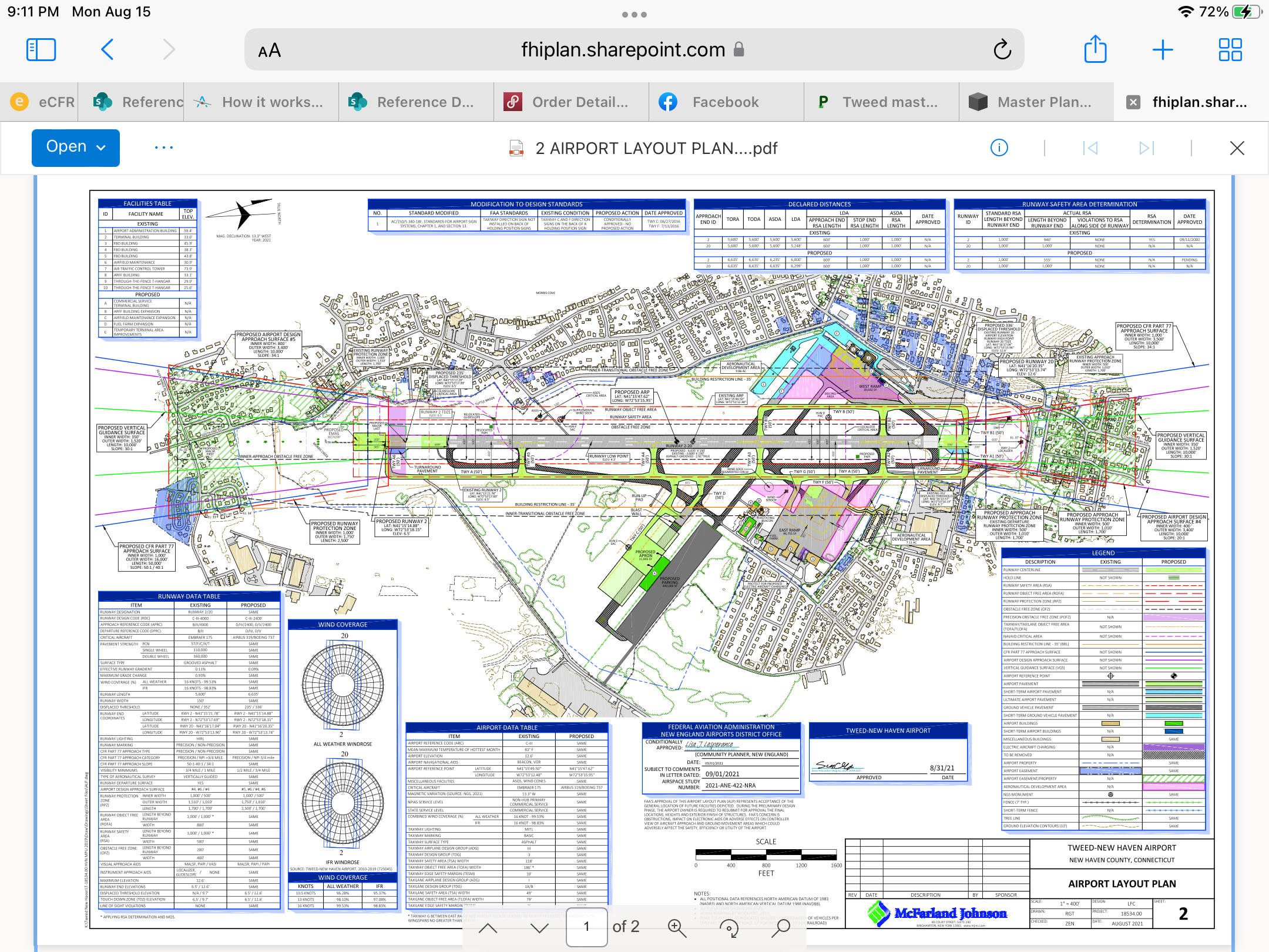
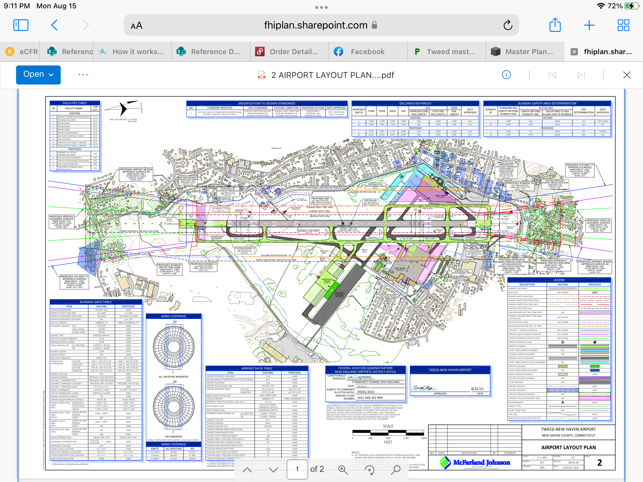
The map you see above is extracted from the voluminous primary document that details the Tweed-New Haven Airport Master Plan. Specifically, it is a look down view of HVN and proposed changes to the airfield layout. Among other things, it shows current, proposed and other surfaces of Tweed Airport. It shows both what are called Landside and Airside features.
Find out what's happening in East Havenfor free with the latest updates from Patch.
Unfortunately for you (and fortunately for my endless list of subjects to write on), it seems someone has made great effort to share their misunderstanding (deliberate denial of truth) of this map with the public. This might be an effort to promote a certain cause, but I am not entirely sure. Either way, I wanted to explain a very important and specific detail about this map. I want to tell you what it means.
ADDENDUM TO HIS ARTICLE: The diagram provided even spells out itself the Part 77 areas that I describe. Amazing! How is it that a diagram that is so difficult to understand, is so easy to understand ? It appears the “10,000 Hawks” and their panel of experts had better hire better experts to read what is right in front of them. - Toni Lorenti. Aug 22.
Find out what's happening in East Havenfor free with the latest updates from Patch.
Imaginary Surfaces and CFR 14 Part 77.
If you look at the end of each runway, you will see trapezoidal shapes. These trapezoidal shapes are referred to by many technical terms, but for brevity's sake, we will call these trapezoidal areas "Imaginary Surfaces". These Imaginary surfaces are areas meant to be obstacle free.
Have you ever noticed that houses are not built right up to the beginning of an airport runway? Did you ever notice that trees do not freely grow right up to where an airport runway actually begins? Do you see Power Companies installing powerlines right next to the runway? There is a reason for this.... it's to allow a gradual, obstacle free path to the runway. This promotes safety by allowing aircraft to make "non-steep" or what we call, "stable" approaches to the runway.
Imaginary Surfaces are invisible slopes that gradually descend to the actual runway pavement. The exact description of these slopes can be very complex and mathematical, but rest assured, such is real fact. CFR 14 Part 77 is linked so that you don't have to take my word for fact.
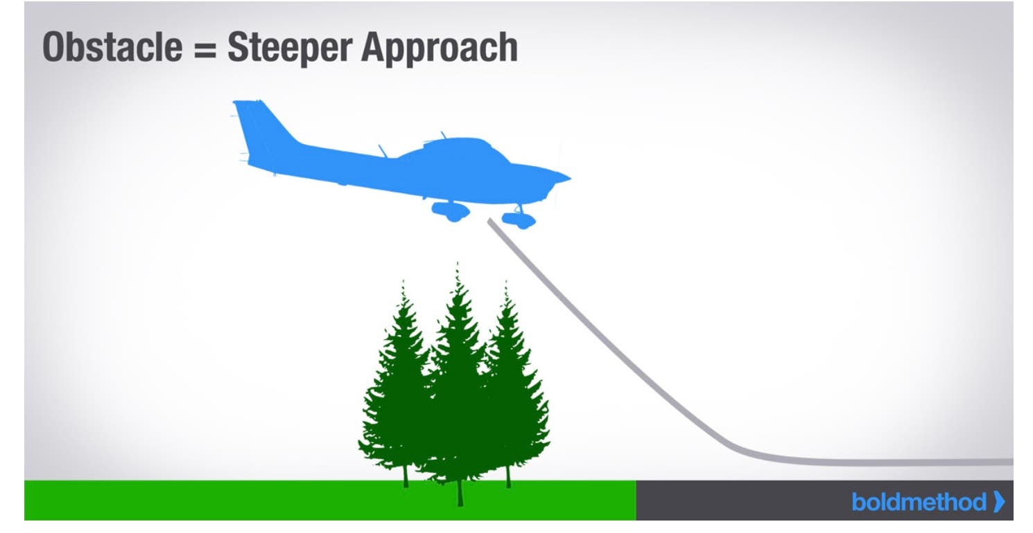
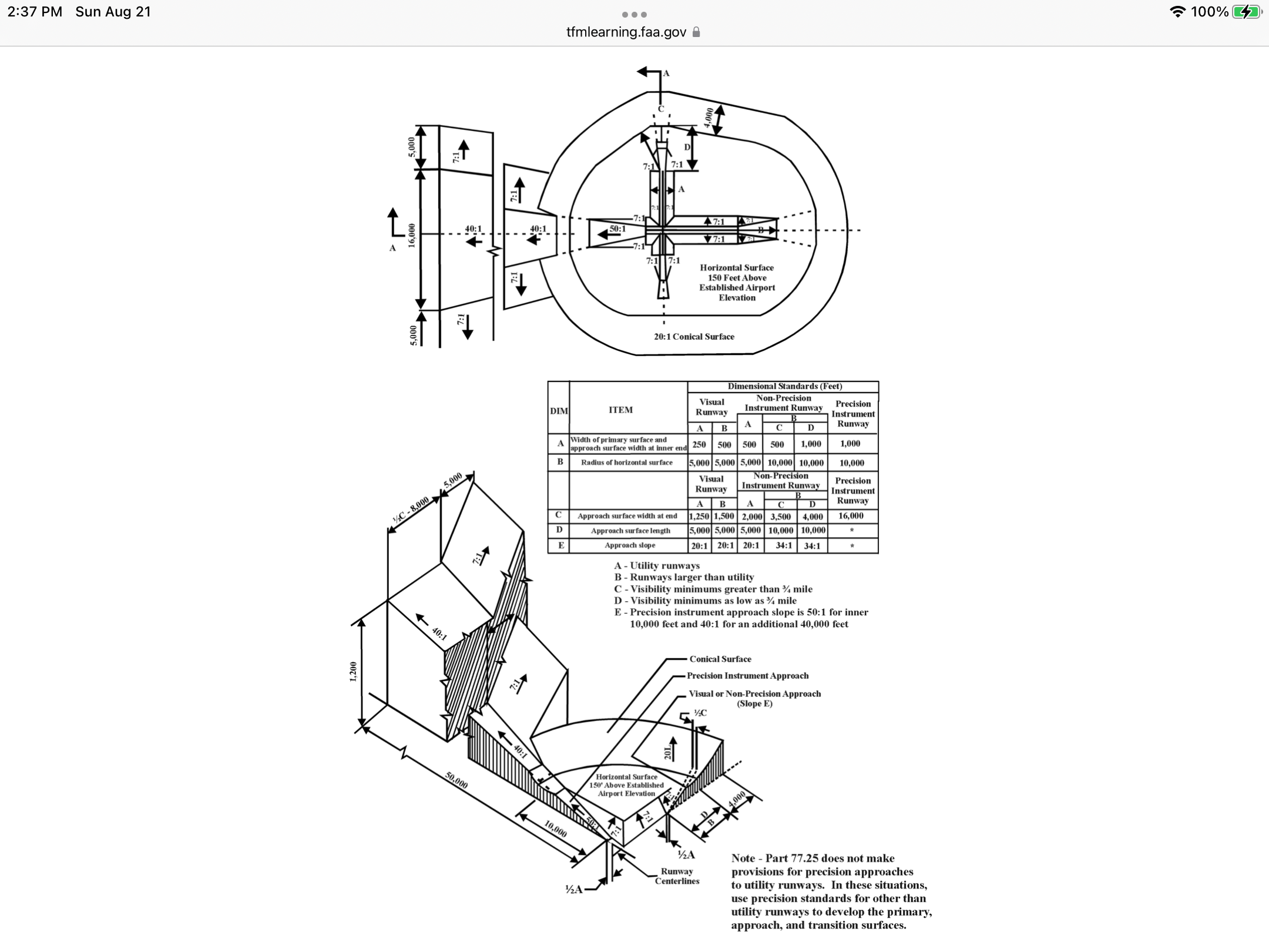
These are diagrams that show the imaginary protected surfaces leading to runways. The FAA requires them to be clear. The provided HVN Airport diagram shows these areas, not homes destined to be bulldozed, that will be addressed regarding EASEMENTS.
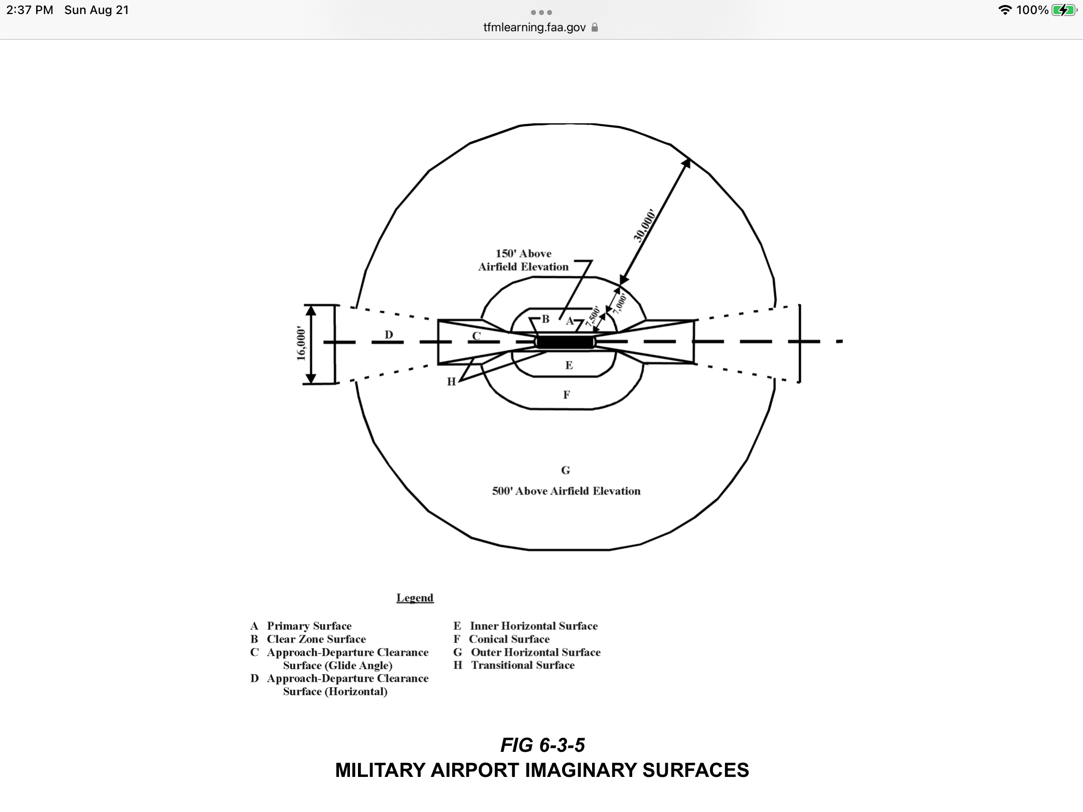
In the maintaining of an airport, the Imaginary Surfaces described require constant observation (surveys) on the part of the specific airport in question. The FAA requires this of all airport operators, master plan study or not. The chart and the symbology you see are all related to the exact matter of illustrating and protecting these imaginary surfaces. Granted, they are adjusted to the proposed runway extension...but they are almost the same approximate location that they are in today in relation to Tweed's current runway length (5,600 feet).
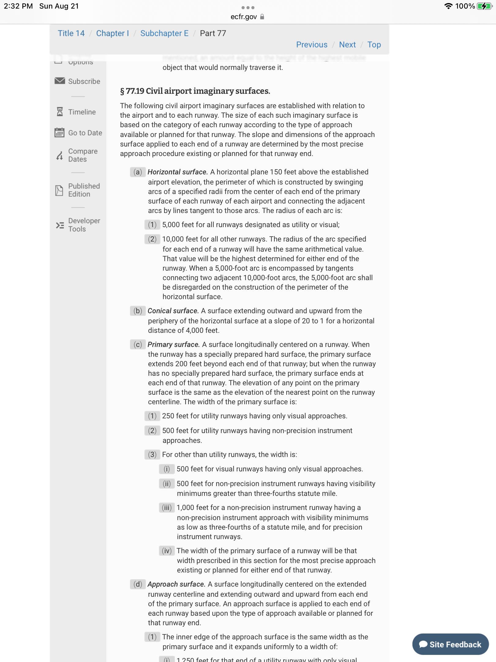
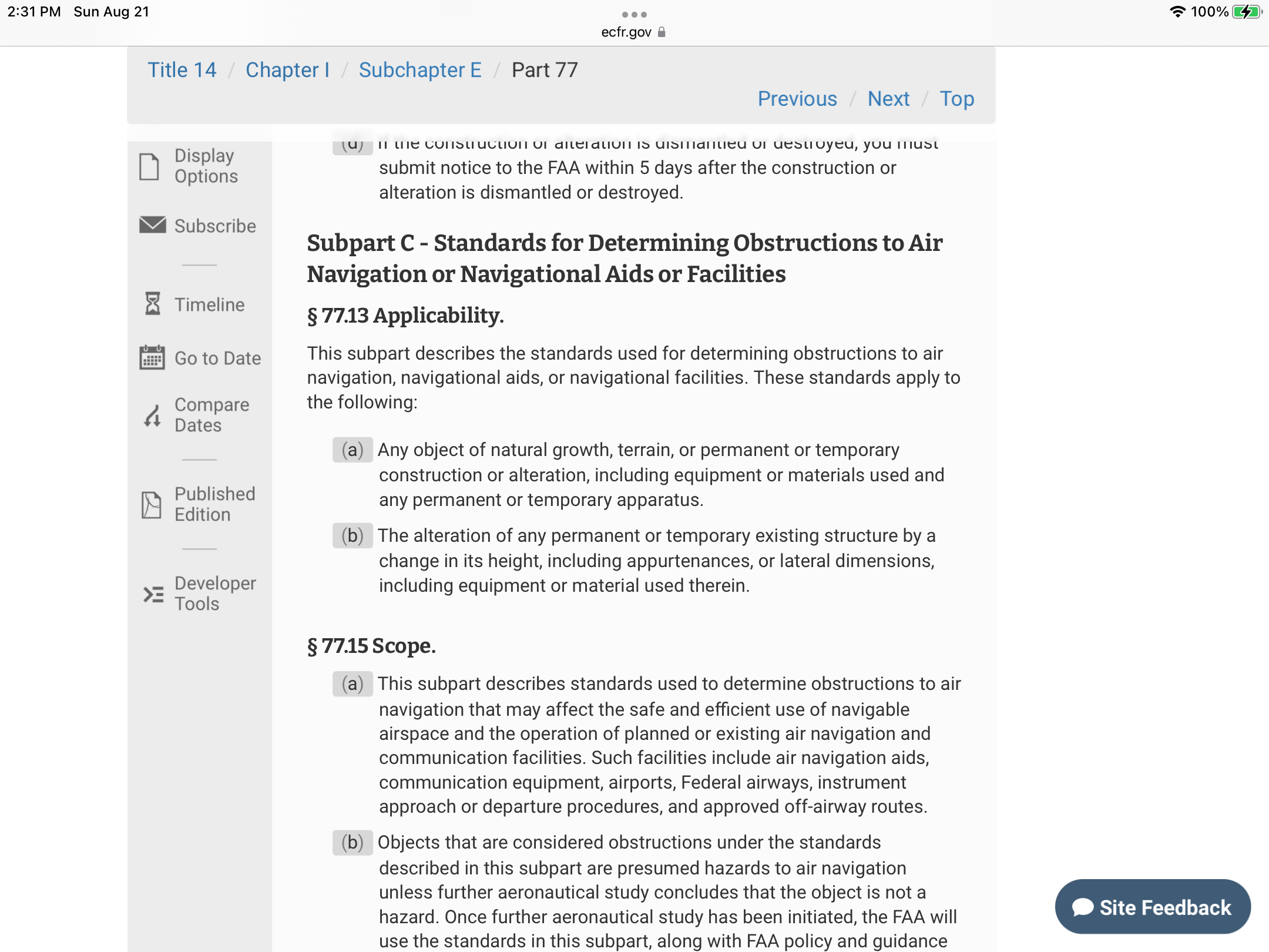
The Primary Culprit in leading the public away from truth.
Through her public Facebook page (East Haven Politics), Lorena Venagas (10,000 Hawks) and her henchmen have purposefully placed this aforementioned diagram in the throes of public discussion. There is no harm in that...except when you deliberately misrepresent and complicate the issue at hand as Ms. Venegas and her team have blatantly done.
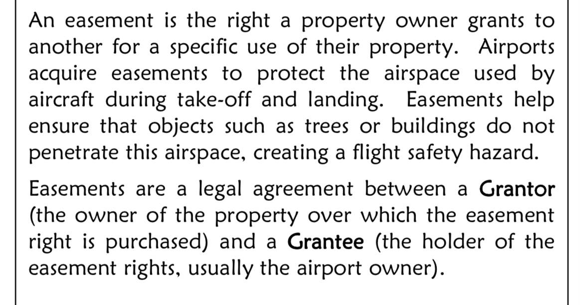
Loreana Venegas purposely raises red flag terms such as the issue of EMINENT DOMAIN in this discussion rather than the issue of EASEMENT which is in actuality what is raised by this map (among other issues). My impression of Lorena Venagas is that she is an intelligent and passionate woman. In this regard, I feel that she knows exactly the issue at hand (not eminent domain) yet selectively contorts an issue so as to promulgate her beliefs. It is my assertion however, that she knows very few people will actually take the time to research or understand the issue and will therefore rely on her word alone as gospel. That makes her gifts of intelligence and passion no gifts at all.
Since Ms. Venagas hasn't differentiated between the two issues, I will;
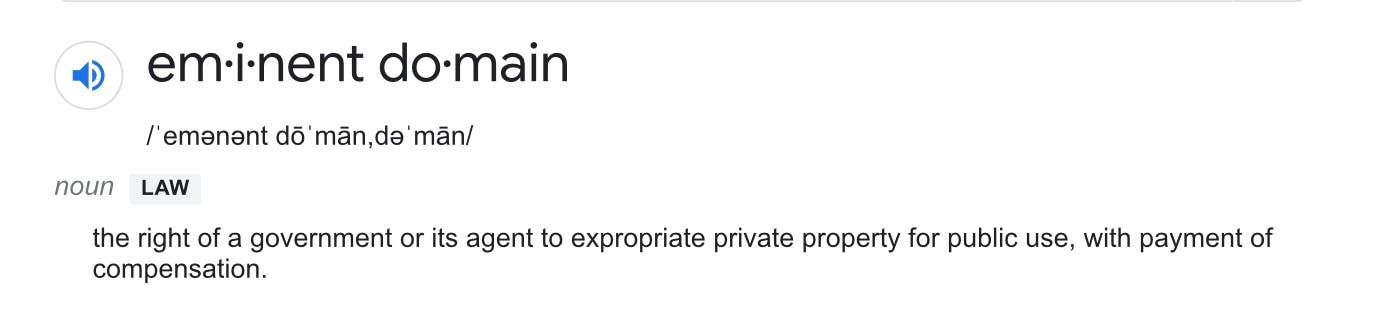
By purposely leaving out the distinction in terms of eminent domain versus easement and accusing authorities of "hiding things from the public", Lorena is using deceptive tactics herself to hide the truth. Ironic. And shameful. She literally has gone on public record telling people that these documents are not available and the she interprets them for us all too. Aren’t we lucky.
We can not only find the documents, but we can read and interpret them ourselves. Thanks for your help TELLING US. This isn’t very civic of you.
With the truth a bit more clear.
I am sharing the technical truth here, and as you can see; it isn't very exciting.
The map attendant to this article illustrates areas (green cross hatches and trapezoidal areas) where EASEMENTS are required in order to maintain proper Imaginary Surfaces. These EASEMENTS will grant the airport the right to legally protect the airspace above each property from the construction of "HAZARDS to NAVIGATION". Such hazards include:
1. Excessively tall trees.
2. Excessively tall buildings.
3. Excessively tall antenna.
4. Powerlines.
5. Smokestacks.
6. Cell phone towers.
7. Billboards.
8. A three ring circus 🎪 with its respective large tents for clowns to run amok.
An airport can be a better neighbor than a Hawk!
From the list above, you can actually see that the existence of an airport can restrict the construction of the very things that many of us do not like or want in our neighborhoods. The very existence of Tweed limits these unsightly and often hazardous things in the surrounding neighborhood. This, all the while promoting safety for aircraft, their crews and passengers. How useful! Talk about an airport being neighborly!
Final Approach
This article is littered with links, sources, diagrams and facts. I do this so that you don't take my word for a particular issue. I provide the commentary and let the realities speak for themselves; directly to you. In a sense, I am not telling you the truth but rather helping you find it yourself.
In this article, I write you on a specific matter regarding HVN so as to personally callout the deliberate and nefarious efforts of the "10,000 Hawks" and their sympathizers. My words have been substantiated by numerous FACTS provided as to how airports and airplanes really work.
It seems to me that the goal of the 10,000 Hawks is to mislead and therefore to wrongly try to sway public opinion. It isn't that the principles raised by this group are wrong, but that their efforts and tactics for doing such are wrong, misguided and veiled in their own special agenda.
🚦 GO TWEED!
Wanting to protect your home, the environment and human well-being are all goals we can subscribe to...it's how some go about achieving these things or if that really is their goal that concerns me. I take personal and professional exception to the misguided efforts of the "10,000 Hawks". It is my hope that as vested stakeholders in the developments around Tweed, you do as well.
To accentuate my points of fact, I very deliberately linked the culprit organization and its specific members to the Federal Regulation that substantiates my explanation of the issue made so contentious by their most recent smear campaign. This, so that FACTS and RUMORS may be differentiated from one another. In doing this, I feel I have helped you to see the actual issues raised by the airport future plans and to compare them to the ones you often hear squawked about by the "10,000 Hawks".