Weather
When Will the Heatwave and Thunderstorm Chances End in New Canaan?
The 7-day forecast offers a couple of more storm chances but there is also plenty of good news too.

Tired of the oppressive heat and thunderstorms? There is some good news on the horizon.
We’re still expecting to hit 90 degrees again on Monday but the humidity will be much less of an issue and it won’t feel like 110 degrees as it did for the past few days.
And it will be mostly sunny Monday and no chance of thunderstorms, well until Tuesday and Wednesday too. So we get a one day reprieve on stormy weather.
Find out what's happening in New Canaanfor free with the latest updates from Patch.
Also for the first time in a week a “Hazardous Weather Outlook” hasn’t been issued for Connecticut. We’ll gladly take it.
Before we get to the 7-day forecast, next weekend as of right now looks almost-perfect, sunny skies and temps in the low 80s.
Find out what's happening in New Canaanfor free with the latest updates from Patch.
See also: A Snowy Winter Forecast From the Farmer's Almanac for Connecticut Offers Relief From The Summer Heat
Summer Olympic Games: How Connecticut's Connections to Team USA Are Faring
23-Year-Old Thanks Surgeon Who Saved Her Life as Newborn
Here is the updated National Weather Service forecast for the area:
Monday: Mostly sunny, temps near 90 degrees.
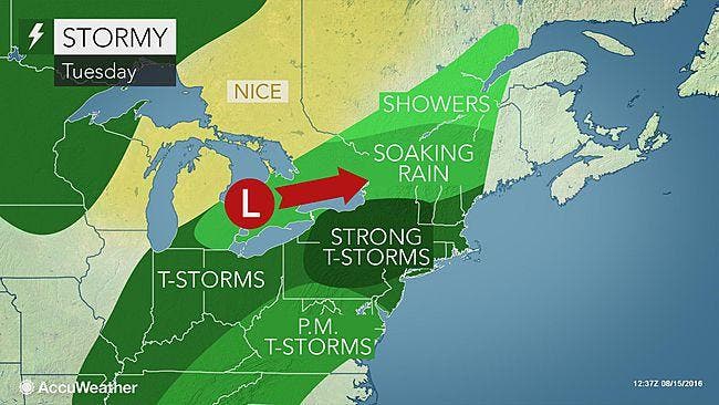
Tuesday: 60 percent chance of showers and thunderstorms during the day and afternoon. Temps around 85 degrees and mostly cloudy skies. We could pick up another quarter of an inch of rain. More storms and showers Tuesday night too.
Wednesday: Partly sunny skies, temps in the upper 80s, and yes, a 30-40 percent chance of some showers and storms possible during the afternoon and evening hours.
Thursday: And here comes the nicer weather. Mostly sunny, temps in the mid to upper 80s with no mention of showers or storms.
Friday: Mostly sunny, temps in the mid 80s.
Saturday: Mostly sunny, temps around 83 degrees.
Sunday: Mostly sunny, temps around 83 degrees.
Get more local news delivered straight to your inbox. Sign up for free Patch newsletters and alerts.