Weather
Tropical Storm Nestor Continues Path To Panhandle
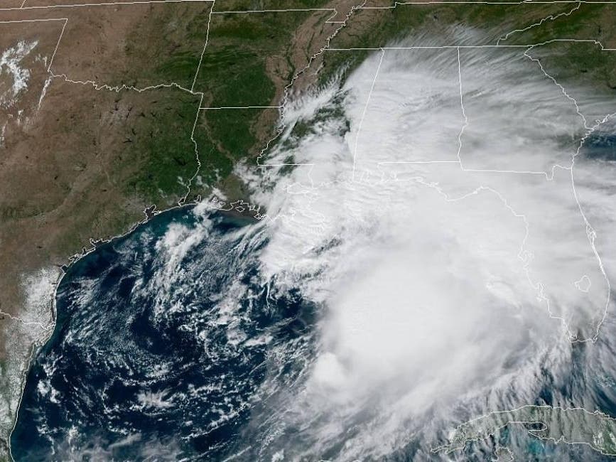
The National Hurricane Center said Tropical Storm Nestor is continuing to move toward the Panhandle at 22 mph.


FLORIDA — The National Hurricane Center said Tropical Storm Nestor could produce life-threatening storm surge and flash flooding along the Florida Gulf Coast from Indian Pass to Clearwater Beach.
A storm surge warning is in effect for this area and counties along the coast have opened sandbag stations for residents to prepare for flooding.
The tropical disturbance that developed Thursday in the Gulf of Mexico was upgraded to Tropical Storm Nestor Friday afternoon.
Find out what's happening in Across Floridafor free with the latest updates from Patch.
A National Oceanic and Atmospheric Administration hurricane hunter aircraft that flew into the storm reported that the system was producing sustained winds of 60 mph.
As of the 5 p.m. Friday update, the hurricane center said the storm is continuing to head northeast toward the Florida Panhandle, bringing tropical storm-force winds and heavy rain to areas of the Gulf coast during the early-morning hours Saturday.
Find out what's happening in Across Floridafor free with the latest updates from Patch.
The center has issued tropical storm and storm surge watches and warnings from Pinellas County to the Panhandle, saying the storm could produce storm surge between 2 to 6 feet.
Nestor is now about 150 miles south-southeast of the mouth of the Mississippi River and 280 miles southwest of Panama City, moving at about 22 mph.
Tropical storm-force winds extend outward up to 140 miles, mainly to northeast and east of the center of the storm.
The tropical storm warning from Grand Isle, Louisiana, to the mouth of the Pearl River, and from the Mississippi/Alabama border to west of Navarre, Florida, has been discontinued as the storm approaches the Florida coast.
A tropical storm warning is in effect from Navarre to Yankeetown, Florida, and a storm surge warning is in effect from Indian Pass, Florida, to Clearwater Beach.
Tropical storm conditions are expected to reach the Florida coast within the warning area this evening, and continue through early Saturday.
The NHC said people in these areas should take all necessary actions to protect themselves and their property from rising water and the potential for other dangerous conditions.
The combination of dangerous storm surge and the high tide will cause normally dry areas near the coast to be flooded by rising waters moving inland from the shoreline. The water could
reach the following heights above ground during high tide Saturday morning:
- Indian Pass to Chassahowitzka, Florida — 3 to 5 feet
- Chassahowitzka to Clearwater Beach — 2 to 4 feet
- Tampa Bay — 1 to 3 feet
Gale-force winds are likely along portions of the Atlantic coast of the southeastern United States by Saturday.
The disturbance is expected to produce total rainfall accumulations of 2 to 4 inches this weekend from the central Gulf coast and northern and central Florida to the eastern Carolinas, with isolated maximum amounts of 6 inches.
A tornado or two is possible tonight through Saturday morning across the northern and central Florida peninsula.
Beach-goers along the Gulf Coast should beware of increasing waves and the formation of rip currents along the coast Friday and Saturday. Boat owners should consider remaining in port along the Gulf Coast and the Atlantic coast from northeastern Florida to North Carolina Saturday.
Get more local news delivered straight to your inbox. Sign up for free Patch newsletters and alerts.