Weather
Prepare Now for Hurricane Season: NOAA
NOAA's sophisticated hurricane hunter aircraft fly directly into the eye of storms.

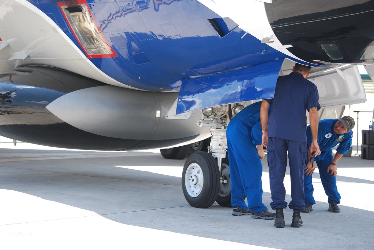
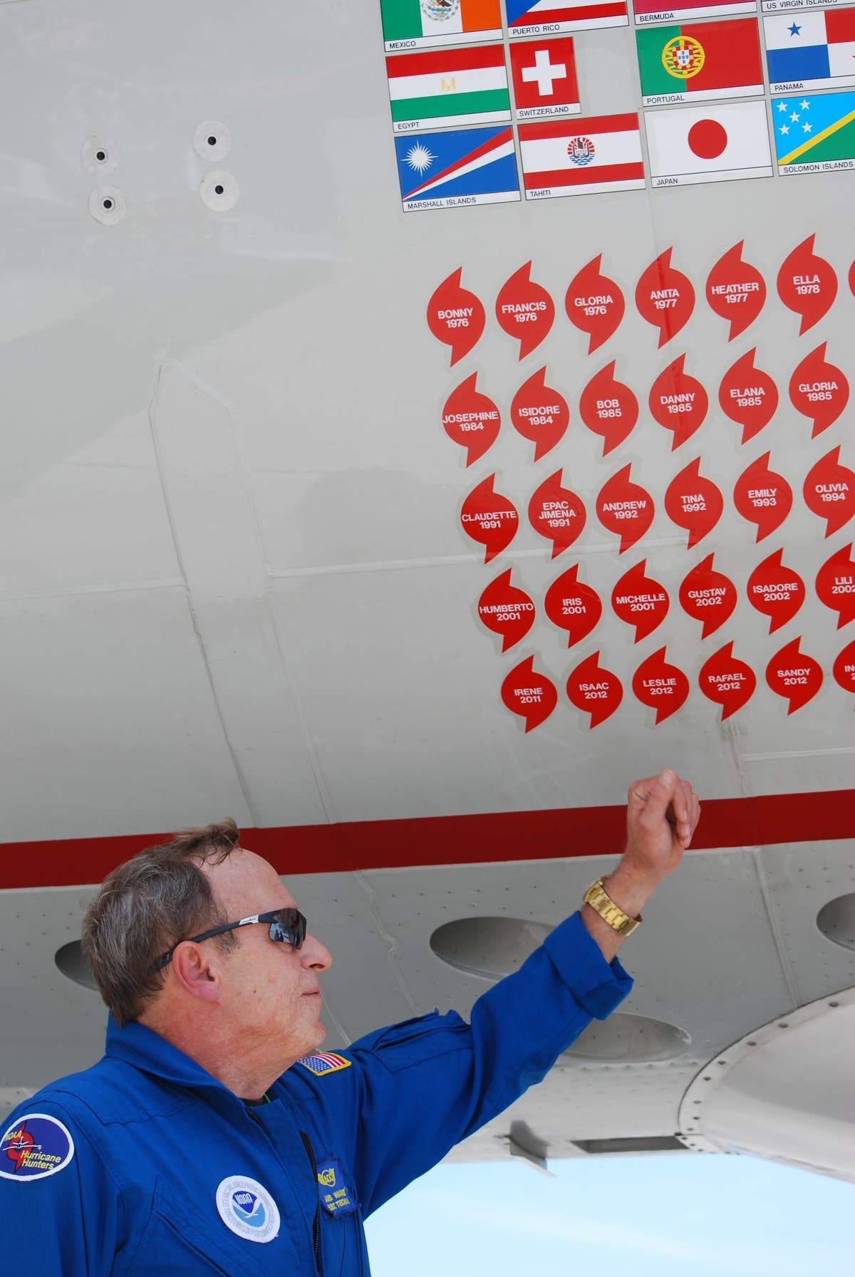
OPA LOCKA, FL — When hurricanes threaten our communities, most of us know to stock up on groceries and stay indoors. Jim Warnecke and his crewmates on the other hand climb into their WP-3D Orion and fly straight into the belly of the beast. They remember each storm with a red cyclonic sticker on the hull of the aircraft and a flag to represent each country they've flown over.
"In seven years, I've been through 17 hurricanes," acknowledged Warnecke, whose job is to drop electronic monitoring devices into the swirling winds to measure wind velocity, direction and other characteristics. The worst that he's been through was Patricia in October 2015 off the coast of Mexico. "It had 210-220 mile per hour winds. It was a Category 5 and it had the lowest central pressure that they had ever measured in a storm." (Sign up for our free Daily Newsletters and Breaking News Alerts for the Miami Patch.)
Even so, Warnecke told Patch on Friday that he wasn't scared by any of the storms. "You get apprehensive sometimes when you see the big red blob and you're getting ready to go towards it. There are certain areas within the hurricane that have stronger convection. ... We pick our way through a storm. We don't just blindly go straight through it. It's kind of like driving down a street with a bunch of potholes. You don't on purpose run into the potholes."
Find out what's happening in Miamifor free with the latest updates from Patch.
Weeks ahead of the 2017 hurricane season, the National Oceanic and Atmospheric Administration (NOAA) held an open house at the Opa Locka Executive Airport on Friday to remind people to be prepared. Hurricane season begins on June 1.
Find out what's happening in Miamifor free with the latest updates from Patch.
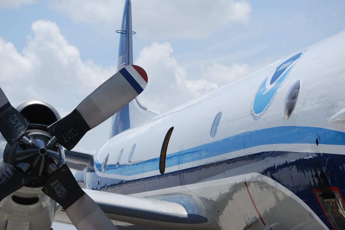
The event included a U.S. Air Force Reserve WC-130J hurricane hunter aircraft, which also flies directly through the eye of a storm, the NOAA G-IV aircraft, which flies ahead of a storm, and the NOAA WP-3D Orion research aircraft.

“Now is the time to prepare for the upcoming hurricane season – have your supplies ready and know where you will go when safe shelter is needed,” said Rick Knabb, Ph.D., director, NOAA’s National Hurricane Center. “With advanced planning, communities can better take a hit from nature and recover more quickly. Don’t wait for a storm to threaten – by then it may be too late.”
“The Hurricane Awareness Tour is an important outreach mission,” added Lt. Col. Kaitlyn Woods, 53rd Weather Reconnaissance Squadron (WRS) senior meteorologist. “Not only does it highlight the mission of the 53rd WRS and how we work with the National Hurricane Center to improve forecasts, but it also educates the public and children who can take severe weather preparedness messages back to their families.”
Staff from local emergency management offices, FEMA, non-profit organizations, such as the American Red Cross, and several local NOAA National Weather Service forecast offices also participated.
NOAA has conducted similar events for more than 35 years, alternating between the U.S. Gulf and Atlantic coasts. This year's event coincide with National Hurricane Preparedness Week.
Each crew flies 10-hour missions during an active hurricane. Typically they bring three pilots on every mission so they can take turns, according to NOAA pilot Robert Mitchell, whose first major storm was Cristobal in 2014.
"The first one will always kind of be with you," he recalled. "There was more lightening than I've ever seen in my life. It was just like a disco. You're hanging on. You're at the controls trying to keep the plane level and the air speed in the right band and just hanging on. That was my first introduction to hurricanes."
In contrast, he has also seen great beauty in the storms. "You see the clouds. You see the sun setting through the thunderstorm and it's one of the most beautiful things you can see. You're like 'okay, I guess we can go back in.'"
Flight meteorologist Jack Parrish has a slightly different perspective on hurricanes having lost his Cutler Ridge home during Hurricane Andrew. He wasn't flying at the time, but it gave him an appreciation for the importance of providing the earliest and most accurate forecasts possible.
"I started flying hurricanes in 1980. I guess I'm coming up on my 38th hurricane season. The scariest was the second flight in a hurricane," he told Patch. "It was really bad for really about 15 minutes. At the time, I was so new at the business I though that this is maybe the way it is every other flight or so. We've never flown anything a tenth that bad since I've been doing it."
Watch hurricane preparedness video below:
Photos by Paul Scicchitano
Get more local news delivered straight to your inbox. Sign up for free Patch newsletters and alerts.