Home & Garden
Flood Watch Issued for Entire Tampa Bay Area
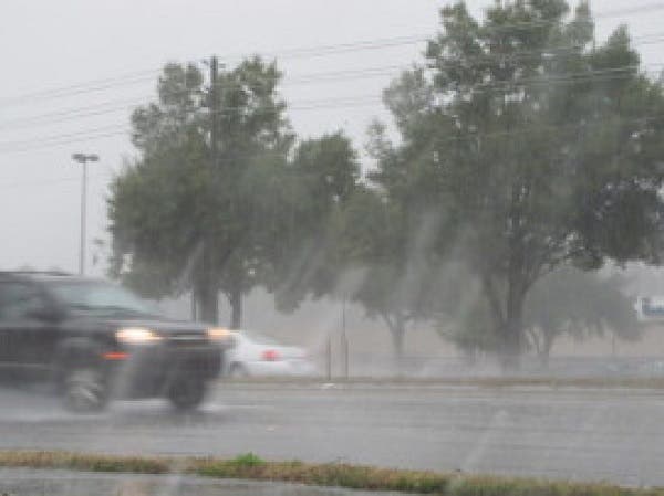
A low pressure system making its way through the Gulf is expected to bring plenty of rain over the next few days.

Tampa Bay area residents might want to pull out the rain gear for the next few days.
The National Weather Service has issued a flood watch for the entire region starting at 2 p.m. Monday and not ending until 2 p.m. Tuesday. The warning comes as a low pressure system located over the south-central Gulf of Mexico begins to make its way northward. The unnamed storm has been given a 40 percent chance of forming into a tropical cyclone over the next 48 hours. Whether it forms or not, weather service forecasters say those on the eastern side of the storm are likely to experience heavy rain as the system passes by.
“The rainfall is likely to be heavy in nature with several inches of accumulation possible,” the weather service’s warning states. “The heaviest rainfall is expected to fall just offshore from the Florida west coast. However, uncertainty in the exact track of the low presents a moderate threat for significant rainfall for coastal counties of western Florida.”
Find out what's happening in Tampafor free with the latest updates from Patch.
The flood watch covers Hillsborough, Pasco, Pinellas, Sarasota, Manatee and Hernando counties, among others. A watch means that flooding is possible in the next 24 to 36 hours.
Monday’s high temperature is expected to reach only the mid-80s with Tuesday bringing much of the same. The heavy rain is expected to clear out by Tuesday evening with a 50 percent chance of scattered storms anticipated on Wednesday.
Find out what's happening in Tampafor free with the latest updates from Patch.
For an extended forecast for your neighborhood, visit your local Patch’s homepage.
Patch file photo
Get more local news delivered straight to your inbox. Sign up for free Patch newsletters and alerts.