Weather
Hurricane Isaias Remains Cat. 3 Storm Ahead Of Landfall, Impacts Expected In GA
Georgia is preparing for a potentially dangerous weekend as Hurricane Isaias approaches the northern Gulf Coast


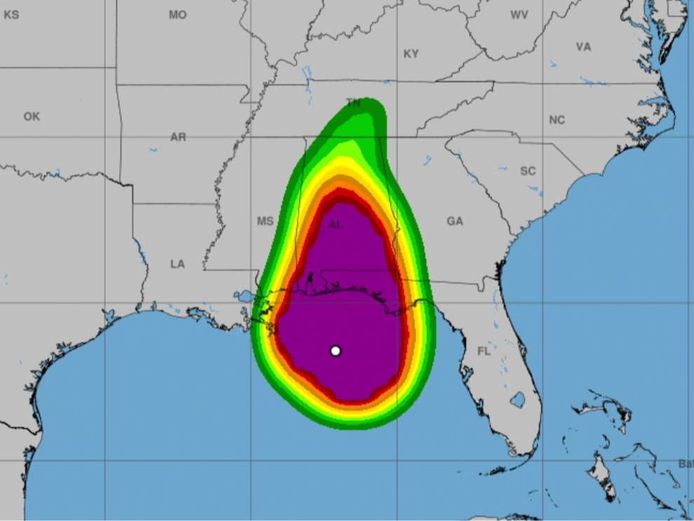
Georgia is preparing for a potentially dangerous weekend as Hurricane Isaias approaches the northern Gulf Coast, with forecasters warning that heavy rainfall, tornadoes and strong winds could spread across the state beginning Friday night.
The National Hurricane Center (NHC) said Friday afternoon that Isaias remained a powerful Category 3 hurricane with maximum sustained winds of 120 mph as it moved north toward the Alabama and Florida Panhandle coastlines.
Although Georgia is not expected to experience the hurricane's initial landfall, forecasters warned that the storm's expansive circulation could produce significant impacts well inland over the weekend.
Find out what's happening in Across Georgiafor free with the latest updates from Patch.
The NHC said Southwestern Georgia faces some of the greatest concerns, with rainfall totals of 4 to 8 inches possible through the weekend.
Officials said localized totals could be even higher where persistent rainbands develop, increasing the potential for flash flooding, overflowing streams and dangerous travel conditions.
Find out what's happening in Across Georgiafor free with the latest updates from Patch.
Elsewhere in Georgia, including portions of central and northern Georgia, widespread rainfall totals of 2 to 5 inches are possible, with isolated amounts reaching 10 inches across the broader Southeast.
As of the publication of this story, the latest totals showed 1,490 customers are without power in the Peach State.
The National Hurricane Center also warned that considerable flash flooding could develop across southwestern Georgia, particularly in low-lying and urban areas.
Tornadoes are another concern as Isaias moves inland.
Forecasters said the tornado threat would extend into southern Georgia Friday afternoon and overnight before expanding across additional portions of the state Saturday.
Strong wind gusts could also bring down trees and power lines, particularly in areas where heavy rainfall saturates the ground.
While Isaias is expected to weaken after landfall, forecasters emphasized that tropical systems can continue producing dangerous flooding and tornadoes well after moving inland.
Emergency officials encouraged Georgia residents to monitor local forecasts and emergency alerts as the storm progresses through the Southeast.
Get more local news delivered straight to your inbox. Sign up for free Patch newsletters and alerts.