Health & Fitness
Cool, Wet at Start of Week...
This week to get off to a cool, wet start in Gwinnett County.
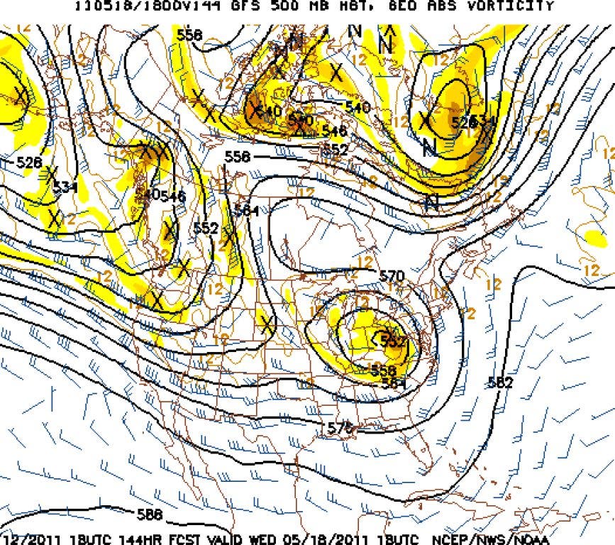
The GFS has a strong, cold, and slow moving bowling ball upper level low moving across Tennessee down into Georgia on Monday with 546 thicknesses. A cold upper low like that in mid-May is going to be big hail maker near its core during the peak of the afternoon heating.
At some point, the timing will have be watched as to which areas experience another episode of extremely large hail. Upper level lows (ULL) are always exciting when they come through the Southeast, and this one is well developed and moves at a decent pace without falling apart.
Anyone under its track will be game from Tennessee to Georgia and eventually into the Carolinas and up the coast. There will be excellent dynamics and rich moist air to work with (although not as much as originally thought), so once again there could be everything with it from high winds, big hail, and heavy rain. Not everyone will get anything so this will be more of a hit or miss scenario.
Find out what's happening in Duluthfor free with the latest updates from Patch.
You can get more information at DaculaWeather.com and can follow us on Twitter@DaculaWeather