Weather
Two Rounds Of Storms In MD Forecast: See Latest Timeline
Maryland skies will turn dark and gloomy as a cold front threatens the region with severe storms to close out the work week.


Marylanders are in for another round of stormy weather as severe thunderstorms are forecast for the end of the work week.
Wednesday will be mostly sunny with high temperatures peaking in the mid-80s, but conditions take a turn by nightfall.
Forecasters say a cold front moving into the region will bring mostly cloudy conditions and wind gusts up to 20 mph.
Find out what's happening in Across Marylandfor free with the latest updates from Patch.
The doom and gloom of a Maryland storm emerges Thursday, followed by a weaker round of storms Friday.
What To Expect Thursday
The National Weather Service says the chance for showers and severe storms runs throughout Thursday, with afternoon commuters likely to take the brunt of the impact.
Find out what's happening in Across Marylandfor free with the latest updates from Patch.
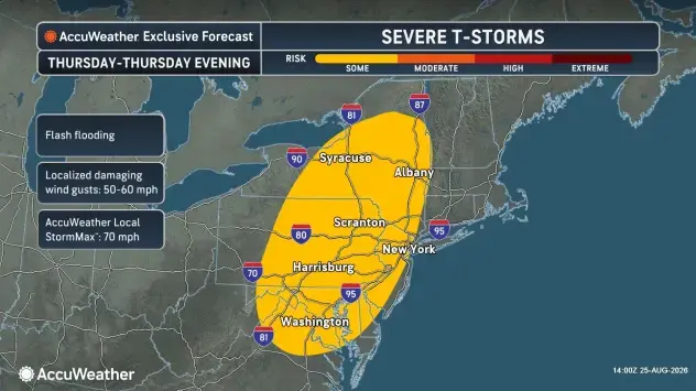
The latest timeline issued by the weather agency indicates severe storms could develop between 2 p.m. and 5 p.m., but that additional storms could go through 2 a.m. Friday.
Early predictions suggest rainfall totals could range between less than a tenth of an inch and a quarter of an inch. Higher isolated amounts are anticipated.
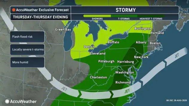
Forecasters warn that damaging winds and flash flooding were the biggest threats from the storms.
What About The Friday Storms?
By Friday, the chance of another serious rain day plummets to 30%, according to the NWS.
Officials say showers and thunderstorms are most likely to develop between 2 p.m. and 8 p.m.
Additional rainfall could emerge before 2 a.m. Saturday.
Detailed Forecast For Baltimore Region
Wednesday: Mostly sunny, with a high near 85. Light and variable wind becoming south 5 to 7 mph in the afternoon.
Wednesday Night: Mostly cloudy, with a low around 71. South wind 6 to 9 mph, with gusts as high as 20 mph.
Thursday: A chance of showers and thunderstorms before 2 p.m., then showers likely and possibly a thunderstorm between 2 p.m. and 5 p.m., then a chance of showers and thunderstorms after 5 p.m. Some of the storms could be severe. Partly sunny, with a high near 88. South wind 6 to 10 mph. Chance of precipitation is 70%. New rainfall amounts of less than a tenth of an inch, except higher amounts possible in thunderstorms.
Thursday Night: A chance of showers and thunderstorms before 7 p.m., then showers likely and possibly a thunderstorm between 7 p.m. and 2 a.m. Some of the storms could be severe. Mostly cloudy, with a low around 69. South wind around 6 mph becoming calm in the evening. Chance of precipitation is 60%. New rainfall amounts between a tenth and quarter of an inch, except higher amounts possible in thunderstorms.
Friday: A chance of showers and thunderstorms after 2 p.m. Partly sunny, with a high near 85. Light northeast wind. Chance of precipitation is 30%.
Friday Night: A chance of showers and thunderstorms before 8 p.m., then a slight chance of showers between 8 p.m. and 2 a.m. Mostly cloudy, with a low around 68. Chance of precipitation is 30%.
Saturday: Partly sunny, with a high near 83.
Saturday Night: Partly cloudy, with a low around 69.
Sunday: Mostly sunny, with a high near 86.
Sunday Night: Partly cloudy, with a low around 71.
Monday: Sunny, with a high near 92.
Monday Night: Partly cloudy, with a low around 73.
Tuesday: A slight chance of showers and thunderstorms. Mostly sunny, with a high near 92. Chance of precipitation is 20%.
Get more local news delivered straight to your inbox. Sign up for free Patch newsletters and alerts.