Weather
MD Flash Flood, Severe Thunderstorm Watches Issued
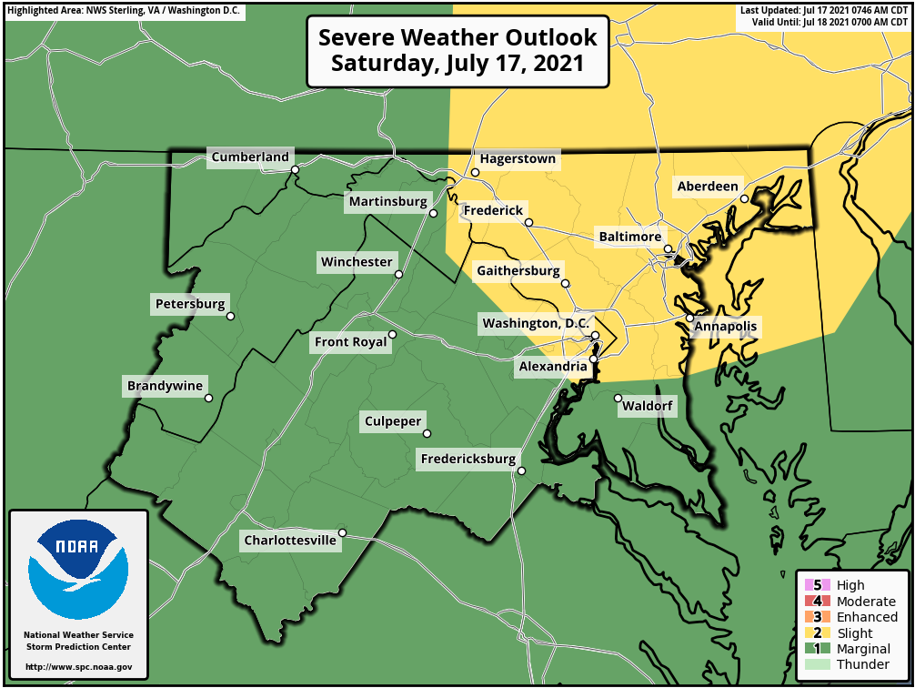
1 to 3 inches of rain are possible across much of MD, with a flash flood watch issued and a severe thunderstorm watch until late Saturday.

MARYLAND — A flash flood watch and a severe thunderstorm watch are in effect until 11 p.m. Saturday for parts of Maryland, Washington, D.C., and northern Virginia. A heat advisory is in effect until 8 p.m. with "feels like" temperatures likely to reach 105 degrees.
During a flash flood watch, conditions may develop leading to flash flooding. The National Weather Service said 3 inches or more of rain could fall in some parts of the region.
Areas in the flash flood watch include: Anne Arundel, Cecil, Howard, Montgomery, Baltimore, Harford, and Prince George's counties.
Find out what's happening in Annapolisfor free with the latest updates from Patch.
Cities in the watch area include: Baltimore, Annapolis, Odenton, Silver Spring, Bethesda, College Park, Reisterstown, Columbia, Severna Park, Greenbelt, Rockville, Jarrettsville, Arnold, Suitland-Silver Hill, Laurel, Severn, Glen Burnie, Ellicott City, Cockeysville, Gaithersburg, and Aberdeen.
The severe thunderstorm watch area includes the city of Baltimore, plus Allegany, Anne Arundel, Baltimore, Calvert, Caroline, Carroll, Cecil, Charles, Frederick, Garrett, Harford, Howard, Kent, Montgomery, Prince George's, Queen Anne's, St. Marys, Talbot and Washington counties.
Find out what's happening in Annapolisfor free with the latest updates from Patch.
Counties under the heat advisory include: Calvert, Harford, Baltimore, Prince George's, Anne Arundel, Charles, St. Marys, Howard and Cecil.
Multiple rounds of thunderstorms are expected Saturday afternoon through the evening. Localized rainfall amounts of up to 1-2 inches per hour will be possible at times. Total rainfall amounts of 1 to 3 inches, with locally higher amounts possible. Heavy rain in short periods of time will cause the potential for streams and creeks to quickly rise out of their banks, as well as the potential for flash flooding in urban areas.
"Scattered to numerous showers and thunderstorms are expected this afternoon and evening, with some becoming severe," the National Weather Service said. "Most likely impacts will be damaging winds and heavy rainfall, warranting a flash flood watch for parts of the area."
Risks From Heat
Hot temperatures and high humidity may cause heat illnesses to occur.
Drink plenty of fluids, stay in an air-conditioned room, stay out of the sun, and check up on relatives and neighbors. Cchildren and pets should never be left unattended in vehicles
under any circumstances.
Take extra precautions if you work or spend time outside. When possible reschedule strenuous activities to early morning or evening.
Know the signs and symptoms of heat exhaustion and heat stroke. Wear lightweight and loose fitting clothing when possible.
To reduce risk during outdoor work, the Occupational Safety and Health Administration recommends scheduling frequent rest breaks in shaded or air-conditioned environments.
Anyone overcome by heat should be moved to a cool and shaded location. Heat stroke is an emergency; call 911.
Get more local news delivered straight to your inbox. Sign up for free Patch newsletters and alerts.