Weather
MD Winter Weather Advisory For Ice Extended
Freezing rain continues to fall in Maryland. A winter weather advisory has been extended. Travel is discouraged until Sunday afternoon.

Updated at 10:50 a.m. Sunday
MARYLAND — Freezing rain continues to fall in Maryland on Sunday, prompting the National Weather Service to extend a winter weather advisory until noon.
Travel is discouraged until Sunday afternoon.
Find out what's happening in Baltimorefor free with the latest updates from Patch.
The National Weather Service said freezing rain will leave a light glaze of ice on parts of central, north central, northeast and northern Maryland and northern Virginia.
Residents should be on the lookout for very slippery sidewalks, roads and bridges are possible.
Find out what's happening in Baltimorefor free with the latest updates from Patch.
"Slow down and use caution while traveling. Prepare for possible power outages," the NWS said.
Re-freeze is possible before the Monday morning commute.
Communities in the advisory include the cities of Baltimore and Frederick, plus Carroll, Baltimore, Montgomery, Howard, Harford counties.
Scattered showers moved through the DC region about 10:30 a.m. Sunday, bringing sleet mixed with rain, The Washington Post's Capital Weather Gang tweeted. Temperatures in the immediate metro area have climbed above freezing but freezing rain is a risk to the north from DC up to Columbia, Maryland.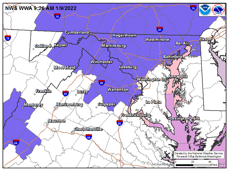
The Maryland Department of Transportation State Highway Administration said drivers should avoid or delay travel Sunday and Monday mornings, and if possible, telework.
If you must drive, follow these tips:
- Slow down. Posted speed limits are for ideal weather conditions.
- Use extra caution on elevated surfaces, such as bridges, overpasses and ramps. These areas freeze first.
- Don’t crowd the plow. Leave plenty of space between your vehicle and MDOT equipment.
Get the latest travel information by logging onto roads.maryland.gov. The Statewide Transportation Operations Resource Map identifies where road equipment is and where they have been.
Drivers can also check road conditions via the hundreds of live traffic cameras.
Residents should be prepared for power outages, the advisory said.
Watch for ice on steps, sidewalks, and driveways.
Here is the NWS forecast:
Sunday: Rain, mainly after noon. High near 41. Southwest wind 9 to 11 mph, with gusts as high as 25 mph. Chance of precipitation is 100%. New precipitation amounts between a quarter and half of an inch possible.
Sunday Night: A chance of rain before 10pm. Cloudy, then gradually becoming partly cloudy, with a low around 25. Northwest wind 8 to 15 mph, with gusts as high as 33 mph. Chance of precipitation is 50%.
Monday: Sunny, with a high near 33. Northwest wind 11 to 13 mph, with gusts as high as 22 mph.
Get more local news delivered straight to your inbox. Sign up for free Patch newsletters and alerts.