Home & Garden
Hour-by-Hour Snow Timeline for Columbia
The National Weather Service maps out the blizzard from start to finish and when the snowfall will be at its worst.

COLUMBIA, MD – The region is preparing for blizzard conditions this weekend, with the potential for more than two feet of snow in Columbia.
Howard County is under a blizzard warning from 3 p.m. Friday to 6 a.m. Sunday, and citizens are advised to stay off the roads this weekend.
The National Weather Service is projecting 27.8 inches of snow in Columbia between Friday and Sunday morning.
Find out what's happening in Columbiafor free with the latest updates from Patch.
Show us your snow pics in the comments, on the Columbia Patch Facebook page or by sending them to elizabeth.janney@patch.com.
The height of the storm will be Friday night through Saturday, according to the National Weather Service, which says heavy snow combined with wind gusts between 20 to 55 mph may make visibility impossible.
Find out what's happening in Columbiafor free with the latest updates from Patch.
Once it starts, the snow will fall quickly, so Maryland State Police asked drivers Friday afternoon to get off the roads before it begins.
Sign up for local news alerts to stay on top of closures, traffic incidents and more.
- Closings in Harford County for Weekend Blizzard
- State of Emergency as Blizzard Aims for Maryland
- Snow Emergency on Maryland Highways in Effect
Here is a breakdown of when the National Weather Service predicts snow will fall in Columbia:
1 to 7 p.m.—1 inch
7 p.m. to 1 a.m.—3.8 inches
Saturday
1 to 7 a.m.—8.9 inches
7 a.m. to 1 p.m.—8.2 inches
1 to 7 p.m.—3.9 inches
7 p.m. to 1 a.m.—2 inches
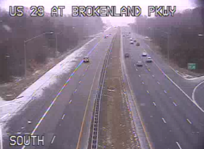
Pictured, snow was coming down along US 29 near Columbia at 2:40 p.m. on Friday, Jan. 22, visible on the CHART traffic camera.
Get more local news delivered straight to your inbox. Sign up for free Patch newsletters and alerts.