Weather
Maryland Weather: Latest Snowfall Estimates For Storm Saturday
Snow is in the weekend forecast. See how much is expected to fall across Maryland and what transportation officials want drivers to know.

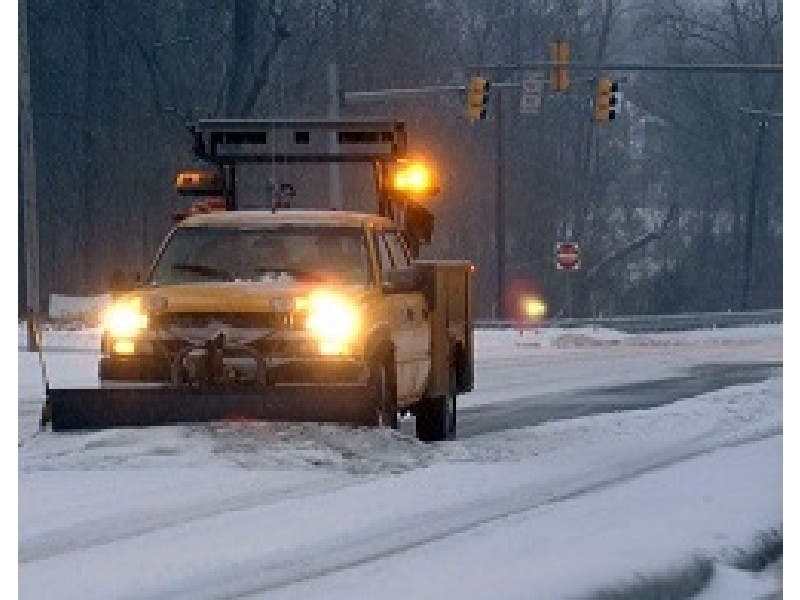

MARYLAND — As temperatures drop Friday across Maryland, crews say they are treating roads before the snow that is in Saturday's forecast. Some activities have been canceled in the region, and officials urge drivers to remember the slogan "take it slow on ice and snow" because roads may get slick this weekend.
The National Weather Service has put much of the state under a winter weather advisory from 7 a.m. to 7 p.m. Saturday.

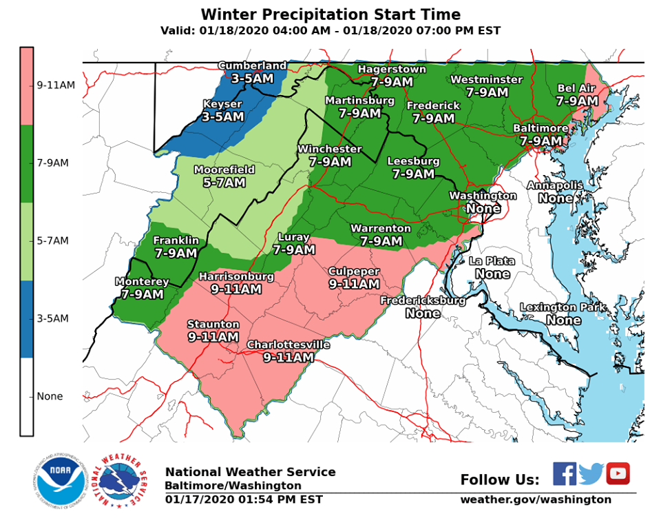
Forecasters are calling for snow to hit the Interstate 95 corridor Saturday morning. It will transition from snow to sleet to freezing rain to rain throughout the day.
Find out what's happening in Towsonfor free with the latest updates from Patch.
Because below-freezing temperatures will grip the region before the snow, the National Weather Service advised that smaller amounts of snow and freezing rain will have more of an impact. Untreated roads and sidewalks may be icy, and people should be extra careful taking the first steps out of their home.
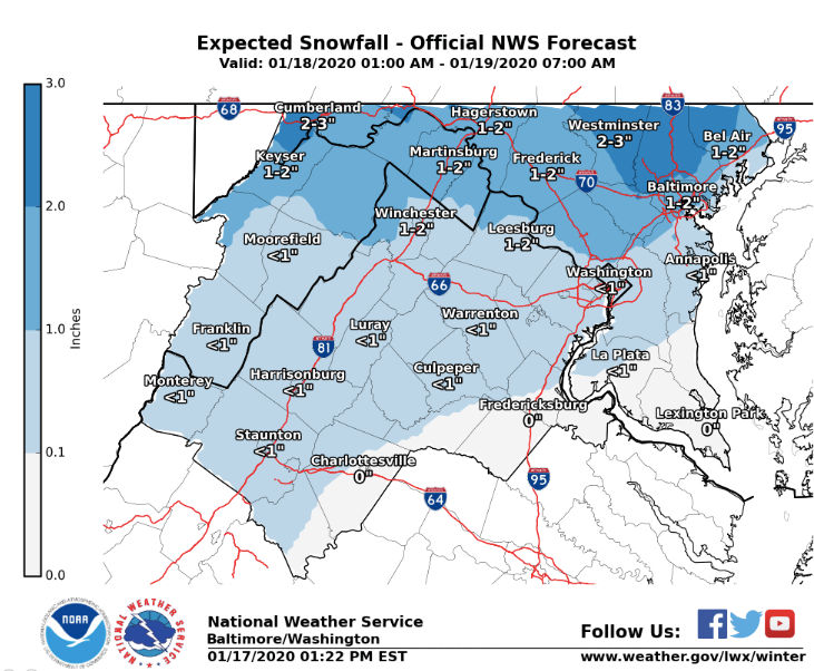
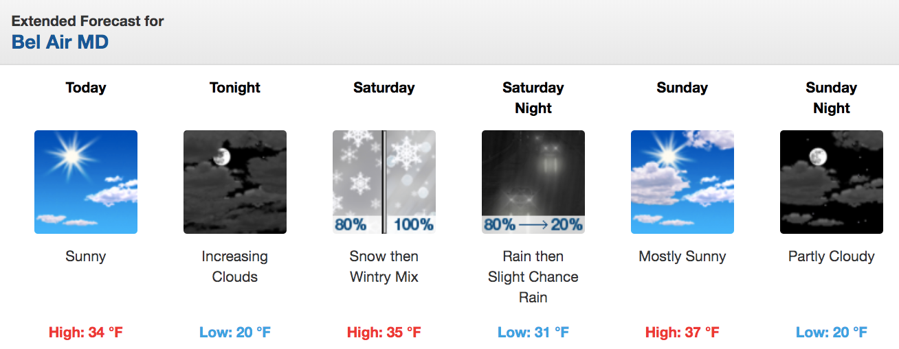
Frederick and Hagerstown are expected to get 2 inches of snow, while the Inner Harbor in Baltimore may see about an inch of accumulation, according to projections released Friday by the National Weather Service. The northern part of the state may see 1 to 2 inches of snow. (See the graphic below for snowfall projections across the state.)
Find out what's happening in Towsonfor free with the latest updates from Patch.
"Northwestern Virginia, eastern West Virginia and northern Maryland likely hang on to cold air longest, resulting in the highest (in a relative sense) accumulations over these areas, with light amounts to about the I-95/US-29 corridor," according to the forecast discussion. "Precipitation should end Saturday evening ... with some residual upslope snow showers lingering into Sunday. Otherwise, it will be cold and dry to end the weekend."
Weather-Related Announcements/Closures
- Anne Arundel County has opened warming centers for those who need to get out of the cold.
- Anne Arundel County Public Schools canceled school-sponsored activities for Saturday.
- Baltimore City Public Schools canceled activities Saturday.
- Baltimore County Public Schools canceled activities that had been scheduled for Saturday. This includes school-sponsored events and those held at school buildings.
- Carroll County Public Schools announced all school-sponsored activities and non-CCPS sponsored activities held at CCPS school facilities will be canceled Saturday.
- Cecil County Public Schools canceled activities that had been scheduled for this Saturday. It has rescheduled the all-county winter art exhibit reception for Saturday, Jan. 25.
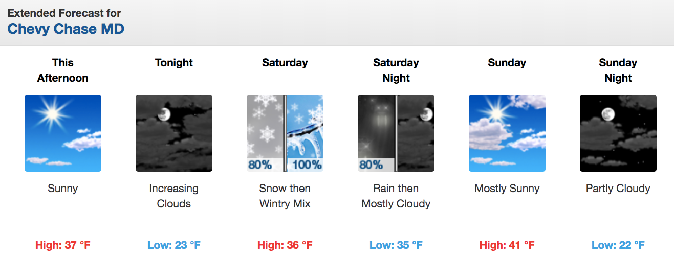
A winter weather advisory for central and northern Maryland calls for 1 to 3 inches of snow and up to 0.1 inch ice accumulating from 7 a.m. to 7 p.m. Saturday. It applies to Baltimore City and Baltimore, Carroll, Frederick, Harford, Howard and Washington counties.
A separate advisory for Montgomery County calls for up to 1 inch of snow and sleet and up to 0.1 inch ice.
Here is the current map of snow accumulation predictions:
Snow in the Baltimore region is expected to start early Saturday and transition to rain by late afternoon, transportation officials said, noting crews are pretreating gateways to the city and primary roads Friday afternoon with salt brine. Baltimore City Department of Transportation crews will begin treating city streets for the weather event at 6 a.m. Saturday, officials said.
The State Highway Administration will be monitoring road conditions using more than 50 vehicles equipped with technology to collect data on pavement temperatures and precipitation.
"Some snow accumulation is expected, particularly in the western and northern parts of the state," the State Highway Administration said in a statement Friday. "As the precipitation transitions from snow to sleet and freezing rain, driving conditions will be challenging, and motorists are urged to make smart travel decisions."
Temperatures dipping below freezing Saturday night in some areas could increase the likelihood of ice, particularly on bridges, ramps, overpasses and other elevated surfaces that freeze first.
Seven-Day Forecast
Here's the forecast for the Baltimore-Washington area from the National Weather Service:
Friday: Sunny, with a high near 36 and low around 22. North wind 10 to 14 mph, with gusts as high as 22 mph. North wind 5 to 7 mph becoming calm in the evening.
Saturday: High near 37 and low around 33. Snow likely before 1 p.m., then snow and sleet between 1 and 4 p.m., with rain from 4 to 10 p.m. South wind 5 to 13 mph, with gusts as high as 21 mph. Chance of precipitation is 100 percent. New snow and sleet accumulations are possible.
Sunday: Mostly sunny, with a high near 40 and low around 22. West wind 9 to 16 mph, with gusts as high as 26 mph.
Monday (MLK Jr. Day): Mostly sunny, with a high near 34 and low around 21.
Tuesday: Mostly sunny, with a high near 34 and low around 20.
Wednesday: Sunny, with a high near 38 and low around 22.
Thursday: Mostly sunny, with a high near 44.
How Drivers Can Prepare For Snow
Pack a winter driving survival kit, including a shovel, flashlight, blanket, water, jumper cables, flares and snacks.
Check traffic cameras before heading out.
Ensure that car battery, tires, belts and hoses are in working order and fluid levels are sufficient.
Keep gas in the tank.
Clear snow from headlights, roof and other places that may obstruct your vision.
Pile snow to your left, off the road, when shoveling.
Source: State Highway Administration.
Get more local news delivered straight to your inbox. Sign up for free Patch newsletters and alerts.