Weather
MA Weather: 2 Nor'easters This Week As First Snow Inches Closer
A storm late tonight could be a problem, but forecasters are eying a system later this week for potential snow.

The first of two nor'easters this week will come late Monday night, and forecasters are wondering aloud whether we will see the season's first snow before they are done. The possibility of snow is higher for the second storm later this week.
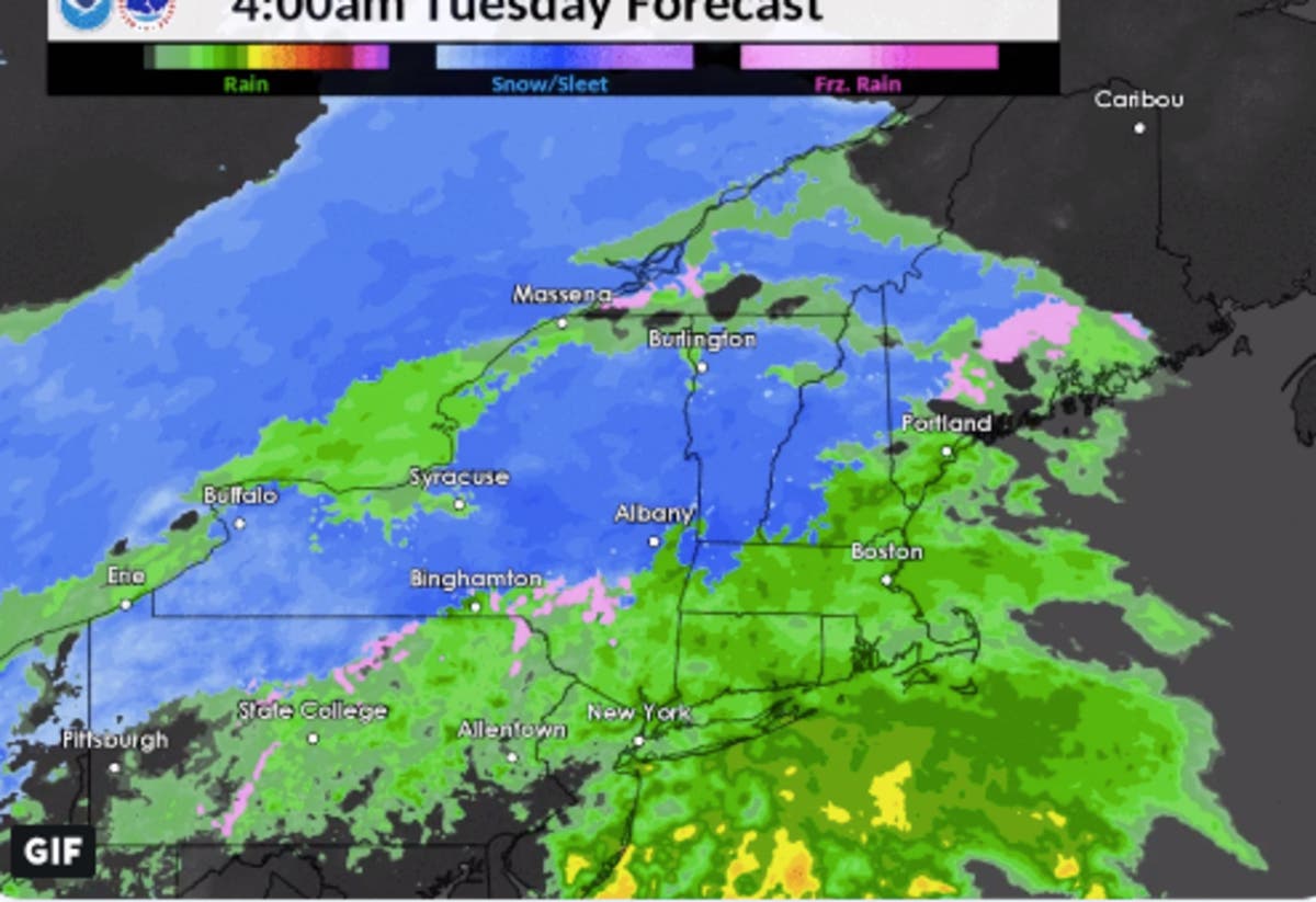
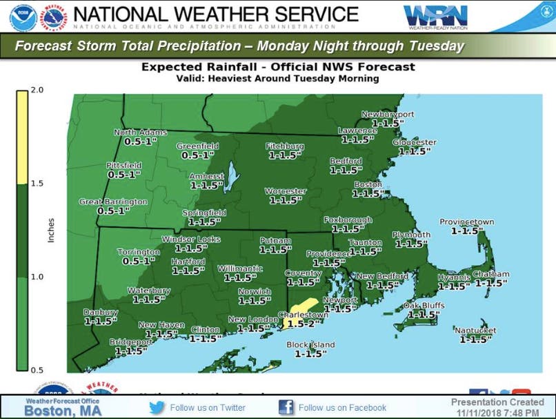
The "stout storm system" Monday night into Tuesday is expected to be strong, but primarily rain. All of Eastern and Central Massachusetts is expected to get between 1 and 1.5 inches of rain. The rain will start overnight - sometime around 2 a.m. Tuesday - and be the heaviest during the commuting hours. It should end just in time for the evening commute.
There will also be very strong winds peaking around midday Tuesday. Eastwardly gusts of 20-30 miles per hour are expected along the coast, making for a high wind watch in Nantucket and gale watches in much of the water.
Find out what's happening in Andoverfor free with the latest updates from Patch.
>>>Related: Smoke From CA Fires Reaches Massachusetts
Forecast model precip-type reflectivity, not to be taken verbatim. It'll be a busy Monday night into Tuesday morning shift; hoping the heaviest rain & strongest winds remain offshore, out to sea. We honestly don't need any more rain right now. pic.twitter.com/4ppQJnUgS6
— NWS Boston (@NWSBoston) November 12, 2018
There is the slight possibility of snow over the next 24 hours, but it's likely to be a dusting in Western Mass.
Find out what's happening in Andoverfor free with the latest updates from Patch.
Snow is much more likely to come to the Boston area during a storm this Thursday into Friday. Forecasters are calling it too early too tell - and it likely won't be a significant snowstorm either way, according to The Boston Globe's forecast - but don't be surprised to see your first glimpse of winter later this week. Subscribe to your local Patch for the latest.
Image via NWS Boston
Get more local news delivered straight to your inbox. Sign up for free Patch newsletters and alerts.