Community Corner
Sunday Scorcher; Threat of Thunderstorms
It's going to be a scorcher: Temperatures are expected to hit the low 90s on Sunday, and close to 90 on Monday.

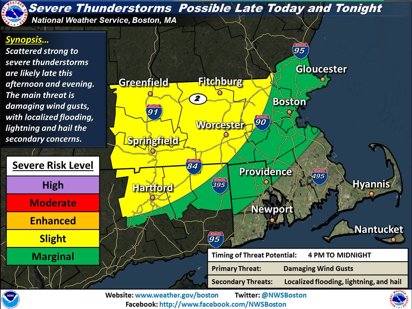
Image: National Weather Service
A hot and humid Sunday is on the way for the region, and there is a risk for severe thunderstorms with strong winds and heavy rainfall are likely late Sunday afternoon and Sunday night, according to the National Weather Service. The areas at highest risk for these storms are north of the Massachusetts Turnpike.
Temperatures are expected to hit the low 90s on Sunday, and close to 90 on Monday.
Find out what's happening in Arlingtonfor free with the latest updates from Patch.
According to NWS officials, the biggest uncertainty is whether or not these isolated strong storms merge into a larger complex of thunderstorms. Again, the highest risk is for north of the Massachusetts Turnpike, but can’t be ruled out across the rest of the region if a larger complex of storms is able to develop. If that is the case, more significant wind damage will be possible and heavy rain may also bring the potential for localized flooding. Dangerous cloud to ground lightning will be possible with these storms. The biggest threat for the these storms is between 4 p.m. and midnight but could linger.
The NWS reminds residents if you are outside and hear thunder you are close enough to get struck by lightening and should head to an indoor shelter immediately.
Find out what's happening in Arlingtonfor free with the latest updates from Patch.
Check out Arlinton’s full forecast for the week.
Get more local news delivered straight to your inbox. Sign up for free Patch newsletters and alerts.