Weather
MA Gets Hazardous Weather Outlook, Hurricane Michael Strengthens
The hurricane is nearing Category 5 classification, and local forecasts are calling for a low risk of flooding and strong winds.

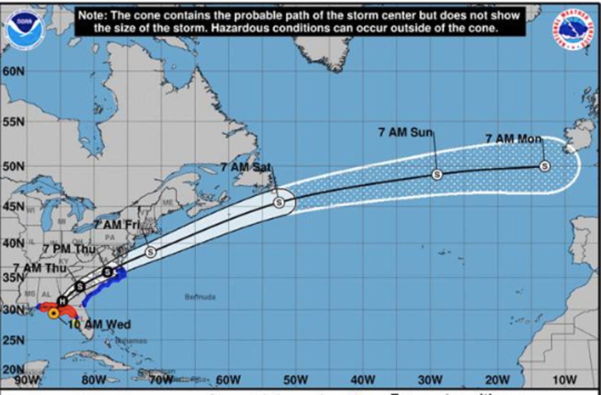
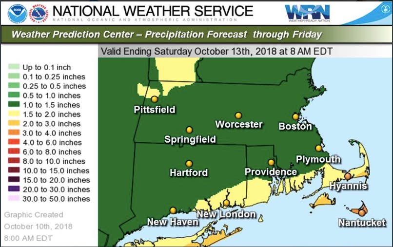
Hurricane Michael, which intensified overnight into a Category 4 hurricane and is threatening Category 5 classification, has prompted a hazardous weather outlook across all of Massachusetts. The massive storm is still expected to sweep by Southern New England, but it will drop an inch or two of rain on the region starting Thursday, while "heavy rain from remnants of Michael may bring a low risk of flooding Friday," the National Weather Service said.
There will also be a low risk of isolated flash flooding Thursday into Thursday night, the NWS said. The heaviest rain will be in the Cape & Islands and other southern areas of the state. Winds could reach 40-50 miles per hour in the hardest-hit areas.
The Weather Channel shows the rain will be intense during the morning commute and even more so around the evening commute, but no radar simulations have been released. Patch will update when they are.
Find out what's happening in Bostonfor free with the latest updates from Patch.
While it will likely just be another wet - though hazardous - storm in Massachusetts, it's being called "life-threatening" as it hits the Florida Panhandle and moves up the coast. The maximum winds as of noon were at 155 miles per hour. A State of Emergency has been called in the area.
Find out what's happening in Bostonfor free with the latest updates from Patch.
"Let me be clear," said Florida Gov. Rick Scott. "Hurricane Michael is a monstrous storm and we're just hours away from seeing impacts. This is the most destructive storm to hit the Panhandle in decades. This storm could kill you."
Main image via National Hurricane Center
Get more local news delivered straight to your inbox. Sign up for free Patch newsletters and alerts.


