Weather
MA Weather Forecast: Nor'easter Ready To Dump Snow, Rain
A winter storm watch was issued overnight for most of Massachusetts, which still has tens of thousands of households without power.

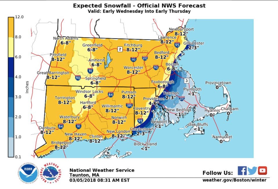
Up to a foot of snow is expected for much of Massachusetts as a midweek nor'easter follows last week's historic storm. A winter storm watch was issued overnight for most of the state. More than 70,000+ Bay State households waking up to the weather warning did so without power, raising questions of how storm-battered communities will handle another hard-hitter.
The winter storm watch is for everywhere but Southeastern Mass., where very little snow, if any, is expected. The rest of the state can expect between 6-12 inches. From Boston to Foxborough is expected to get 6-8 inches, while everyone farther inland is expected to get 8-12. (See the National Weather Service map below.)
The storm is expected to start early Wednesday and last into early Thursday. Some communities aren't expected to have had power back for 24 hours by the time the snow begins.
Find out what's happening in Bostonfor free with the latest updates from Patch.
Subscribe to news alerts from your local Patch for updated local storm coverage.
The news comes as more than 73,000 in Massachusetts are still without power, according to the Massachusetts Emergency Management Agency, and some weren't expected to get it back until Tuesday evening. More than half the power customers in Scituate, Norwell, Cohasset, and Pembroke remain in the dark.
Find out what's happening in Bostonfor free with the latest updates from Patch.
Several districts canceled school and the MBTA saw more delays Monday, largely due to lingering outages and damages. There were scattered snow showers moving across the region in the early morning.
The rest of Monday and Tuesday is expected to be dry and gusty with temperatures hovering above freezing. A coastal flood advisory will be in effect from 11 a.m. - 3 p.m. in anticipation of the midday high tide.
You can see the rest of the week's forecast for Boston via the National Weather Service below:
Monday - Cloudy, then gradually becoming mostly sunny, with a high near 40. North wind around 15 mph, with gusts as high as 32 mph.
Monday night - Mostly cloudy, with a low around 29. North wind 10 to 13 mph, with gusts as high as 24 mph.
Tuesday - Partly sunny, with a high near 41. North wind around 10 mph, with gusts as high as 20 mph.
Tuesday night - A chance of snow, mainly after 5am. Mostly cloudy, with a low around 32. North wind 6 to 9 mph. Chance of precipitation is 30%. Little or no snow accumulation expected.
Wednesday - Snow, mainly after 9am. High near 39. Northeast wind 9 to 16 mph. Chance of precipitation is 80%.
Wednesday night - Snow. Low around 34. Chance of precipitation is 90%.
Thursday - Snow likely before 9am, then a chance of rain showers between 9am and 2pm. Mostly cloudy, with a high near 42. Chance of precipitation is 60%.
Thursday night - Mostly cloudy, with a low around 31.
Friday - Partly sunny, with a high near 44.
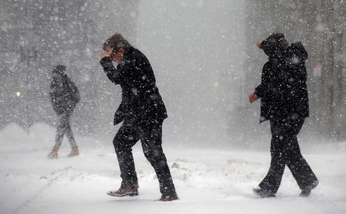
Pedestrians cross the street in downtown Boston, Thursday, Jan. 4, 2018. A massive winter storm swept from the Carolinas to Maine on Thursday, dumping snow along the coast and bringing strong winds that will usher in possible record-breaking cold. (AP Photo/Michael Dwyer)
Get more local news delivered straight to your inbox. Sign up for free Patch newsletters and alerts.