Weather
MA Weather: Messy Midweek Snowfall Expected Across State
A winter storm watch was called for parts of the state while forecasters expect a mix of snow and rain.


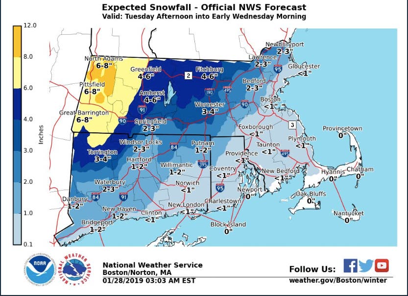
The second accumulating snow of the year is coming midweek, but in most of Eastern and Central Massachusetts, it's again expected to be accompanied by rain and slush. The snowfall is expected Tuesday afternoon into early Wednesday morning. A winter storm watch has been called for the Worcester area and Western Mass.
The most snow will fall in places with higher elevations, up to 8 inches in the Berkshires. Inside I-495 and north of Boston could see 2-3 inches, while the Boston area and south of the city can expect just a dusting of snow.
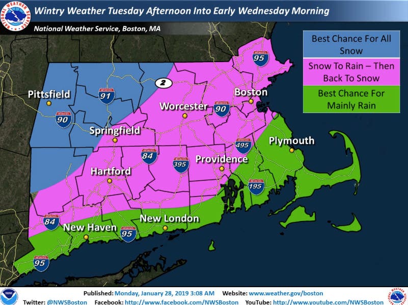
That doesn't mean that's all the precipitation to expect. Most of Eastern Mass. is due to get a mixture that will start as snow, turn to rain, then revert back to snow. The southeastern part of the state is slated to get primarily rain, hence the lower snow totals. See the maps below for a sense of what to expect.
Find out what's happening in Bostonfor free with the latest updates from Patch.
The National Weather Service said there could be impacts to the Tuesday evening and Wednesday morning commutes. We could then have a repeat of the last storm that froze over: Thursday's high temperature is set to be 15 degrees, and Friday and Saturday will also be below freezing.
Find out what's happening in Bostonfor free with the latest updates from Patch.
Patch will update this forecast as necessary.
Image via shutterstock
Get more local news delivered straight to your inbox. Sign up for free Patch newsletters and alerts.