Weather
Hurricane Jose Could Bring 85 mph Winds To Massachusetts
The worst- and best-case scenarios were laid out by the National Weather Service.

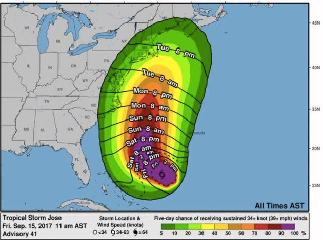
The anticipated track of Hurricane Jose is still a bit scattered, but the forecast is beginning to solidify. The National Weather Service says that means winds of up to 85 miles per hour in parts of Massachusetts early next week.
The Cape and Southeastern Massachusetts are in the most danger of getting wind gusts of that magnitude over the course of Tuesday and Wednesday, but gusts of at least 45 mph could come inland. The storm could also cause power outages, downed trees and "significant coastal flooding." Heavy rain and urban flooding is possible, as well.
"Potential for at least some impact increasing," the NWS wrote. "Worst case scenario category 1 Hurricane with 65-85 mph wind gusts. Best case scenario 35-45 mph gusts." Find your local Patch and keep up with storm coverage and other news.
Find out what's happening in Burlingtonfor free with the latest updates from Patch.
The storm was about 485 miles southwest of Bermuda as of Friday afternoon. Tropical storm-force winds will start picking up in New England some time Tuesday. All of Southern New England is expected to at least get a very windy week.
NWS photo
Find out what's happening in Burlingtonfor free with the latest updates from Patch.
Get more local news delivered straight to your inbox. Sign up for free Patch newsletters and alerts.