Weather
MA Weather: Snow Totals Adjusted, Storm Timing Set
There is still a major question as to how much sleet and rain will accompany the snow this weekend.

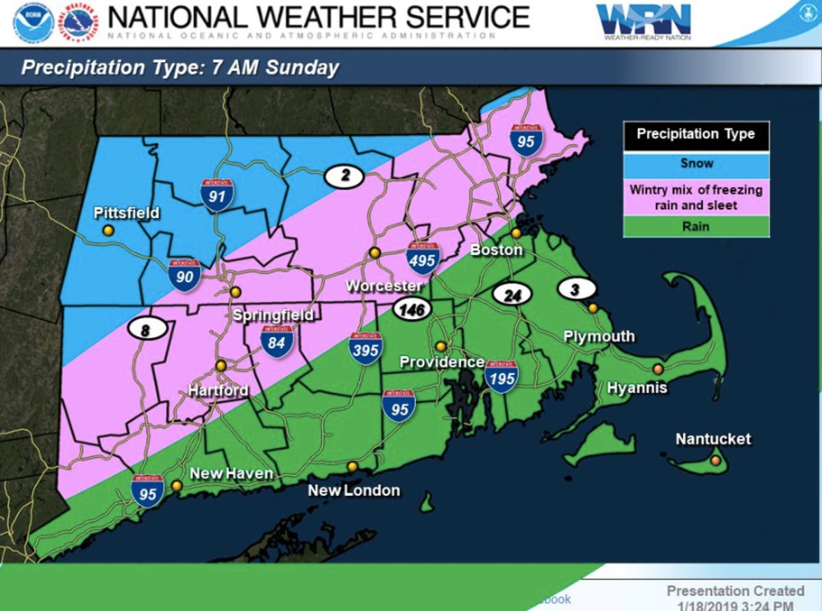
The newest forecast from the National Weather Service is emphasizing the uncertainty for how much of the precipitation this weekend will be snow and how much will be rain and sleet. The updated forecast followed an upgrade to a winter storm watch for north of the Pike, while most other areas remain under a winter storm warning.
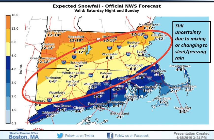
The new snow total maps, released shortly after 3:30 p.m. Friday, have slightly adjusted snow estimates in the Boston and Worcester area, which now show 6-8 inches. The North Shore, Merrimack Valley, and northern Worcester County can expect 8-12 inches, while some more northern and western parts of the state are still in line for 12-18 inches.
South of Boston is looking at 6-8 inches, with even less in Taunton and Plymouth. The Cape & Islands might just get an inch or two. There's a possibility the southernmost parts of the state get just rain.
Find out what's happening in Cambridgefor free with the latest updates from Patch.
Precipitation is expected to start overnight Saturday and persist into Sunday. It may waver back and forth between snow, sleet and rain.
This isn't likely to be the final forecast from the NWS. The government agency, operating in spite of a partial government shutdown, said to "expect further adjustments in later forecasts!" Patch will have the latest.
Find out what's happening in Cambridgefor free with the latest updates from Patch.


NWS Images
Get more local news delivered straight to your inbox. Sign up for free Patch newsletters and alerts.