Weather
Rain Could Turn To Snow In Twin Cities Saturday: NWS
Some residents may see up to 2 inches of snow, especially if you live north of Interstate 94.

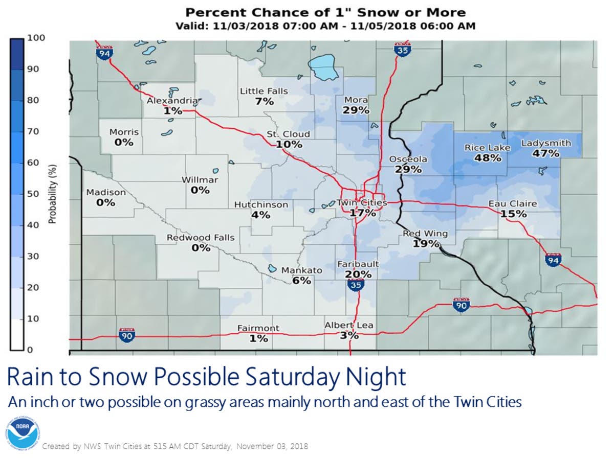
TWIN CITIES, MN — Rain could change over to wet snow Saturday night, according to the National Weather Service. A hazardous weather outlook has been issued for much of central Minnesota, including Hennepin, Ramsey, Washington, and Dakota County.
Some residents may see up to 2 inches of snow, especially if you live north of Interstate 94.
Don't be surprised if you look out the window and see this Sunday morning. Rain will change over to snow Saturday night, and a few of you could see 1 to 2 inches on grassy surfaces, especially north of I-94 #mnwx #wiwx More info at https://t.co/01z4l1HAvb pic.twitter.com/aDYnGvDu45
— NWS Twin Cities (@NWSTwinCities) November 2, 2018
Residents north of the Minnesota River will likely wake up to light, slushy snow Sunday morning. Another storm system could bring rain Monday night.
Find out what's happening in Southwest Minneapolisfor free with the latest updates from Patch.
Saturday night's storm could spoil the Taurid meteor shower.
Much colder the rest of the week
Find out what's happening in Southwest Minneapolisfor free with the latest updates from Patch.
Temperatures will drop into the 20s this week. Thursday currently features a 30 percent chance of snow, with a low around 21, according to the latest forecast.
Also read
- 12 Tips To Prepare For Minnesota's Winter
- Daylight Saving Time 2018 Ends: When Clocks Fall Back Minnesota
Sign Up For Patch's Daily Newsletter and Breaking News Alerts in Your Neighborhood
Image via National Weather Service
Get more local news delivered straight to your inbox. Sign up for free Patch newsletters and alerts.


