Weather
Hazardous NH Weather Outlook: Icy Roads Monday Night, Tuesday Morning
The National Weather Service has issued a winter weather advisory for icy roads on Monday night and Tuesday morning.

GRAY, ME — The National Weather Service has issued a “hazardous weather outlook” winter weather advisory for tonight for the entire state of New Hampshire. The outlook alert was issued at 11:15 a.m. on Dec. 31, 2016.
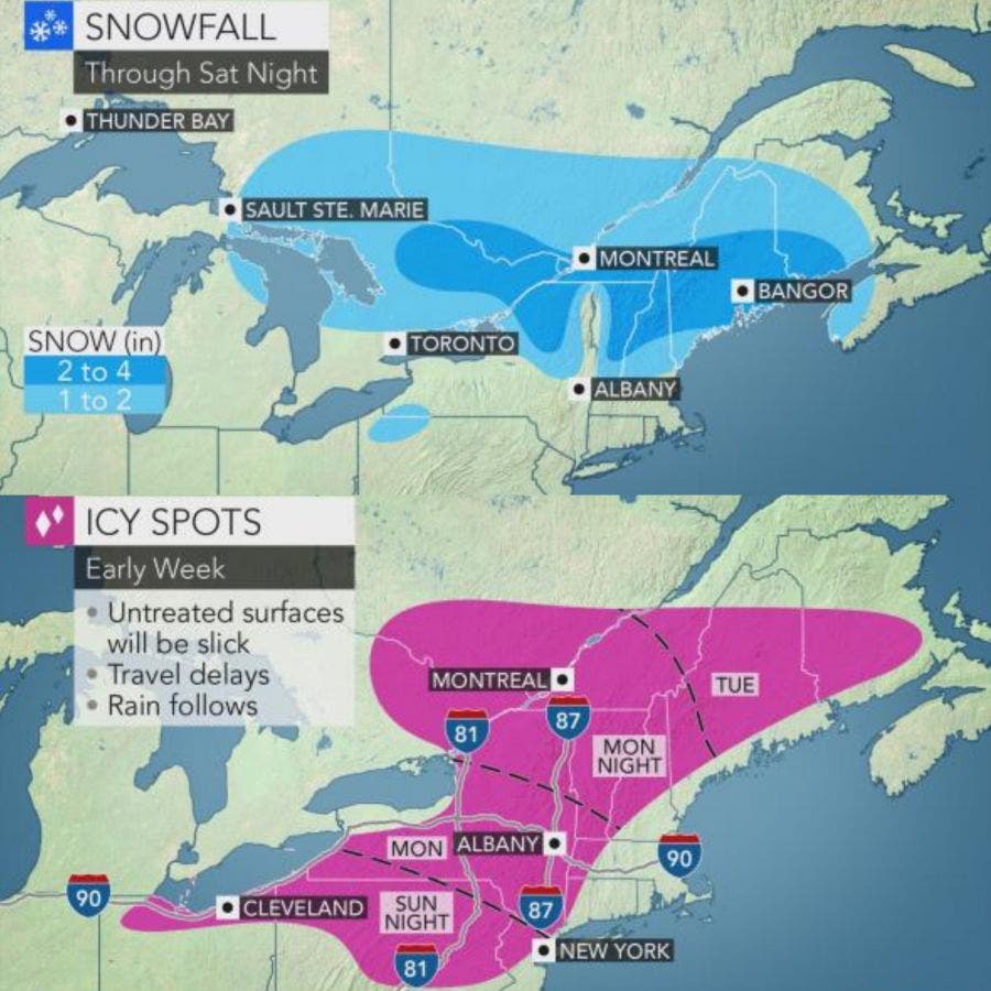
Light snow – of up to 3 inches – is expected in the late afternoon and through this evening which could make travel – on an already complicated evening, New Year’s Eve – a bit slippery, according to the alert.
Find out what's happening in Concordfor free with the latest updates from Patch.
In other words, take your time tonight … and don’t drink and drive.
However, a more complex weather system is expected on Tuesday, according to the NWS. This new storm will, according to the alert, “provide a chance of mixed precipitation to most of New Hampshire and western Maine.” The freezing rain will likely change to rain during the day on Tuesday, as temps warm up. But inland – including east central New Hampshire – could see mixed precipitation into the afternoon and evening.
Find out what's happening in Concordfor free with the latest updates from Patch.
AccuWeather.com suggested earlier today that the icy spots will start in New Hampshire on Monday night and continue into the morning on Tuesday, just when everyone will be returning to work after the long holiday weekend.
ALSO READ:
The latest weather conditions can be found on the front page of every Patch.com site in the United States including the 12 New Hampshire Patch news and community websites. Local, four-day weather reports for New Hampshire are posted on Sundays and Thursdays; alerts are posted when needed.
Graphics courtesy of AccuWeather.com.
Get more local news delivered straight to your inbox. Sign up for free Patch newsletters and alerts.