Weather
State Of Emergency Declared In NJ As Rainfall Accelerates: See Latest
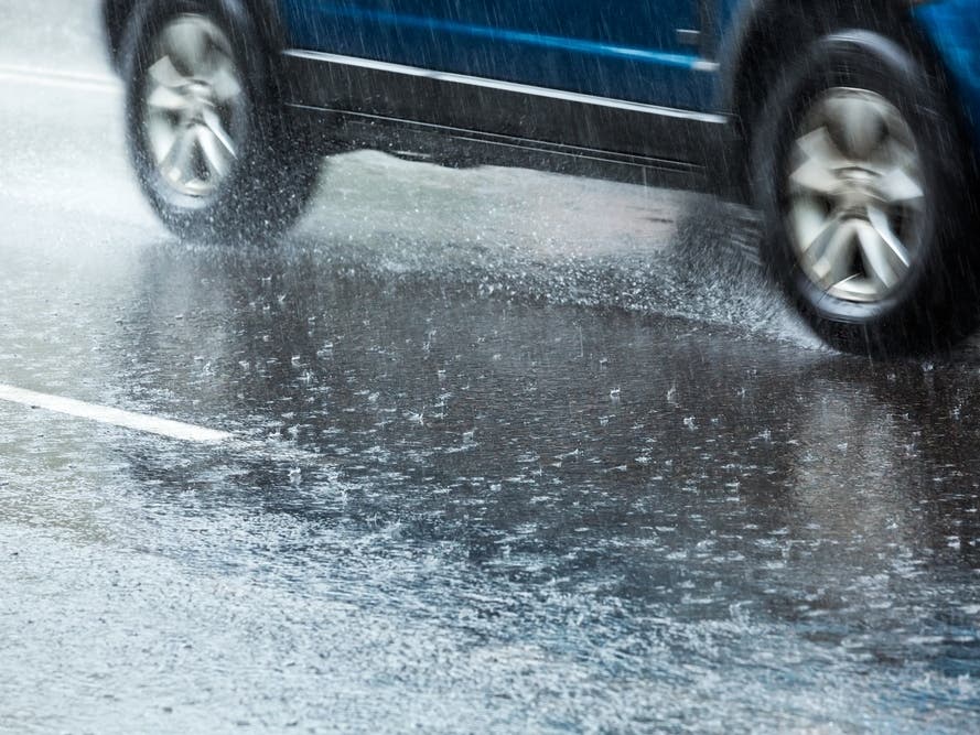
Gov. Murphy declared a state of emergency due to the significant flooding and heavy rain in the state.


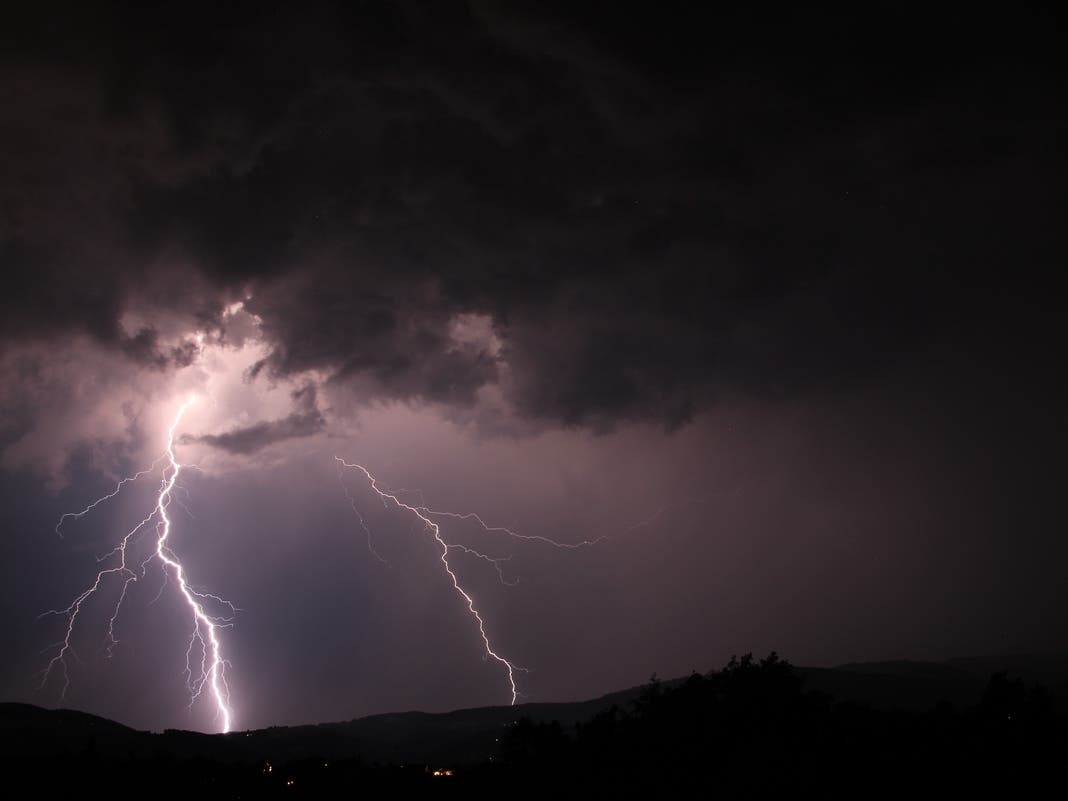
NEW JERSEY — Gov. Phil Murphy declared a state of emergency on Friday afternoon as rainfall is expected to continue soaking the state, with a slow-moving band of precipitation targeting the New York City metro and communities in northern and central New Jersey with heavy rain.
More than 4 inches of rain have fallen in some parts of the Garden State as this coastal low, which absorbed the remnants of Tropical Storm Ophelia, will continue chugging across the region.
“Throughout the state, especially in the north and central regions, we are experiencing heavy rainfalls resulting in hazardous conditions, and the rainfall is expected to accelerate in many parts of the state over the next several hours,” said Governor Murphy. “Flooding remains a significant concern due to the heavy rains much of the state already experienced this week. Residents should stay off the roads, remain alert, and follow all safety protocols.”
Find out what's happening in Across New Jerseyfor free with the latest updates from Patch.
The state of emergency went into effect at 3 p.m., and allows New Jersey officials to deploy resources quickly around the state. State offices closed at 3 p.m. Friday.
Areas in Bergen, Passaic, Monmouth, and Ocean counties are still under a flood warning as of 3:30 p.m. Friday.
Find out what's happening in Across New Jerseyfor free with the latest updates from Patch.
Click here to view all National Weather Service advisories in New Jersey.
As of the latest update. Friday, precipitation totals show more than 4 inches of rain have fallen in Asbury Park and Monmouth Beach, and 3.19 inches in Point Pleasant Beach.
Rainfall totals from Friday afternoon measured 2.9 inches in Hoboken, as the city declared a state of emergency. Reports said West Caldwell has received 3.09 inches of rain as of 2 p.m.
Through Friday night, forecasters said rainfall and scattered showers will continue to affect areas near the coast, "especially over coastal Ocean and Monmouth County where we are most concerned about flooding."
The "overall trend" for the region Friday night will be for heavier rain rates "to start to come down in intensity by the late evening and overnight," forecasters said.
"However, flooding near the coast will also be exacerbated by tidal flooding around the times of high tide," forecasters added.
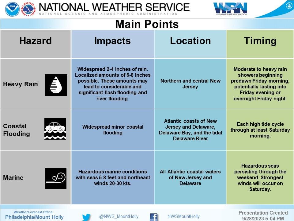
The latest total predictions for New Jersey are between 2 and 4 inches of rain in most parts of the state, with “localized pockets of higher amounts” between 5 and 8 inches, AccuWeather predicted.
The National Weather Service also predicted widespread amounts of 2 to 4 inches of rain, with localized amounts between 6 and 8 inches.
“This system will move east of the area slowly on Saturday, with high pressure regaining full control Sunday into early next week,” the NWS said.
Here is a look at the forecast through Sunday around the Garden State, from the National Weather Service.
North Jersey
Friday: Showers and possibly a thunderstorm. Some of the storms could produce heavy rain. High near 61. Northeast wind 8 to 11 mph. Chance of precipitation is 100 percent. New rainfall amounts between 1 and 2 inches possible.
Friday Night: Showers and possibly a thunderstorm before 2am, then rain likely after 2am. Some of the storms could produce heavy rain. Low around 56. North wind 9 to 11 mph. Chance of precipitation is 80 percent. New rainfall amounts between a half and three quarters of an inch possible.
Saturday: Rain likely before 8am, then a chance of showers, mainly between 8am and 2pm. Mostly cloudy, with a high near 66. North wind around 9 mph. Chance of precipitation is 60 percent. New precipitation amounts between a tenth and quarter of an inch possible.
Saturday Night: Mostly clear, with a low around 53. North wind 3 to 5 mph.
Sunday: Sunny, with a high near 75. North wind 6 to 13 mph.
Sunday Night: Mostly clear, with a low around 58.
Central Jersey
Friday: Showers and possibly a thunderstorm. Some of the storms could produce heavy rain. High near 63. Northeast wind 10 to 15 mph. Chance of precipitation is 80%. New rainfall amounts between a half and three quarters of an inch possible.
Friday Night: Showers likely and possibly a thunderstorm before 3am, then a chance of showers. Some of the storms could produce heavy rain. Patchy fog after 3am. Otherwise, cloudy, with a low around 57. North wind around 10 mph. Chance of precipitation is 70 percent. New rainfall amounts between a tenth and quarter of an inch, except higher amounts possible in thunderstorms.
Saturday: A chance of showers, mainly before 2pm. Patchy fog before 8am. Otherwise, mostly cloudy, with a high near 66. North wind around 10 mph. Chance of precipitation is 30 percent. New precipitation amounts of less than a tenth of an inch possible.
Saturday Night: Partly cloudy, with a low around 55. North wind around 5 mph.
Sunday: Sunny, with a high near 77. North wind 5 to 10 mph.
Sunday Night: Mostly clear, with a low around 58.
South Jersey
Friday: Showers likely and possibly a thunderstorm before 2pm, then a chance of showers. Some of the storms could produce heavy rain. Patchy fog after 2pm. Otherwise, cloudy, with a high near 67. Northeast wind around 10 mph. Chance of precipitation is 60 percent. New rainfall amounts between a tenth and quarter of an inch, except higher amounts possible in thunderstorms.
Friday Night: A chance of showers. Patchy fog. Otherwise, cloudy, with a low around 57. North wind around 10 mph. Chance of precipitation is 40 percent. New precipitation amounts of less than a tenth of an inch possible.
Saturday: A slight chance of showers. Mostly cloudy, with a high near 67. North wind 10 to 15 mph. Chance of precipitation is 20 percent.
Saturday Night
Partly cloudy, with a low around 53. North wind around 5 mph.
Sunday
Sunny, with a high near 76. North wind around 10 mph.
Get more local news delivered straight to your inbox. Sign up for free Patch newsletters and alerts.