Weather
Big Snow Totals, Power Outages, Icy Commute As Weekend Storm Leaves NJ In Deep Freeze
"The Monday morning commute will be very tricky," Gov. Mikie Sherrill said. NJ Transit service is shut down, officials said.

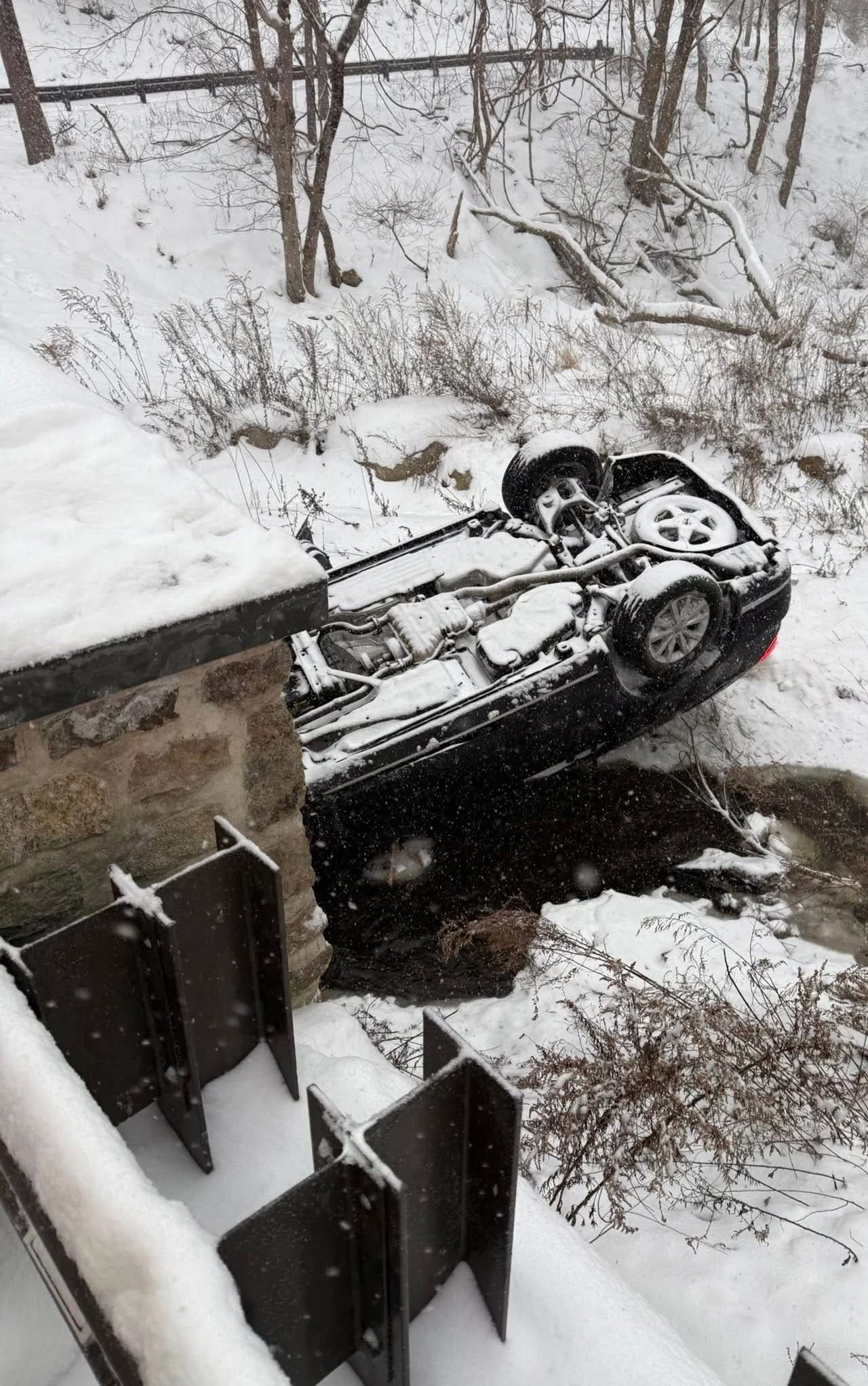
Snow, ice, wintry mix and subzero wind chills lashed the Garden State Sunday as the massive winter storm anticipated for days arrived in earnest at daybreak and deprived thousands of power.
More than 6,000 people lost power during the day Sunday with crews working diligently to restore service.
Governor Mikie Sherrill has directed all state offices will be closed Monday due to inclement weather conditions.
Find out what's happening in Across New Jerseyfor free with the latest updates from Patch.
Hundreds of New Jersey school districts have announced snow days for Monday as well. Read more: NJ School Closings, Delays As Winter Storm Blankets NJ
According to the National Weather Service early tallies show Atlantic City International Airport registered 6.2 inches, Flemington 10 inches, 9 inches in Mercerville, 8.6 in North Brunswick, 9.8 inches in Aberdeen, 11.8 in Boonton, 11.5 in Hillsborough, 12 in Randolph and Ringoes and 17 in Stockholm.
Find out what's happening in Across New Jerseyfor free with the latest updates from Patch.
The storm shut down travel in multiple Eastern and central states because of dangerous ice and more than a foot of snow, Accuweather reported.
In New Jersey, commercial vehicles have been banned from the state's highways as of 12:01 a.m. Sunday. Only the New Jersey Turnpike, Garden State Parkway and Atlantic City Expressway are exempted from that ban, state transportation officials said.
Shortly after 10 p.m. Sunday Sherrill shared a commuter update.
“NJ TRANSIT light rail service will be up and running for tomorrow’s commute. Crews are working overnight and aiming to get bus, Access Link, and rail service up, even if it is limited, by sometime tomorrow afternoon,” she said. “Stay updated by visiting njtransit.com or their app.”
Newark Liberty International Airport was open as of 10 a.m. but was urging travelers to check with their airlines for delays or cancellations before coming to the airport.
Snow fell at 1 to 2 inches per hour on Sunday morning, the National Weather Service said, and those rates were expected to continue throughout the day. Sleet and ice mixed in, making for dangerous travel conditions, and a winter storm warning remains in effect through 1 p.m. Monday.
In Morris County, where snow was nearing a foot by Sunday afternoon, the Office of Emergency Management was pleading with residents to stay off the road.
Snow totals are expected to be 6 to 8 inches in the southern and coastal areas of the state, with 8 to 12 inches predicted for much of New Jersey. The northwestern part of the state could see as much as 18 inches.
Authorities across the state have been urging people to stay home.
"I encourage everyone who does not have to be out, do not get out on the roads," Sherrill said in an interview Sunday on ABC7 Eyewitness News. Sherrill issued a state of emergency on Friday ahead of the storm that will remain in place through the storm.
There is a potential for power outages, and Sherrill said the state's power companies have crews coming from other states to help get electricity back up as quickly as possible.
"The snowplows are out in force," she said. The goal is to get the roads clear and return to normal activities as quickly as possible after the storm, Sherrill said, but she warned that Monday will be difficult.
"The Monday morning commute will be very tricky," she said. "If you can go in later, make alternate plans."
Returning to normal as quickly as possible is critical, as damage and economic losses from the storm are expected to exceed $100 billion, according to a new preliminary estimate from AccuWeather.
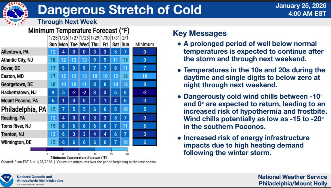
Here are the latest predictions across New Jersey from the National Weather Service:
As the storm moves out, the coldest temperatures of this winter will move in and are expected to remain through next weekend. Temperatures will be in the 10s and 20s during the daytime and single digits to below zero at night through next weekend. Wind chills will be dangerously cold, as low as negative-10 degrees in parts of the state.
Get more local news delivered straight to your inbox. Sign up for free Patch newsletters and alerts.