Weather
NJ Weather: Tropical Storm Philippe Could Add To Wet Weekend
Expect a dreary Saturday; here's the latest forecast as a tropical storm packing torrential rain and strong winds heads north.

NEW JERSEY — Forecasters now say four inches of rain could fall on already-saturated parts of the Garden State before dry and cool temperatures settle in, as a tropical storm packing torrential rain and strong winds marches toward the Northeast.
Meteorologists predict a dreary day around the Garden State on Saturday, with an approaching cold front knocking down temperatures and bringing showers, possibly with lightning and a few thunderstorms. And Tropical Storm Philippe could add moisture to the bands of heavy downpours predicted across parts of the Garden State, according to AccuWeather forecasters.
“By far, the most far-reaching impact from Philippe will be its drenching rainfall,” said AccuWeather on Friday.
Find out what's happening in Across New Jerseyfor free with the latest updates from Patch.
Forecasters said Philippe's impacts could potentially dump more moisture on North Jersey and the New York City region, where the slow-moving remnants of Ophelia deluged communities with up to 9 inches of rain just last weekend.
Bergen, Essex, Hudson, Passaic, and Union counties are flood watch as a widespread 1 to 2 inches of rain are anticipated, and locally higher amounts of 3 to 4 inches are possible.
Find out what's happening in Across New Jerseyfor free with the latest updates from Patch.
"Most of this rainfall is expected to fall in a 6 hour period between 4 am and 2 pm on Saturday," said forecasters.
Minor roadway flooding will be the main threat for the region, said the National Weather Service office in New York.
"Due to saturated soil conditions and high streamflows in the area, this will present a threat for isolated to scattered instances of flash flooding," said the NWS.
In general, this weekend is not expected to be a "washout" for most of the state, forecasters said on social media. But most residents can expect rain at some point, meteorologists added.
Showers and possibly a few thunderstorms will work their way through the region beginning Friday night, tapering off from west to east throughout the day, per the National Weather Service. Showers “should end over eastern zones Saturday evening,” the NWS said.
“There will be scattered showers around the entire region, especially in the morning,” forecasters said.”The frontal passage should start to dry things out into the afternoon.”
And, those on the Jersey Shore should again watch for dangerous swimming conditions and high surf, said forecasters.
“Swells are also reaching portions of the southeastern U.S. coast and will spread northward along the east coast to Atlantic Canada during the next couple of days,” added the National Hurricane Center. “These conditions are likely to cause life-threatening surf and rip currents."
Philippe is expected to pass by Bermuda later Friday, turning north-northwest on track to reach the coast of Nova Scotia or eastern Maine from Saturday night into Sunday.
Peak wind gusts of 70 miles per hour and torrential rain are expected where the storm is predicted to slam into Maine and Atlantic Canada this weekend – also bringing high winds, rain, and coastal flooding to the New England region.
“For portions of New York and New England, rainfall amounts of 1 to 3 inches, with local amounts of 5 inches, are expected with Philippe as it moves through the region this weekend,” said the National Hurricane Center. “Isolated to scattered instances of urban and flash flooding are expected.”
Philippe’s interaction with the setup over the region “will lead to an extended period of November-like weather for much of the Northeast and Atlantic Canada next week,” AccuWeather said.
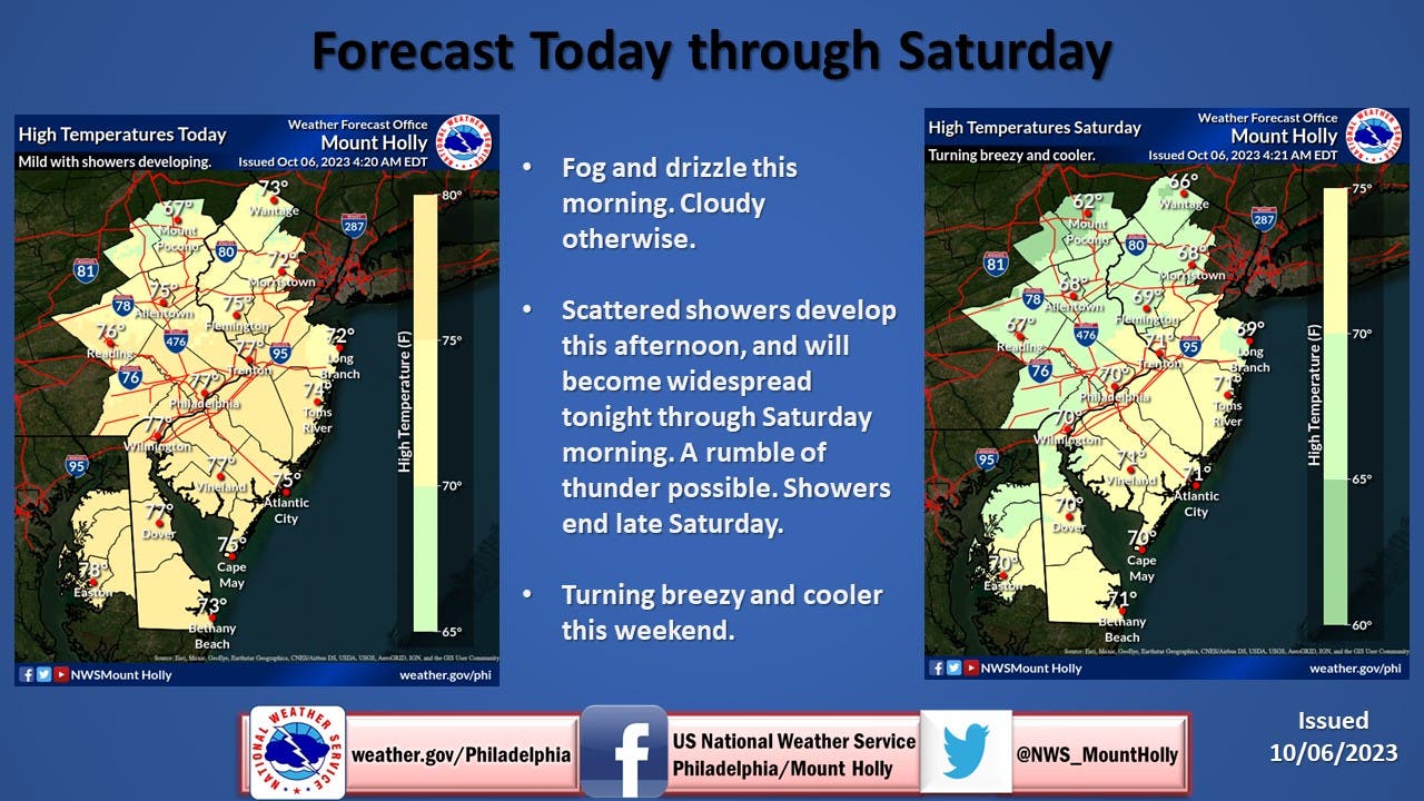
Here's a look at the forecast this weekend around New Jersey, from the National Weather Service:
North Jersey
Friday: A 50 percent chance of showers. Patchy fog before 11am. Otherwise, cloudy, with a high near 72. Southeast wind 6 to 8 mph.
Friday Night: Showers. Low around 61. Southeast wind around 6 mph. Chance of precipitation is 90 percent. New precipitation amounts between a quarter and half of an inch possible.
Saturday: Showers and possibly a thunderstorm. Some of the storms could produce heavy rain. Temperature rising to near 66 by 10am, then falling to around 61 during the remainder of the day. Southeast wind 5 to 10 mph becoming northwest in the afternoon. Chance of precipitation is 90 percent. New rainfall amounts between a half and three quarters of an inch possible.
Saturday Night: Showers likely, mainly before 8pm. Mostly cloudy, then gradually becoming mostly clear, with a low around 47. Northwest wind 11 to 15 mph. Chance of precipitation is 60 percent. New precipitation amounts of less than a tenth of an inch possible.
Sunday: Mostly sunny, with a high near 60. West wind around 15 mph.
Sunday Night: Partly cloudy, with a low around 43.
Central Jersey
Friday: A chance of showers. Cloudy, with a high near 77. Southeast wind around 5 mph. Chance of precipitation is 40 percent. New precipitation amounts of less than a tenth of an inch possible.
Friday Night: Showers likely, mainly after 4am. Patchy fog after 11pm. Otherwise, cloudy, with a low around 63. Southeast wind around 5 mph becoming calm in the evening. Chance of precipitation is 60 percent. New precipitation amounts between a tenth and quarter of an inch possible.
Saturday: Showers and possibly a thunderstorm, mainly before 2pm, then a chance of showers and thunderstorms after 2pm. High near 71. Light west wind becoming northwest 5 to 10 mph in the morning. Chance of precipitation is 80 percent. New rainfall amounts between a tenth and quarter of an inch, except higher amounts possible in thunderstorms.
Saturday Night: A chance of showers, mainly before 8pm. Mostly cloudy, then gradually becoming mostly clear, with a low around 48. West wind around 10 mph. Chance of precipitation is 30 percent. New precipitation amounts of less than a tenth of an inch possible.
Sunday: Mostly sunny, with a high near 61. West wind 10 to 15 mph, with gusts as high as 25 mph.
Sunday Night: Partly cloudy, with a low around 44.
South Jersey
Friday: A chance of showers, mainly between noon and 3pm. Cloudy, with a high near 77. Southeast wind around 5 mph. Chance of precipitation is 30 percent. New precipitation amounts of less than a tenth of an inch possible.
Friday Night: A slight chance of showers before 7pm, then a chance of showers after 11pm. Patchy fog after 11pm. Otherwise, cloudy, with a low around 61. East wind around 5 mph becoming calm in the evening. Chance of precipitation is 40 percent. New precipitation amounts between a tenth and quarter of an inch possible.
Saturday: Showers and thunderstorms likely before 2pm, then a chance of showers. Mostly cloudy, with a high near 71. Northwest wind 5 to 15 mph. Chance of precipitation is 70 percent. New rainfall amounts of less than a tenth of an inch, except higher amounts possible in thunderstorms.
Saturday Night: Mostly cloudy, then gradually becoming clear, with a low around 46. West wind around 15 mph.
Sunday: Mostly sunny, with a high near 62. West wind around 15 mph, with gusts as high as 25 mph.
Sunday Night: Partly cloudy, with a low around 43.
Get more local news delivered straight to your inbox. Sign up for free Patch newsletters and alerts.