Weather
New Timing Of Snow, Ice Storm Set To Pummel NJ
"Expect widespread road closures and significant delays on major interstates and highways," the National Weather Service said.

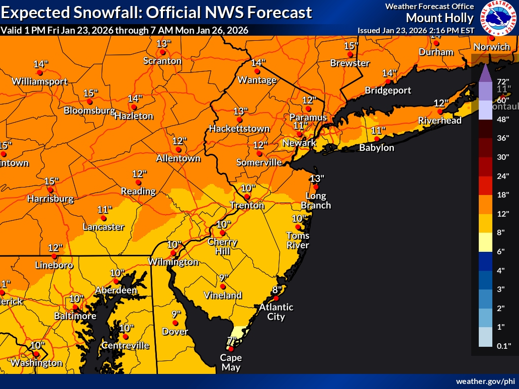
Snow totals have trended down slightly, but the threat of ice has increased ahead of a major storm preparing to dump up to 16 inches of snow on New Jersey this weekend.
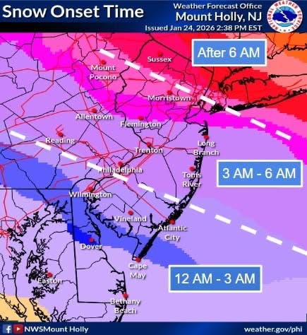
The latest timing shows the earliest snow arriving overnight.
All of the Garden State is under a Winter Storm Warning, upgraded from a Watch, Saturday evening through Monday morning, as well as a State of Emergency.
Find out what's happening in Across New Jerseyfor free with the latest updates from Patch.
Gov. Mikie Sherrill declared a State of Emergency in all 21 counties Friday afternoon ahead of the storm, her second so far in office. Her first was on her first day in office, when she declared a State of Emergency over rising electricity costs. Read more: Sherrill Declares State Of Emergency In 1st Day As Governor
"I want to be clear that this is not an average storm," Sherrill said, noting that a storm this intense has not been seen in about a decade. She urged residents to stay home.
Find out what's happening in Across New Jerseyfor free with the latest updates from Patch.
A commercial vehicle travel restriction will be in place on interstate highways.
"Please stay off the roads," Sherrill said. She added not to make any plans for Monday, as "we may still be digging out."
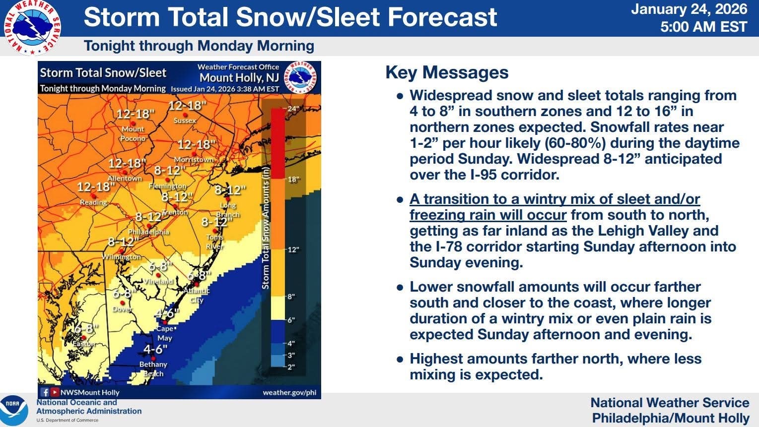
"Significant snowfall accumulations are expected across the entire area, with some sleet and freezing rain accumulation in some areas as well," the National Weather Service said in a Friday afternoon briefing.
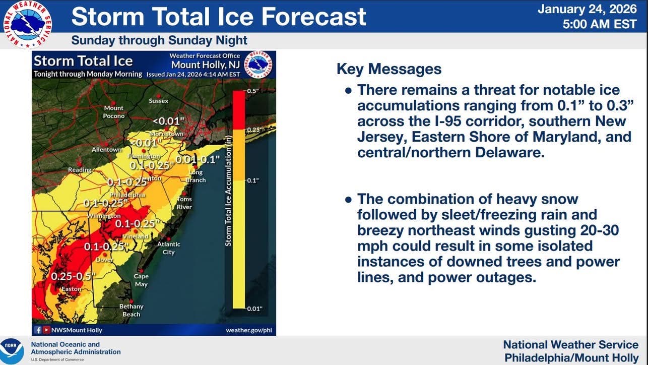
The I-95 corridor and South Jersey are where the ice risk is highest. See the below map for details.
"Heavy snow and some ice accumulation will make travel dangerous or impossible," the National Weather Service said. "Expect widespread road closures and significant delays on major interstates and highways."
Ice, along with breezy winds, could also cause power outages, forecasters warned.
Snow is expected to start falling late Saturday, with heavy snowfall Sunday. Rates of 1 to 2 inches per hour are possible during the daytime on Sunday, according to National Weather Service forecasters.
"A transition to a wintry mix of sleet and/or freezing rain will occur from south to north inland into the I-95 corridor, and potentially as far north as the I-78 corridor starting Sunday afternoon into Sunday evening," the National Weather Service said.
Get more local news delivered straight to your inbox. Sign up for free Patch newsletters and alerts.