Weather
10 Inches Of Snow Possible As Winter Weather Alerts Blanket NJ
The probability of at least 2 inches of snow accumulation has increased to 60 to 80 percent, National Weather Service forecasters said.

All of New Jersey will be under a Winter Storm Watch Sunday morning through Monday afternoon as heavy snow and gusty winds prepare to slam the state.
Snowfall accumulations have increased in the latest forecast, though there remains some uncertainty in the totals. Dangerous conditions are possible with wind gusts of up to 35 mph creating blizzard conditions.
"It is not out of the question that there could be near-blizzard conditions for a time along the immediate coast Sunday night, especially parts of the Jersey Shore, eastern Long Island and far southeast New England, including Cape Cod, Nantucket and Martha’s Vineyard," AccuWeather Vice President of Forecasting Operations Dan DePodwin said.
Find out what's happening in Across New Jerseyfor free with the latest updates from Patch.
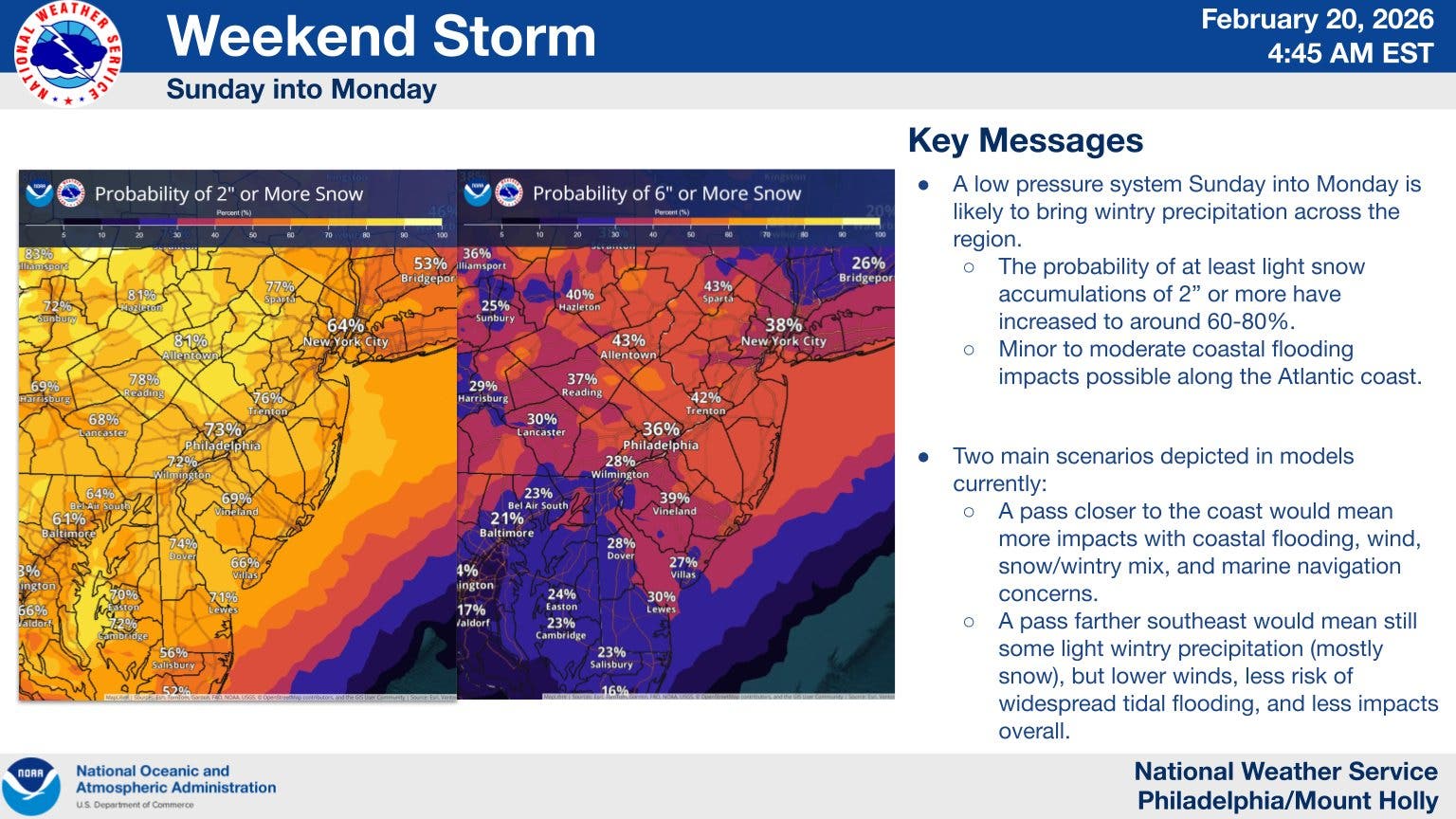
The exact amount of snowfall predicted is still unclear, though a widespread 6 inches or has been forecast. The National Weather Service's New York City office, which covers Bergen, Essex, Hudson, Passaic and Union counties, said that 6 to 10 inches of snow is forecast in that area.
There's a chance the storm rapidly strengthens and dumps more snow, forecasters said.
Find out what's happening in Across New Jerseyfor free with the latest updates from Patch.
.png)
"Not only will the storm evolve into a significant nor'easter with strong winds and heavy snow along parts of the Atlantic coast, but it may become a bomb cyclone as it begins to move away," AccuWeather Senior Meteorologist Chad Merrill said. "A bomb cyclone is a storm that rapidly strengthens when the central barometric pressure in the storm drops 0.71 of an inch of mercury (24 millibars) in 24 hours or less."
AccuWeather forecasters said that the more likely scenario is for the storm to strengthen later, which would mean less snow for New Jersey. Coastal hazards are also a risk, particularly coastal flooding along the shore.
National Weather Service forecasters said that specifics will likely become clearer by Friday night and forecast amounts may change.
Get more local news delivered straight to your inbox. Sign up for free Patch newsletters and alerts.