Weather
Weekend Nor’Easter Heads Up NJ Coast
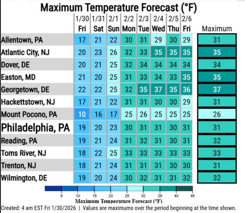
Temperatures well below zero are expected to remain into next week across New Jersey, the forecasters said

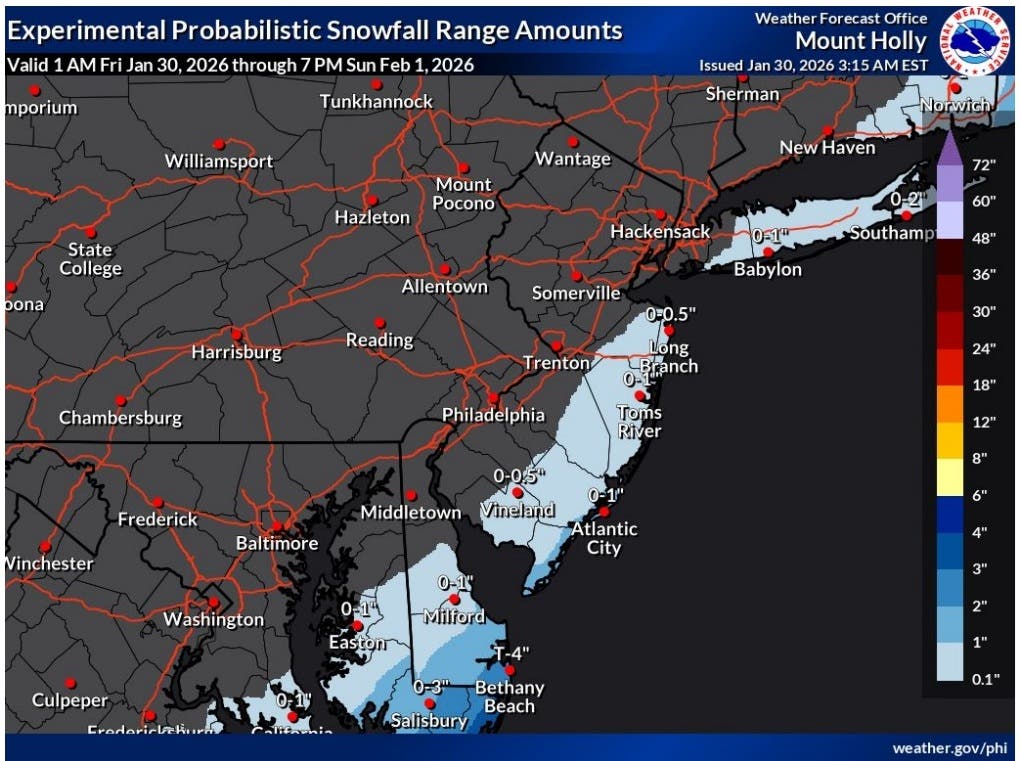
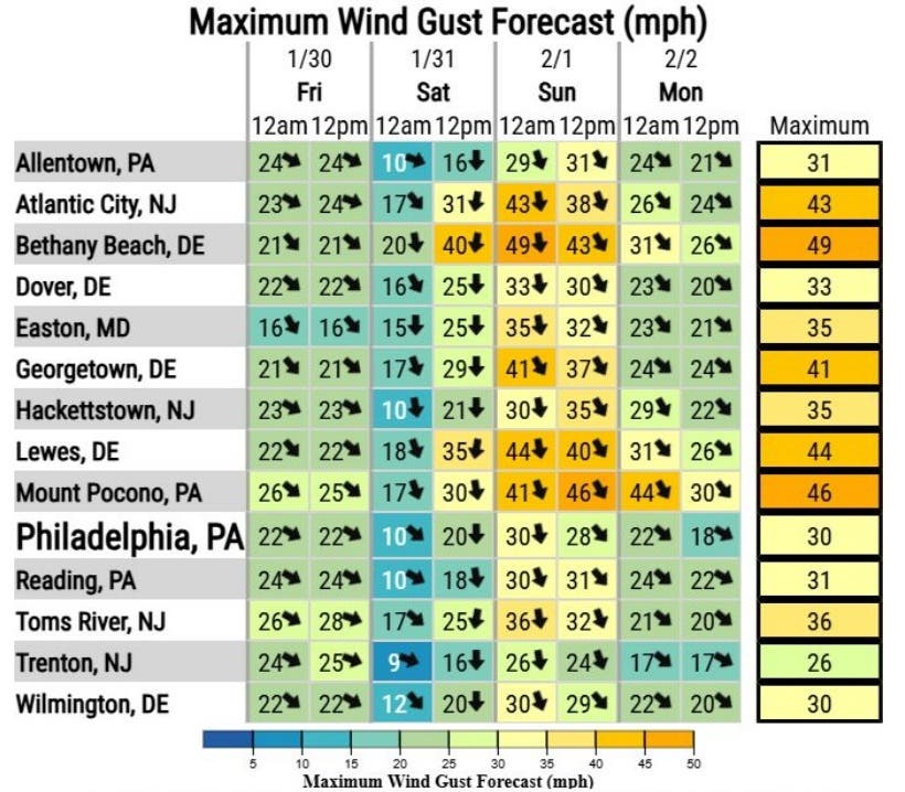
A winter storm forming in the south on Friday is expected to bring strong winds gusting to 50 mph and coastal flooding, but just a dusting of snow to New Jersey, mostly at the Shore, forecasters say.
The National Weather Service is calling for the largest impacts from the storm to be in the Carolinas and southeastern Virginia, but as the storm makes its way north, it will be well offshore, the forecasters said.
The storm still will be close enough to the coast to see some impacts, particularly from the wind, the forecasts say.
Find out what's happening in Across New Jerseyfor free with the latest updates from Patch.
Wind gusts of up to 50 mph are possible, according to the National Weather Service, with sustained winds of 30 to 40 mph likely throughout the state on Sunday.
"Wind gusts up to 50 mph could result in tree and wire damage. More severe impacts are possible than what usually occurs at these wind speeds due to snow and ice remaining on many branches and wires," the weather service said.
Find out what's happening in Across New Jerseyfor free with the latest updates from Patch.
That could mean possible power outages, and those combined with the continued dangerous cold will pose serious concerns.
"Prolonged dangerous cold continues," the National Weather Service said, with below-zero wind chills Friday night and below-zero temperatures likely to continue throughout next week.
"The longer this stretch of sub-freezing temperatures continues, the higher the risk of impacts including to people and infrastructure," the weather service said.
The potential coastal flooding has been reduced and is anticipated to be minor, said meteorologist Dan Zarrow of NJ 101.5.
The high tide on Sunday morning will see the biggest potential flooding with the possibility of moderate flooding in some parts of New Jersey. There could be road closures in low-lying areas near the coast and some tidal waterways. Ice on the back bays could further complicate the flooding, the weather service said.
"Overall, confidence is moderate regarding snow amounts in the region. Snowfall amounts could change slightly depending on the exact track of the storm as is moves out to sea to our southeast," the National Weather Service Mount Holly office said.
Get more local news delivered straight to your inbox. Sign up for free Patch newsletters and alerts.