Weather
Strengthening Storm Targets NJ: What To Know
A storm pummeling the Carolinas and parts of Virginia will reach New Jersey late Saturday. See the potential impacts.

Snow may not be a concern this weekend but strong winds are anticipated to batter New Jersey and make bitterly cold temperatures even colder through Sunday.
That's the forecast from the National Weather Service Mount Holly office as a powerful storm makes its way north Saturday into Sunday.
That storm was expected to deposit several inches of snow in the Carolinas but pass New Jersey farther offshore. The anticipated storm track has continued to move farther east, forecasters said.
Find out what's happening in Across New Jerseyfor free with the latest updates from Patch.
The possible snowfall has been reduced to a dusting to an inch along the Jersey Shore as a result.
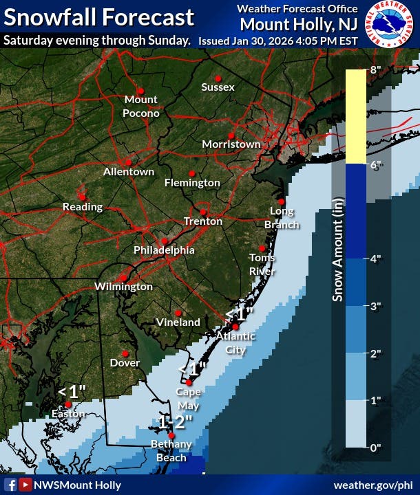
Light snow accumulations could lead to slippery road conditions, but that will be strictly along the Jersey Shore from Cape May parts of Ocean County right along the coast.
Find out what's happening in Across New Jerseyfor free with the latest updates from Patch.
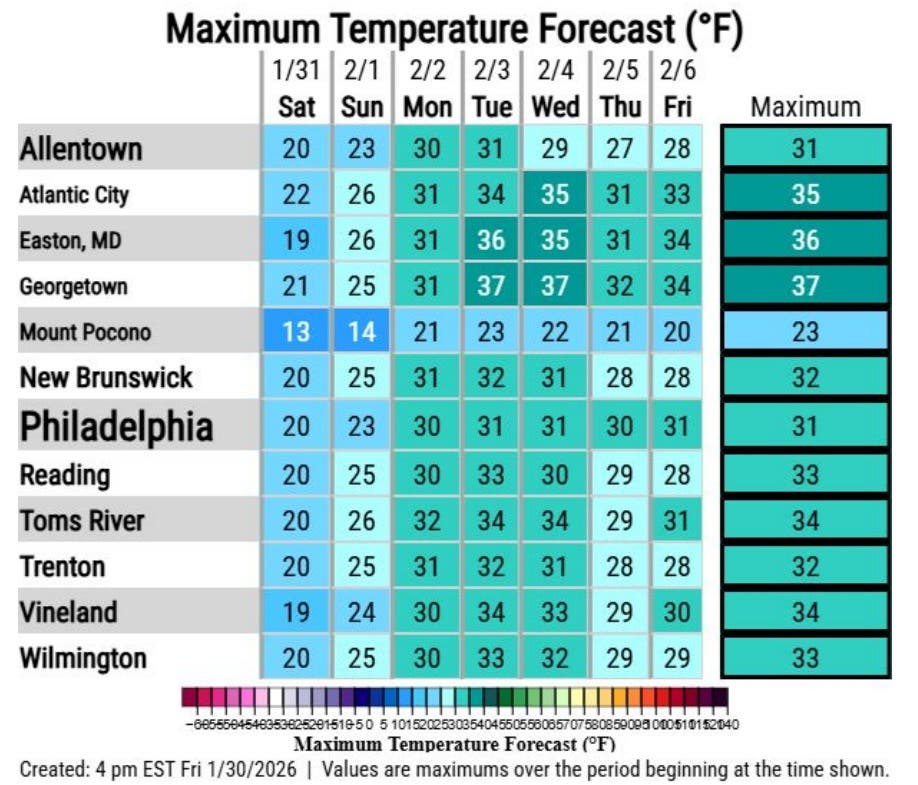
The significant cold will be the biggest factor, as the cold wave that has gripped the area since last weekend will remain through Monday at least, the weather service said. Temperatures will not rise above freezing until Tuesday for most of New Jersey, the weather service said.
The cold weather advisory remains in place through Sunday morning.
Strong winds Saturday into Sunday still are expected to have 30- to 40-mph wind gusts, which could result in tree damage and power outages, the weather service said. The wind will drive wind chills well below freezing.
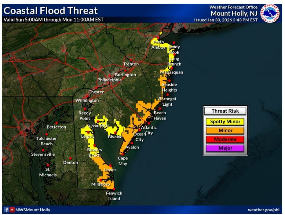
Coastal flooding will be something to watch for those who live along the shore. That flooding could be widespread on Sunday with the morning high tide and could linger into Monday.
The coastal flooding could push ice across the back bays onshore, the weather service said.
Get more local news delivered straight to your inbox. Sign up for free Patch newsletters and alerts.