Neighbor News
How a Marine Navigation App Assists in Precise Docking and Anchoring?
Docking and anchoring are easier with a marine navigation app, offering GPS guidance, depth charts, wind data, AR, and anchoring alerts.

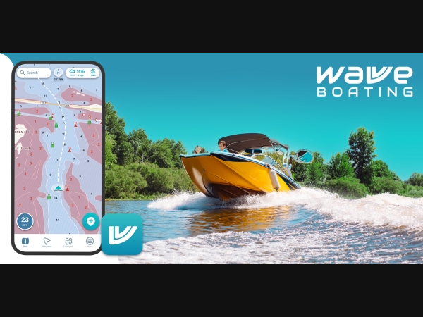
Docking and anchoring are two of the most challenging tasks for boaters, requiring skill, careful planning, and real-time awareness of their surroundings. Wind, currents, water depth, and tight marina spaces can make manoeuvring difficult, especially for new or occasional boaters. Fortunately, a marine navigation app simplifies these processes by providing accurate guidance, depth charts, and positioning data. With innovative navigation features, Wavve Boating enhances docking and anchoring precision, making boating safer and more efficient.
1. Real-Time GPS Guidance for Smooth Docking
A marine navigation app is a virtual assistant offering real-time GPS tracking and route planning to help boaters confidently approach docks. Key benefits include:
- Turn-by-Turn Navigation – Helps boaters follow the best path toward a marina or docking area.
- Speed Monitoring – Ensures controlled and safe speeds when entering tight spaces.
- Distance Alerts – Notifies boaters when approaching the dock, allowing ample time to adjust course and speed.
With precise GPS guidance, boaters can avoid last-minute miscalculations and ensure a stress-free docking experience.
Find out what's happening in East Brunswickfor free with the latest updates from Patch.
2. Depth Charts for Safe Navigation Near Shore
Shallow waters pose a significant risk when docking or anchoring. Marine navigation apps provide detailed depth charts, helping boaters:
- Identify Safe Approach Paths – Avoid shallow areas and underwater obstacles.
- Prevent Grounding – Stay clear of areas where water depth is too low for the vessel.
- Adjust Based on Tide Levels – Monitor real-time tide conditions to ensure safe docking, especially in fluctuating water levels.
Boaters can confidently navigate near shorelines using depth charts without worrying about unexpected underwater hazards.
Find out what's happening in East Brunswickfor free with the latest updates from Patch.
3. Custom Docking and Anchorage Waypoints
A waypoint system is a valuable tool for planning docking and anchoring locations. Marine navigation apps allow users to:
- Mark Preferred Docking Spots – Save locations for future visits.
- Set Safe Anchorage Zones – Identify areas with good holding ground for anchoring.
- Share Waypoints with Other Boaters – Exchange docking and anchoring recommendations within the boating community.
These personalized markers ensure efficient trip planning and safe vessel positioning.
4. Wind and Current Data for Controlled Maneuvering
Wind and water currents significantly impact docking and anchoring. Marine navigation apps provide live weather data, helping boaters adjust their techniques based on the following:
- Wind Speed and Direction – Essential for manoeuvring a boat smoothly into a slip.
- Current Strength and Flow – Determines how a vessel may drift during docking or anchoring.
- Real-Time Weather Alerts – Notify boaters about sudden weather changes affecting docking safety.
By factoring in these conditions, boaters can make precise adjustments for a seamless docking process.
5. Virtual Docking Assistance with Augmented Reality
Some advanced marine navigation apps integrate augmented reality (AR) features, overlaying navigation data onto a live camera feed. This assists with:
- Visualizing Approach Paths – Helps boaters line up correctly with the dock.
- Estimating Safe Distances – Reduces the risk of bumping into pilings or other boats.
- Providing Step-by-Step Guidance – Displays on-screen instructions for smoother docking.
Augmented reality enhances visibility and control, making docking easier even for inexperienced boaters.
6. Drag Anchor Alerts for Secure Anchoring
Proper anchoring is just as crucial as docking, as improper anchoring can lead to drift and potential collisions. A marine navigation app offers drag anchor alarms, which:
- Monitor Boat Positioning – Alerts boaters if the anchor shifts unexpectedly.
- Provide Holding Ground Data – Suggest optimal spots with a firm seabed for anchoring.
- Set Safety Perimeters – Warns users when their boat drifts beyond a predefined range.
These alerts help boaters maintain a secure anchorage, preventing their vessel from unintentionally drifting into unsafe areas.
7. Marina and Dock Availability Information
Finding a suitable docking space can be challenging, especially during peak boating seasons. Many marine navigation apps provide the following:
- Marina Listings with Availability – Helps boaters find open slips or mooring spots.
- Docking Fee Estimates – Displays pricing details for different marina facilities.
- Reservation Capabilities – Some apps allow boaters to book a slip in advance.
Access to real-time marina information reduces uncertainty and ensures a hassle-free docking experience.
Final Thoughts
A marine navigation app is an essential tool for boaters looking to dock and anchor with precision. These apps simplify the most complex boating manoeuvres by offering real-time GPS tracking, depth charts, wind data, augmented reality guidance, and anchoring alerts. Whether navigating a crowded marina or securing an anchor for an overnight stay, proper navigation assistance enhances safety, efficiency, and confidence on the water.